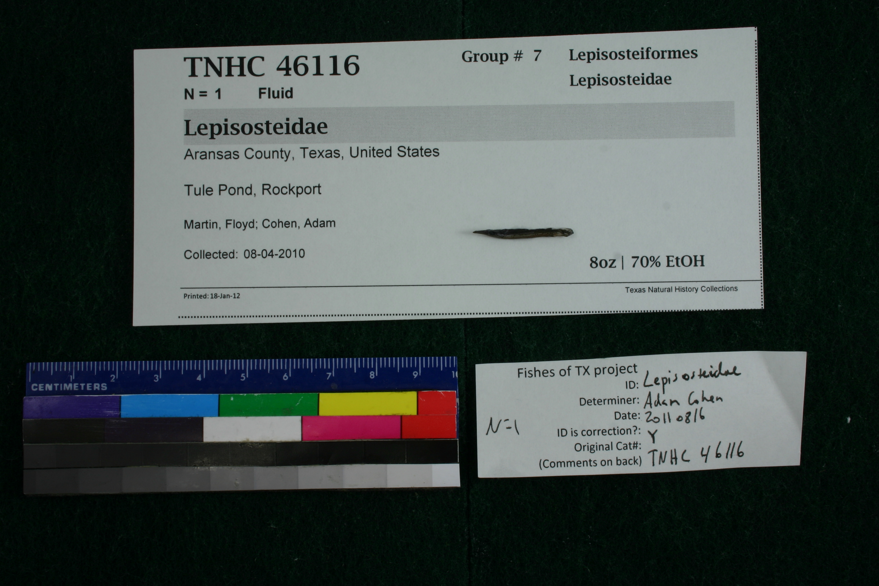
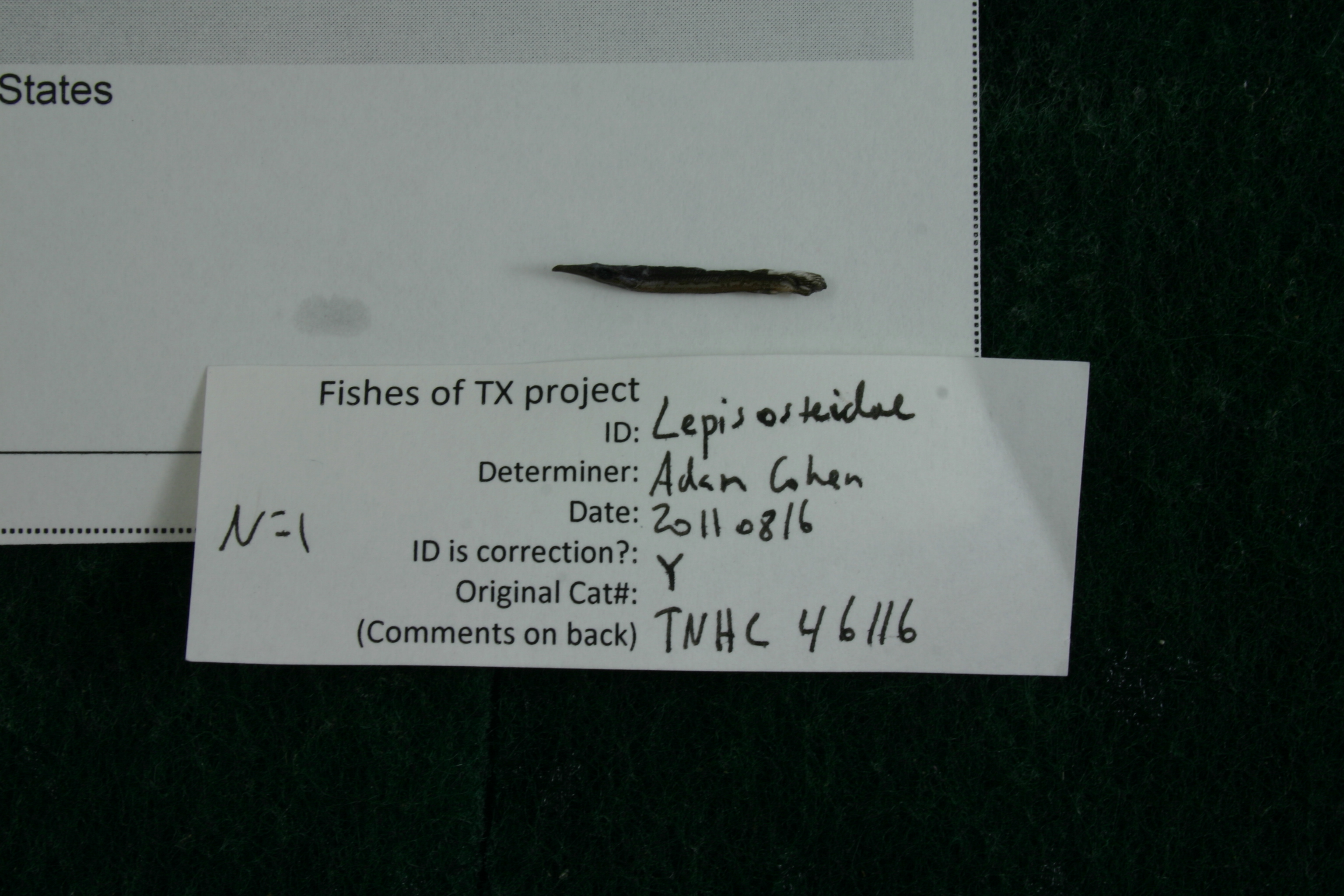
TNHCi_46116
Not suspect, not examinedPhotos
Map
Location
28.05073° N, 97.04274° W
(± 44
m)
Taxonomy
FamilyLepisosteidae
GenusLepisosteus
Speciesoculatus
Specimen
Num Specimens1
PreparationFluid - 1
Identification
Identification RemarksFDM notes: 53 myomeres (anything below 57 is L. oculatus)
Identified ByMartin, Floyd
Date Identified2013.2.6
Collection Event
CollectorMartin, Floyd; Cohen, Adam
Collected Date2010.4.8
Field NumberFDM20100408-1
Geography
CountryUnited States
StateTexas
CountyAransas
LocalityTule Pond, Rockport
Latitude28.0507282
Longitude-97.0427404
DatumWGS84
Error44.0
Georeferencing
Georeference RemarksOriginally this entry was georeferenced incorrectly. Caught by F.D. Martin, who provided coordinates for Tule Pond, which match locality description of Rockport and Aransas County. Using these coordinates, even though "Tule Pond" name does not appear on USGS maps.
Record Source
Source
Texas Natural History Collections
(type: specimens)
Institution
Texas Natural History Collections
(type: museum)
Curator
Dean Hendrickson
Record Added
June 24, 2020
Record Last Modified
March 23, 2026
Data Processing Track
Track 3
From Data Set Received
5/2017 to 11/2017
Identification
Suspect Notes
None
Count
1
Current Determination
Determiner
Floyd Douglas Martin
Determination Date
Feb. 11, 2016
Determination Type
specimen examination
Identification Comments
Specimen examined and Id'ed for FoTX project. | 53 myomeres; anything below 57 is L. oculatus; *note for SL measurements that gar have heterocercal tails - all length measurements are based on SL and are approximate; MinSL(mm): 21.9; MaxSL(mm): ; Jar: 8 oz; Specimen condition: excellent; Mutations: none; Count Male: ; Count female: ; Extern parasites: n
Identification Confidence
High
Collecting Event
Collected
April 8, 2010
Collector(s)
Collecting Event ID
398801
Field Notes
There are no field notes available.
Locality
Jurisdiction
Aransas, Texas
Name
Tule Pond, Rockport
Hydrography
Texas-Gulf Region
Central Texas Coastal
Central Texas Coastal
Aransas Bay
Aransas Bay
Aransas Bay
Captive
no
Locality Photos
No locality photos available.
HUC 12
121004050400
Georeferencing Remarks
Georeference needs verification/refinement; coordinates provided by donor
Georeferencing Annotation
—
Has not been Georeferenced because
This record, being part of the track 3 import, is not formally georeferenced by FoTX staff at this time. However, to allow mapping and visualization of this record, locality information has been provisionally accepted if provided by the donor or if location text could be matched to previously georeferenced records by FoTX team or donor data. For many records spatial error is either accepted from the donor (when provided) or derived based on coordinate precision.
Comments On TNHCi_46116