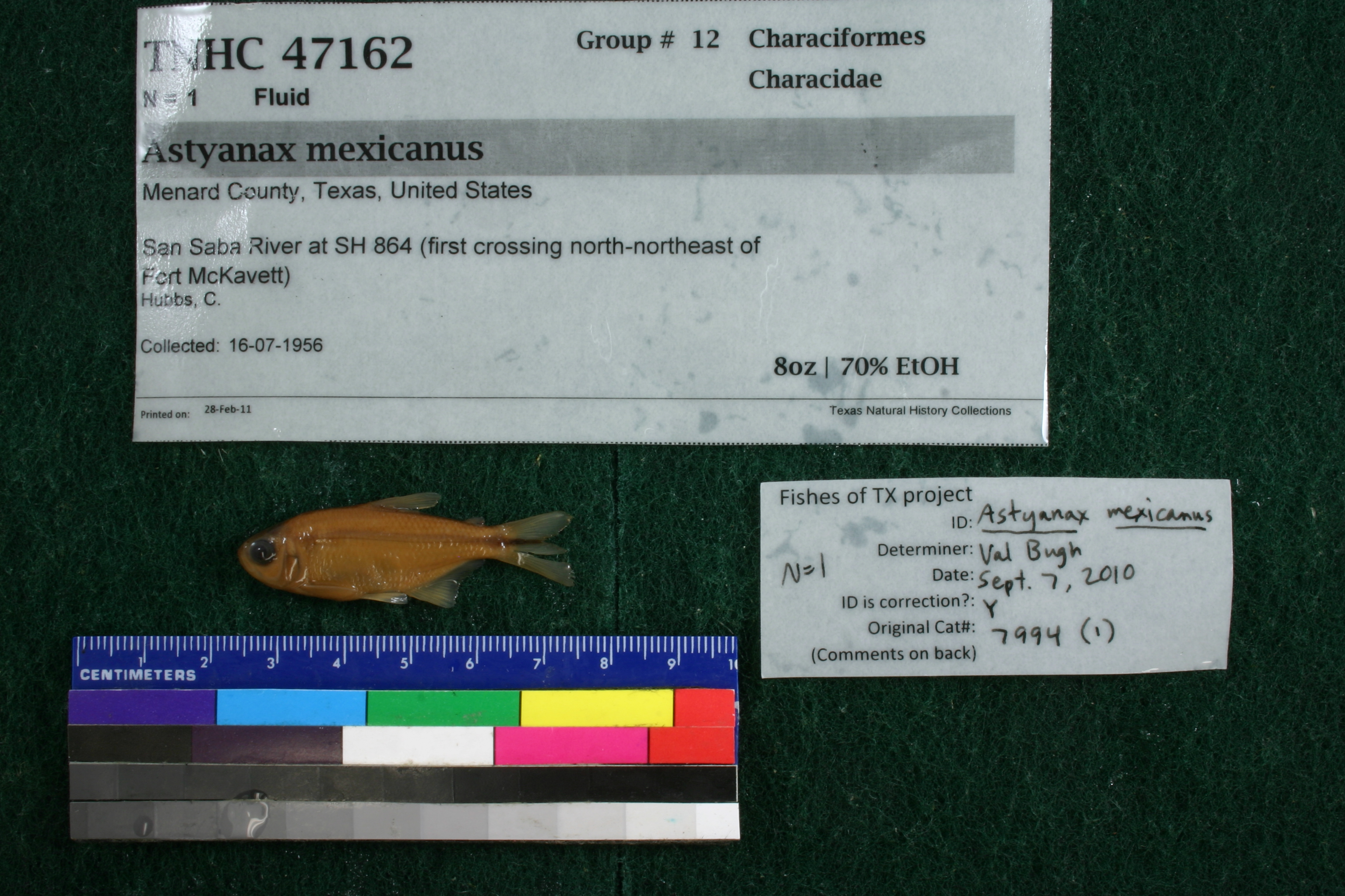
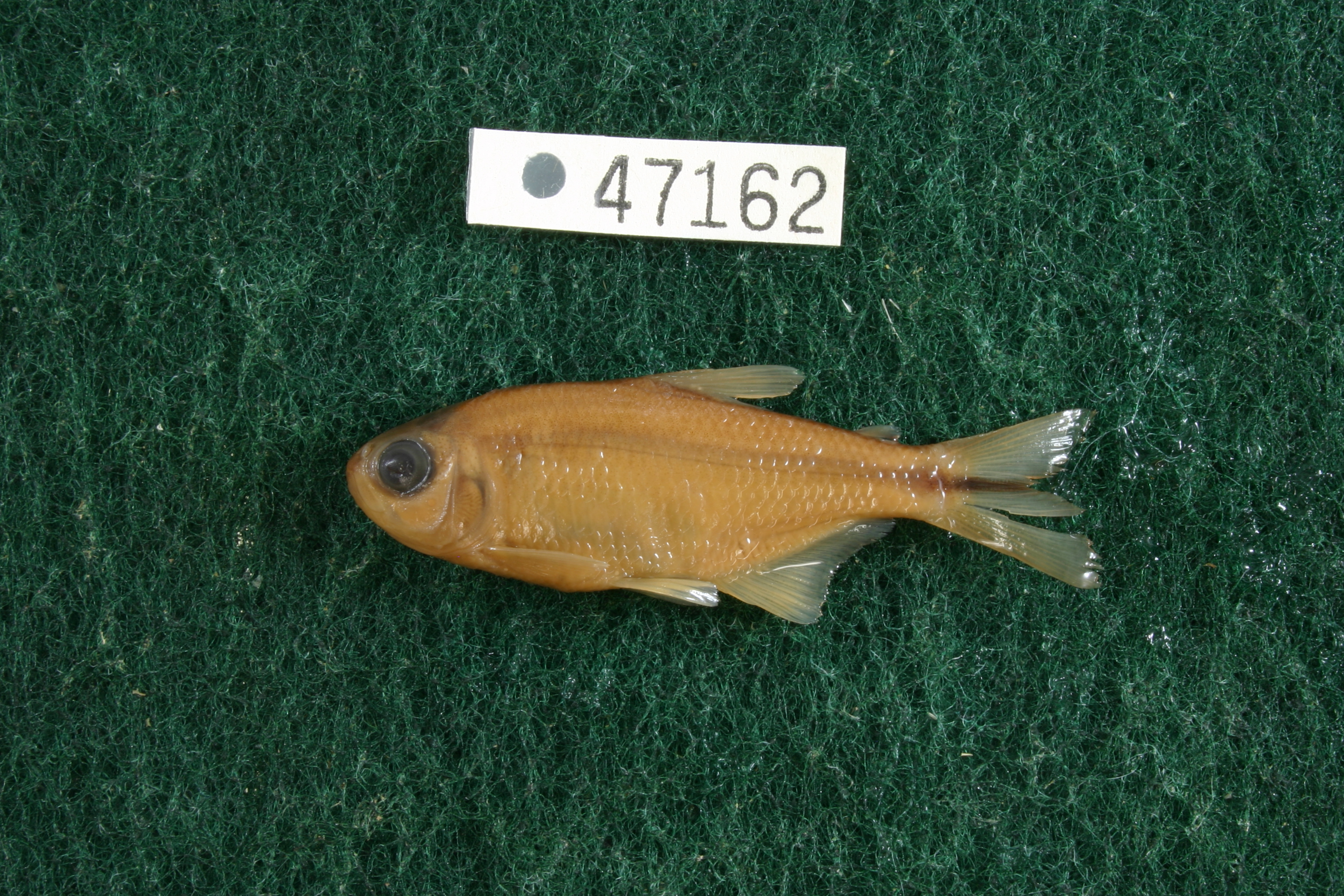
TNHCi_47162
Not suspect, not examinedPhotos
Map
Location
30.83462° N, 100.09372° W
(± 43.7
m)
Taxonomy
FamilyCharacidae
GenusAstyanax
Speciesmexicanus
Specimen
Num Specimens1
PreparationFluid - 1
Identification
Identified ByBugh, Valerie
Date Identified2010.9.7
Collection Event
CollectorHubbs, C.
Collected Date1956.7.16
Field NumberQ-56-40
Geography
CountryUnited States
StateTexas
CountyMenard
LocalitySan Saba River at SH 864 (first crossing north-northeast of Fort McKavett)
Latitude30.8346153
Longitude-100.093721
DatumWGS84
Error43.656
Georeferencing
Georeference RemarksAssumed to be the crossing of SH 864. Should be SH 864 not ranch road 824
Record Source
Source
Texas Natural History Collections
(type: specimens)
Institution
Texas Natural History Collections
(type: museum)
Curator
Dean Hendrickson
Record Added
June 24, 2020
Record Last Modified
March 23, 2026
Data Processing Track
Track 3
From Data Set Received
5/2017 to 11/2017
Identification
Suspect Notes
None
Count
1
Current Determination
Determiner
Unknown
Determination Date
Unknown
Determination Type
Unspecified
Identification Comments
None
Identification Confidence
Unknown
Collecting Event
Collected
July 16, 1956
Collector(s)
Collecting Event ID
280883
Field Notes
There are no field notes available.
Locality
Jurisdiction
Menard, Texas
Name
San Saba River at SH 864 (first crossing north-northeast of Fort McKavett)
Hydrography
Texas-Gulf Region
Lower Colorado-San Bernard Coastal
Middle Colorado-Concho
San Saba
Rocky Creek-San Saba River
Headwaters San Saba River
Captive
no
Locality Photos
No locality photos available.
HUC 12
120901090303
Georeferencing Remarks
Georeference needs verification/refinement; coordinates provided by donor
Georeferencing Annotation
—
Has not been Georeferenced because
This record, being part of the track 3 import, is not formally georeferenced by FoTX staff at this time. However, to allow mapping and visualization of this record, locality information has been provisionally accepted if provided by the donor or if location text could be matched to previously georeferenced records by FoTX team or donor data. For many records spatial error is either accepted from the donor (when provided) or derived based on coordinate precision.
Comments On TNHCi_47162