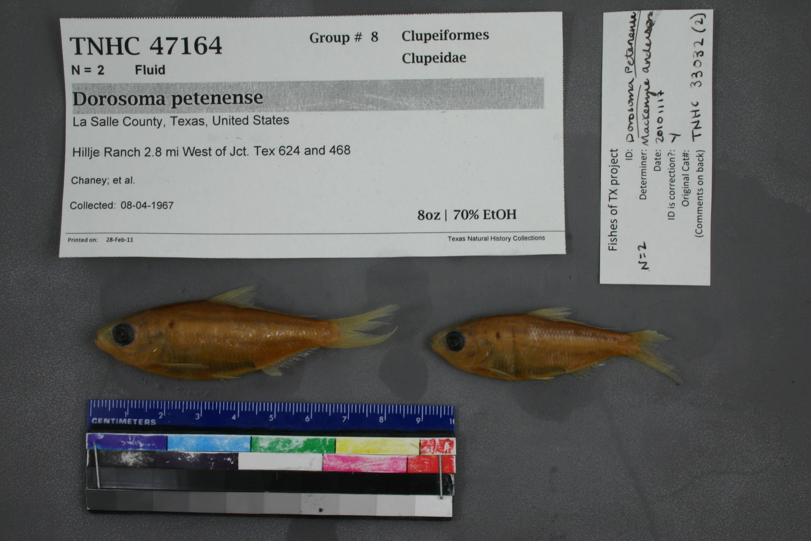
TNHCi_47164
Not suspect, not examinedPhotos
Map
Location
28.43363° N, 99.27779° W
(± 4797.5
m)
Taxonomy
FamilyClupeidae
GenusDorosoma
Speciespetenense
Specimen
Num Specimens2
PreparationFluid - 2
Identification
Identification RemarksAnderson's notes: anal rays 28.
Identified ByAnderson, Mackenzie
Date Identified2010.11.17
Collection Event
CollectorChaney; et al.
Collected Date1967.4.8
Field Numberz33032
Geography
CountryUnited States
StateTexas
CountyLa Salle
LocalityHillje Ranch 2.8 mi W of Cotulla
Latitude28.4336266
Longitude-99.2777906
DatumWGS84
Error4797.454464
Georeferencing
Georeference RemarksCould not find information about Hillje Ranch. Junction of FM 468 and RR 624 is right in the middle of the town, Cotulla. Because of latlong remarks, am changing named place to 2.8 miles W of Cotulla, instead of junction
Record Source
Source
Texas Natural History Collections
(type: specimens)
Institution
Texas Natural History Collections
(type: museum)
Curator
Dean Hendrickson
Record Added
June 24, 2020
Record Last Modified
March 23, 2026
Data Processing Track
Track 3
From Data Set Received
5/2017 to 11/2017
Identification
Suspect Notes
None
Count
2
Current Determination
Determiner
Unknown
Determination Date
Unknown
Determination Type
Unspecified
Identification Comments
None
Identification Confidence
Unknown
Collecting Event
Collected
April 8, 1967
Collector(s)
Collecting Event ID
289998
Field Notes
There are no field notes available.
Locality
Jurisdiction
La Salle, Texas
Name
Hillje Ranch 2.8 mi W of Cotulla
Hydrography
Texas-Gulf Region
Nueces-Southwestern Texas Coastal
Nueces
Upper Nueces
Espio Creek-Nueces River
Salt Creek-Nueces River
Captive
no
Locality Photos
No locality photos available.
HUC 12
121101030705
Georeferencing Remarks
Georeference needs verification/refinement; coordinates provided by donor
Georeferencing Annotation
—
Has not been Georeferenced because
This record, being part of the track 3 import, is not formally georeferenced by FoTX staff at this time. However, to allow mapping and visualization of this record, locality information has been provisionally accepted if provided by the donor or if location text could be matched to previously georeferenced records by FoTX team or donor data. For many records spatial error is either accepted from the donor (when provided) or derived based on coordinate precision.
Comments On TNHCi_47164