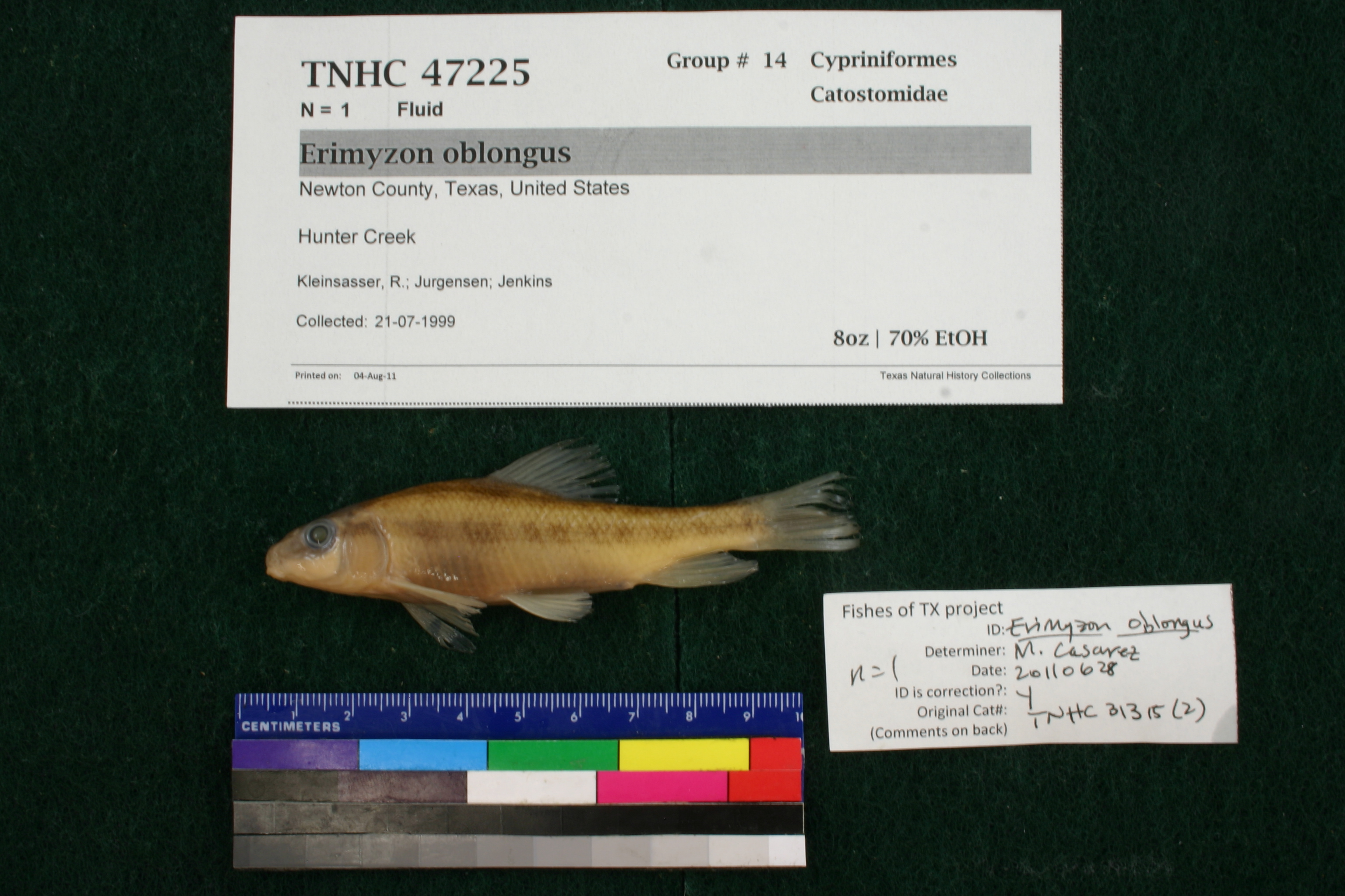
TNHCi_47225
Not suspect, not examinedPhotos
Map
Location
30.96442° N, 93.84245° W
(± 6812.4
m)
Taxonomy
FamilyCatostomidae
GenusErimyzon
Speciesoblongus
Specimen
Num Specimens1
PreparationFluid - 1
Identification
Identification RemarksCasarez's notes: 45 lateral scale rows.
Identified ByCasarez, Melissa
Date Identified2011.6.28
Collection Event
CollectorKleinsasser, R.; Jurgensen; Jenkins
Collected Date1999.7.21
Field Numberz31187
Event RemarksRemap 88. Electrofish sample. Old coll. method: : Electroshocker
Geography
CountryUnited States
StateTexas
CountyNewton
LocalityHunter Creek
Latitude30.9644215
Longitude-93.8424509
DatumWGS84
Error6812.353152
Georeferencing
Georeference RemarksCan't find "CR 274" so treated as "Hunter Creek".
Record Source
Source
Texas Natural History Collections
(type: specimens)
Institution
Texas Natural History Collections
(type: museum)
Curator
Dean Hendrickson
Record Added
June 24, 2020
Record Last Modified
March 23, 2026
Data Processing Track
Track 3
From Data Set Received
5/2017 to 11/2017
Identification
Suspect Notes
None
Count
1
Current Determination
Determiner
Unknown
Determination Date
Unknown
Determination Type
Unspecified
Identification Comments
None
Identification Confidence
Unknown
Collecting Event
Collected
July 21, 1999
Collector(s)
Collecting Event ID
358730
Field Notes
There are no field notes available.
Locality
Jurisdiction
Newton, Texas
Name
Hunter Creek
Hydrography
Texas-Gulf Region
Sabine
Sabine
Lower Sabine
Big Cow Creek
Hunter Creek
Captive
no
Locality Photos
No locality photos available.
HUC 12
120100050601
Georeferencing Remarks
Georeference needs verification/refinement; coordinates provided by donor
Georeferencing Annotation
—
Has not been Georeferenced because
This record, being part of the track 3 import, is not formally georeferenced by FoTX staff at this time. However, to allow mapping and visualization of this record, locality information has been provisionally accepted if provided by the donor or if location text could be matched to previously georeferenced records by FoTX team or donor data. For many records spatial error is either accepted from the donor (when provided) or derived based on coordinate precision.
Comments On TNHCi_47225