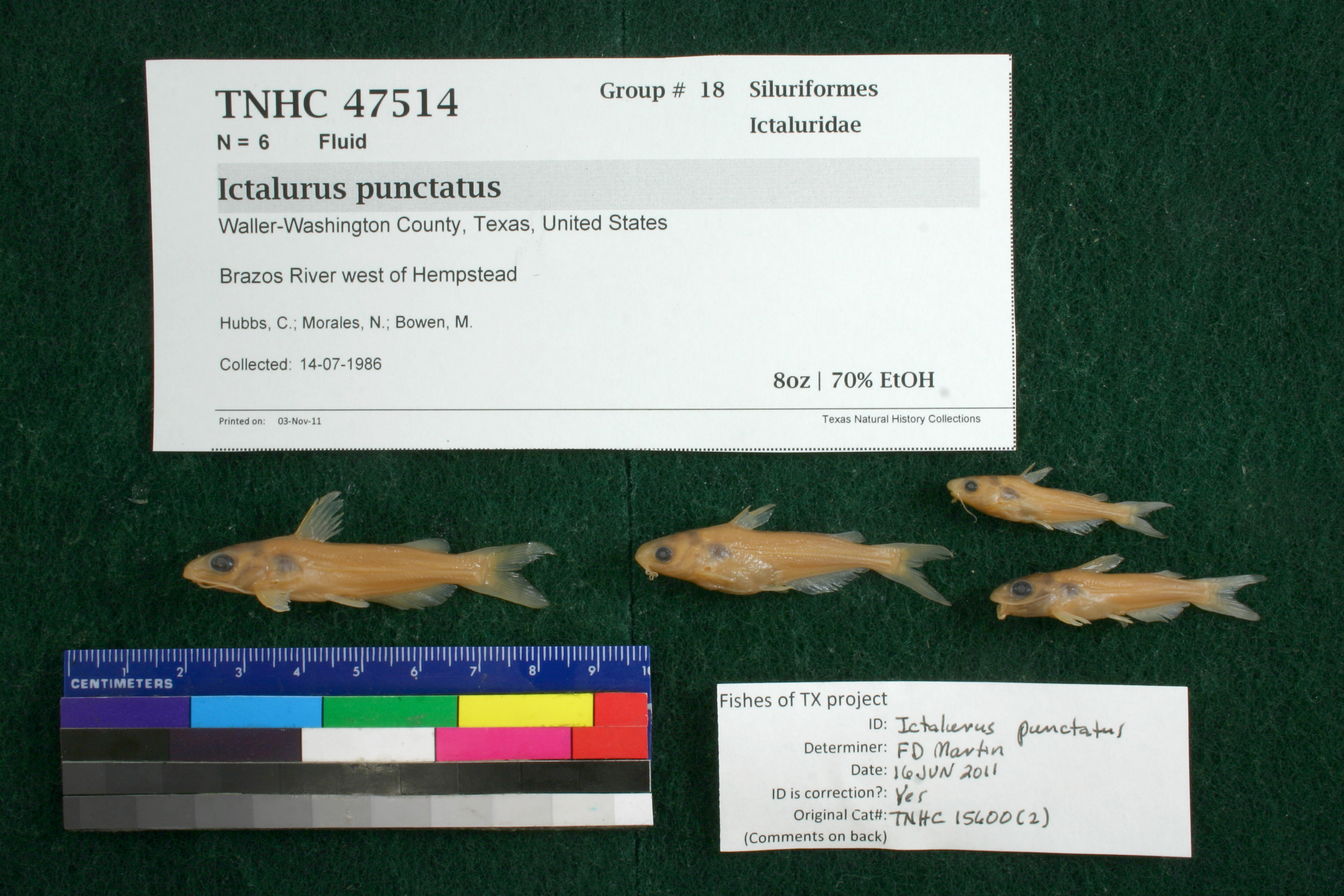
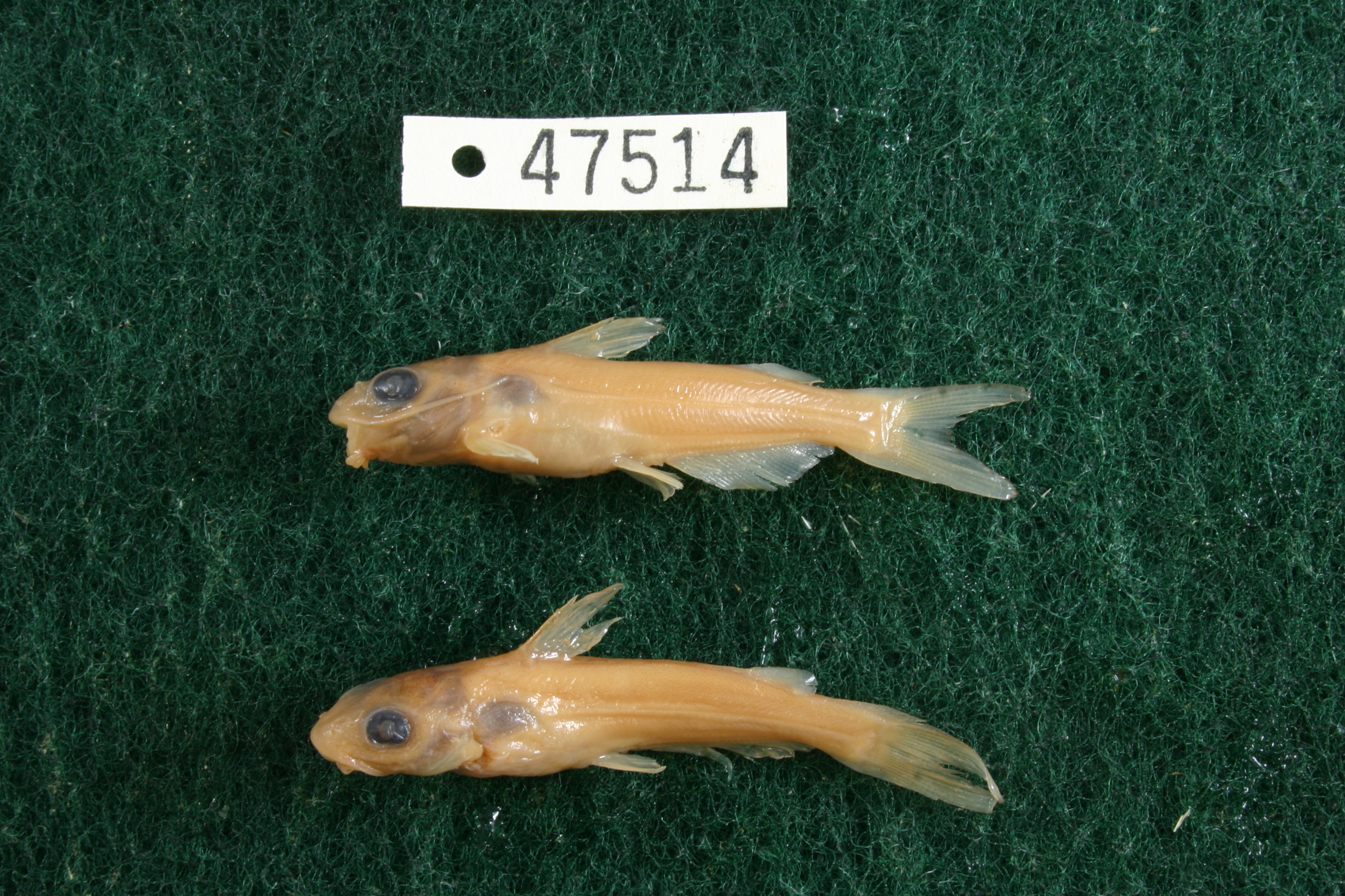
TNHCi_47514
Not suspect, not examinedPhotos
Map
Location
30.09770° N, 96.15895° W
(± 6691.7
m)
Taxonomy
FamilyIctaluridae
GenusIctalurus
Speciespunctatus
Specimen
Num Specimens6
PreparationFluid - 6
Identification
Identification RemarksMartin's notes; anal rays 27-29.
Identified ByMartin, Floyd
Date Identified2011.6.16
Collection Event
CollectorHubbs, C.; Morales, N.; Bowen, M.
Collected Date1986.7.14
Field NumberZ15600Q-86-108
Geography
CountryUnited States
StateTexas
CountyWaller-Washington
LocalityBrazos River west of Hempstead
Latitude30.0976963
Longitude-96.158949
DatumWGS84
Error6691.652352
Georeferencing
Georeference RemarksPoint placed west of Hempstead and extents placed on river at headings going SW and NW of Hempstead. No county given, but determined to be Waller/Washington co. line
Record Source
Source
Texas Natural History Collections
(type: specimens)
Institution
Texas Natural History Collections
(type: museum)
Curator
Dean Hendrickson
Record Added
June 24, 2020
Record Last Modified
March 23, 2026
Data Processing Track
Track 3
From Data Set Received
5/2017 to 11/2017
Identification
Suspect Notes
None
Count
6
Current Determination
Determiner
Unknown
Determination Date
Unknown
Determination Type
Unspecified
Identification Comments
None
Identification Confidence
Unknown
Collecting Event
Collected
July 14, 1986
Collector(s)
Collecting Event ID
317696
Field Notes
There are no field notes available.
Locality
Jurisdiction
Washington, Texas
Name
Brazos River west of Hempstead
Hydrography
Texas-Gulf Region
Lower Brazos
Lower Brazos
Lower Brazos
Clear Creek-Brazos River
Browning Branch-Brazos River
Captive
no
Locality Photos
No locality photos available.
HUC 12
120701040102
Georeferencing Remarks
Georeference needs verification/refinement; coordinates provided by donor
Georeferencing Annotation
—
Has not been Georeferenced because
This record, being part of the track 3 import, is not formally georeferenced by FoTX staff at this time. However, to allow mapping and visualization of this record, locality information has been provisionally accepted if provided by the donor or if location text could be matched to previously georeferenced records by FoTX team or donor data. For many records spatial error is either accepted from the donor (when provided) or derived based on coordinate precision.
Comments On TNHCi_47514