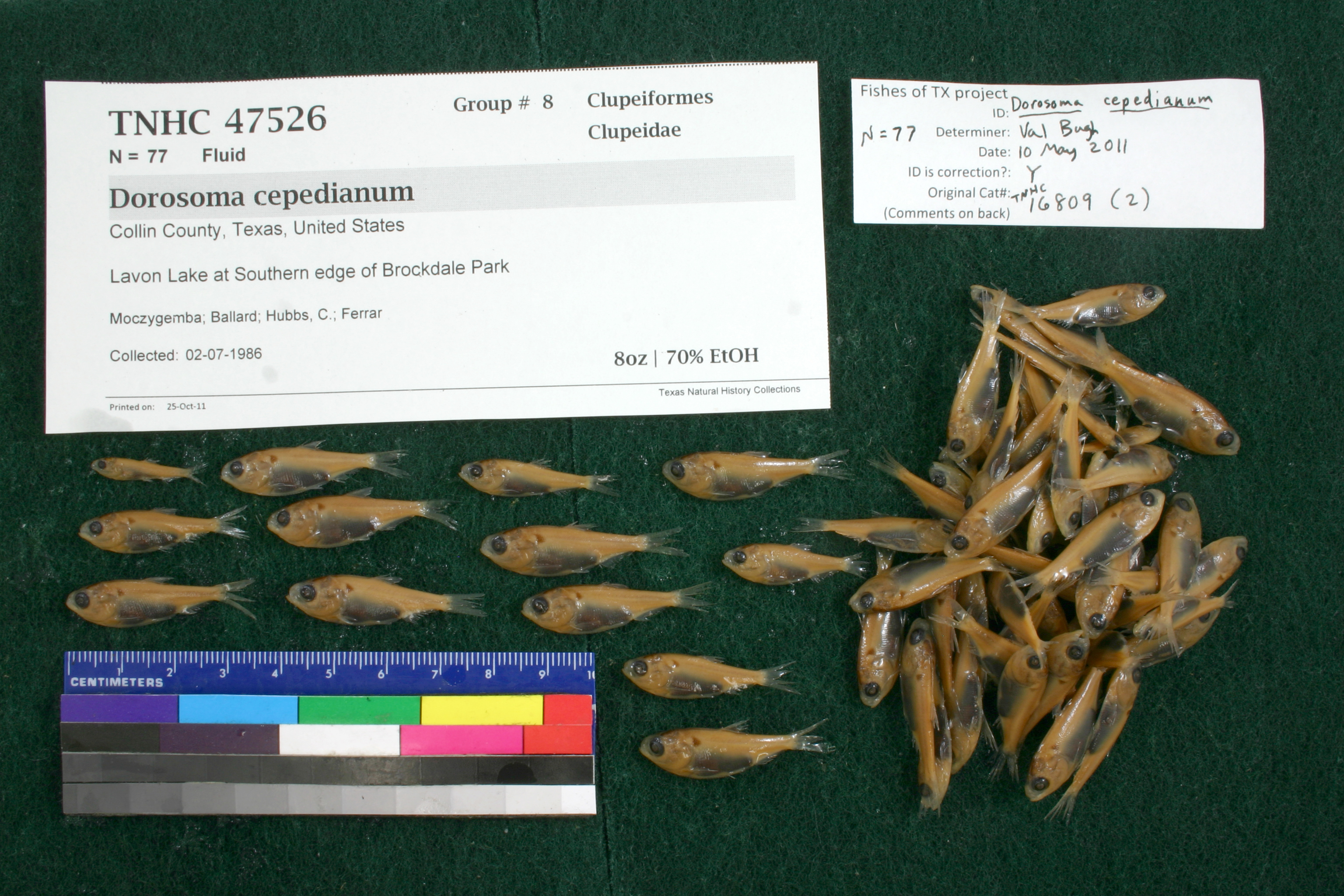
TNHCi_47526
Not suspect, not examinedPhotos
Map
Location
33.07114° N, 96.54398° W
(± 2748.8
m)
Taxonomy
FamilyClupeidae
GenusDorosoma
Speciescepedianum
Specimen
Num Specimens77
PreparationFluid - 77
Identification
Identification RemarksBugh's notes: anal rays 32, 31.
Identified ByBugh, Valerie
Date Identified2011.5.10
Collection Event
CollectorMoczygemba, John; Ballard; Hubbs, C.; Ferrar
Collected Date1986.7.2
Field NumberZ16809Q-86-85
Event RemarksLocality updated to Brockdale from Brockvale, 29 Aug 2011. Only the Locality field was updated, none of the georef. fields were updated with the corrected name.
Geography
CountryUnited States
StateTexas
CountyCollin
LocalityLavon Lake at S edge of Brockdale Park
Latitude33.071136
Longitude-96.543975
DatumWGS84
Error2748.759552
Georeferencing
Georeference Remarkspoint placed on lake at Brockdale Park (from google maps) extent runs to Collin Park
Record Source
Source
Texas Natural History Collections
(type: specimens)
Institution
Texas Natural History Collections
(type: museum)
Curator
Dean Hendrickson
Record Added
June 24, 2020
Record Last Modified
March 23, 2026
Data Processing Track
Track 3
From Data Set Received
5/2017 to 11/2017
Identification
Suspect Notes
None
Count
77
Current Determination
Determiner
Unknown
Determination Date
Unknown
Determination Type
Unspecified
Identification Comments
None
Identification Confidence
Unknown
Collecting Event
Collected
July 2, 1986
Collector(s)
Collecting Event ID
317660
Field Notes
There are no field notes available.
Locality
Jurisdiction
Collin, Texas
Name
Lavon Lake at S edge of Brockdale Park
Hydrography
Texas-Gulf Region
Trinity
Upper Trinity
East Fork Trinity
East Fork Trinity River-Levon Lake
White Rock Creek-Levon Lake
Captive
no
Locality Photos
No locality photos available.
HUC 12
120301060208
Georeferencing Remarks
Georeference needs verification/refinement; coordinates provided by donor
Georeferencing Annotation
—
Has not been Georeferenced because
This record, being part of the track 3 import, is not formally georeferenced by FoTX staff at this time. However, to allow mapping and visualization of this record, locality information has been provisionally accepted if provided by the donor or if location text could be matched to previously georeferenced records by FoTX team or donor data. For many records spatial error is either accepted from the donor (when provided) or derived based on coordinate precision.
Comments On TNHCi_47526