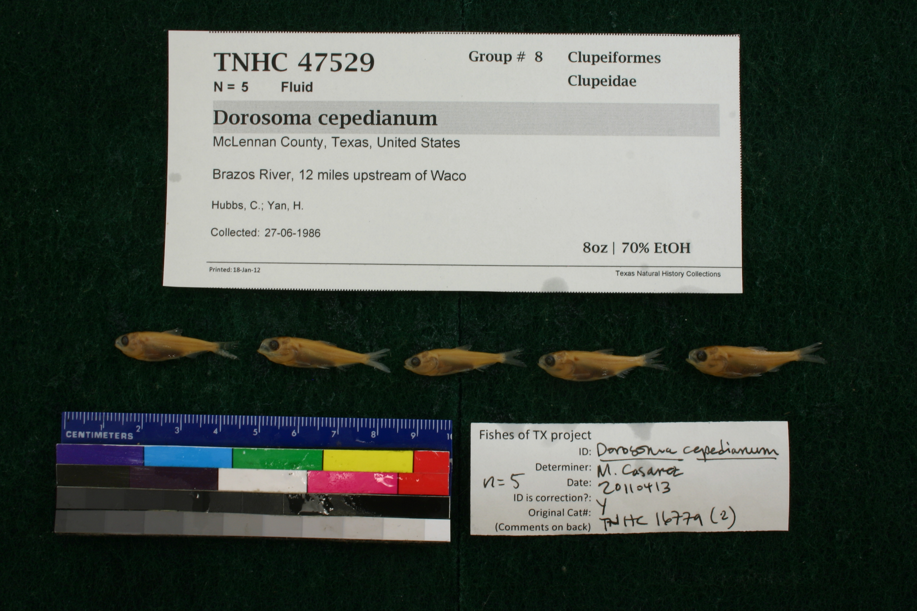
TNHCi_47529
Not suspect, not examinedPhotos
Map
Location
31.67122° N, 97.17740° W
(± 111.2
m)
Taxonomy
FamilyClupeidae
GenusDorosoma
Speciescepedianum
Specimen
Num Specimens5
PreparationFluid - 5
Identification
Identification RemarksVerified by Doug Martin on 11 Aug 2011 with notes: anal rays of 32 on two individuals, 33 on one.
Identified ByCasarez, Melissa
Date Identified2011.4.13
Collection Event
CollectorHubbs, C.; Yan, H.
Collected Date1986.6.27
Field NumberZ16779Q-86-71
Geography
CountryUnited States
StateTexas
CountyMcLennan
LocalityBrazos River, 12 miles upstream of Waco
Latitude31.6712153
Longitude-97.1773985
DatumWGS84
Error111.1870776
Georeferencing
Georeference RemarksAssumed travel upstream by river
Record
Occurrence Remarksremoved from TNHC# 16779 and redetermined to be D. cepedianum
Record Source
Source
Texas Natural History Collections
(type: specimens)
Institution
Texas Natural History Collections
(type: museum)
Curator
Dean Hendrickson
Record Added
June 24, 2020
Record Last Modified
March 23, 2026
Data Processing Track
Track 3
From Data Set Received
5/2017 to 11/2017
Identification
Suspect Notes
None
Count
5
Current Determination
Determiner
Unknown
Determination Date
Unknown
Determination Type
Unspecified
Identification Comments
None
Identification Confidence
Unknown
Collecting Event
Collected
June 27, 1986
Collecting Event ID
317649
Field Notes
There are no field notes available.
Locality
Jurisdiction
McLennan, Texas
Name
Brazos River, 12 miles upstream of Waco
Hydrography
Texas-Gulf Region
Middle Brazos
Middle Brazos-Bosque
Middle Brazos-Lake Whitney
Childress Creek-Brazos River
Eagle Creek-Brazos River
Captive
no
Locality Photos
No locality photos available.
HUC 12
120602020605
Georeferencing Remarks
Georeference needs verification/refinement; coordinates provided by donor
Georeferencing Annotation
—
Has not been Georeferenced because
This record, being part of the track 3 import, is not formally georeferenced by FoTX staff at this time. However, to allow mapping and visualization of this record, locality information has been provisionally accepted if provided by the donor or if location text could be matched to previously georeferenced records by FoTX team or donor data. For many records spatial error is either accepted from the donor (when provided) or derived based on coordinate precision.
Comments On TNHCi_47529