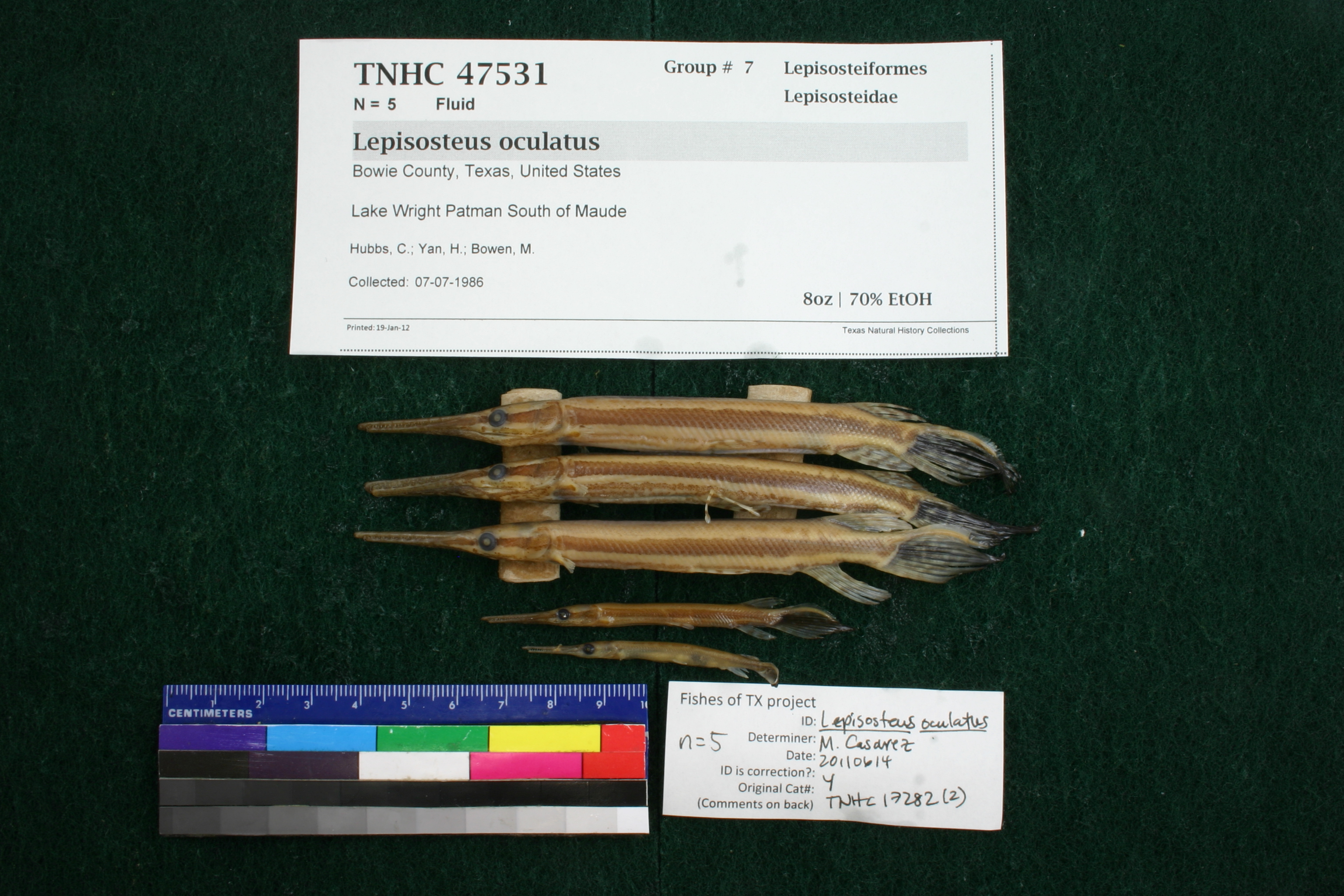
TNHCi_47531
Not suspect, not examinedPhotos
Map
Location
33.26915° N, 94.34221° W
(± 1622.2
m)
Taxonomy
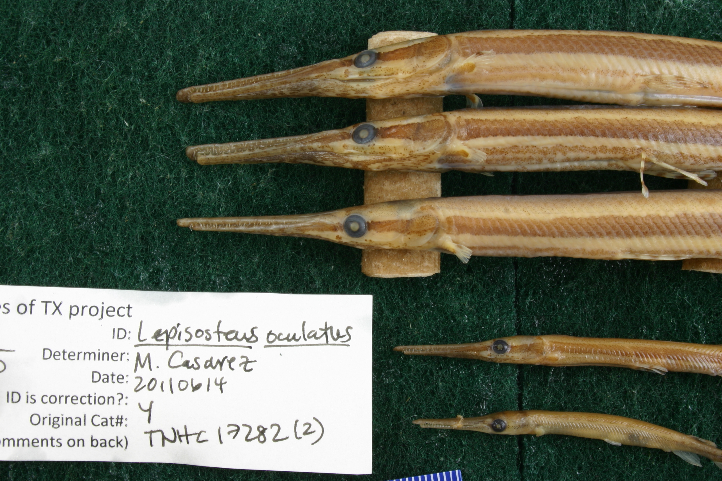
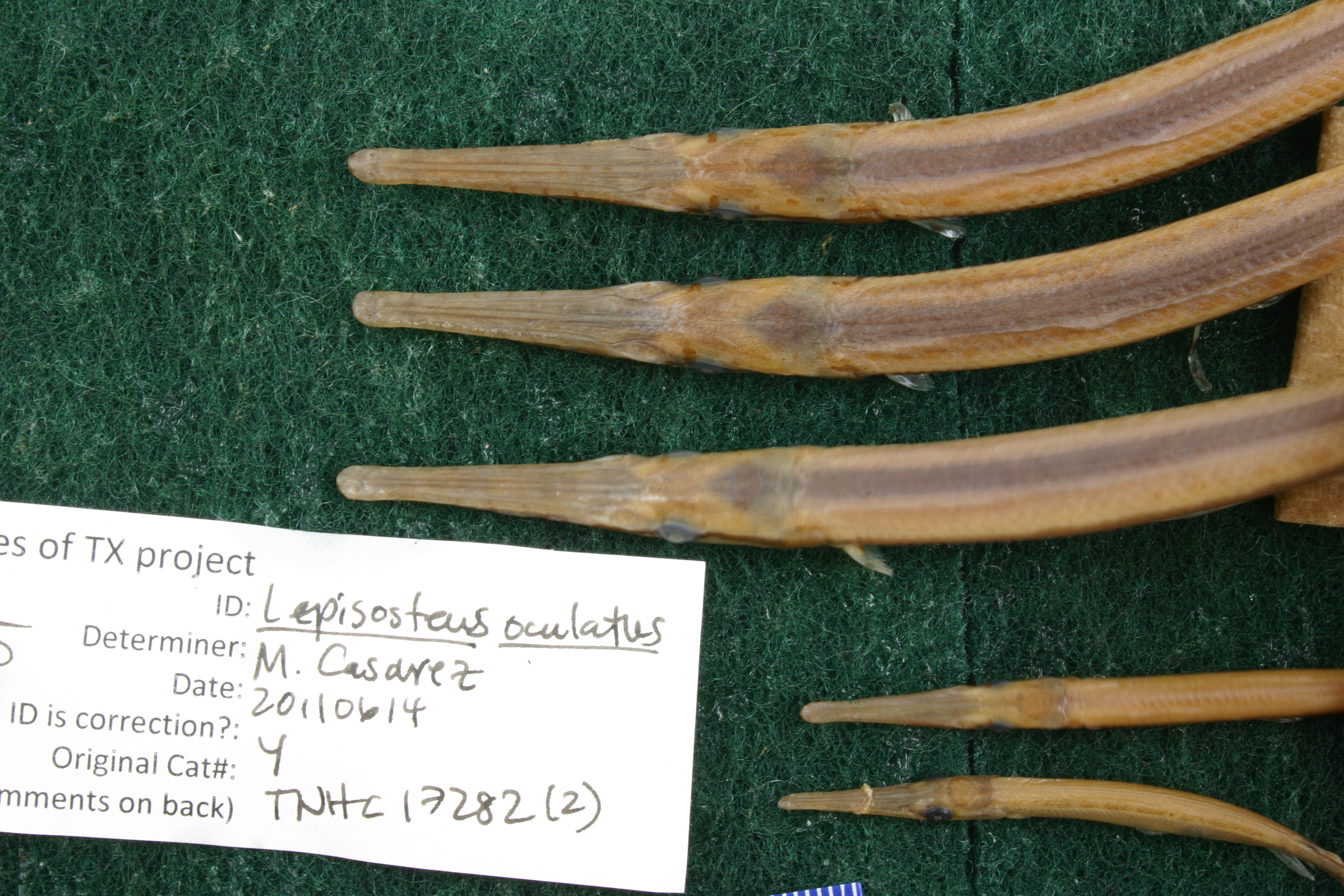
FamilyLepisosteidae
GenusLepisosteus
Speciesoculatus
Specimen
Num Specimens5
PreparationFluid - 5
Identification
Identification RemarksCasarez's notes: lateral line scales 55, 56.
Identified ByCasarez, Melissa
Date Identified2011.6.14
Collection Event
CollectorHubbs, C.; Yan, H.; Bowen, M.
Collected Date1986.7.7
Field NumberQ-86-97
Geography
CountryUnited States
StateTexas
CountyBowie
LocalityLake Wright Patman South of Maude
Latitude33.2691537
Longitude-94.3422075
DatumWGS84
Error1622.218752
Record Source
Source
Texas Natural History Collections
(type: specimens)
Institution
Texas Natural History Collections
(type: museum)
Curator
Dean Hendrickson
Record Added
June 24, 2020
Record Last Modified
March 23, 2026
Data Processing Track
Track 3
From Data Set Received
5/2017 to 11/2017
Identification
Suspect Notes
None
Count
5
Current Determination
Determiner
Unknown
Determination Date
Unknown
Determination Type
Unspecified
Identification Comments
None
Identification Confidence
Unknown
Collecting Event
Collected
July 7, 1986
Collecting Event ID
317668
Field Notes
There are no field notes available.
Locality
Jurisdiction
Bowie, Texas
Name
Lake Wright Patman South of Maude
Hydrography
Arkansas-White-Red Region
Red-Sulphur
Big Cypress-Sulphur
Lower Sulpher
Sulphur River-Wright Patman Lake
Webster Creek-Wright Patman Lake
Captive
no
Locality Photos
No locality photos available.
HUC 12
111403020606
Georeferencing Remarks
Georeference needs verification/refinement; coordinates provided by donor
Georeferencing Annotation
—
Has not been Georeferenced because
This record, being part of the track 3 import, is not formally georeferenced by FoTX staff at this time. However, to allow mapping and visualization of this record, locality information has been provisionally accepted if provided by the donor or if location text could be matched to previously georeferenced records by FoTX team or donor data. For many records spatial error is either accepted from the donor (when provided) or derived based on coordinate precision.
Comments On TNHCi_47531