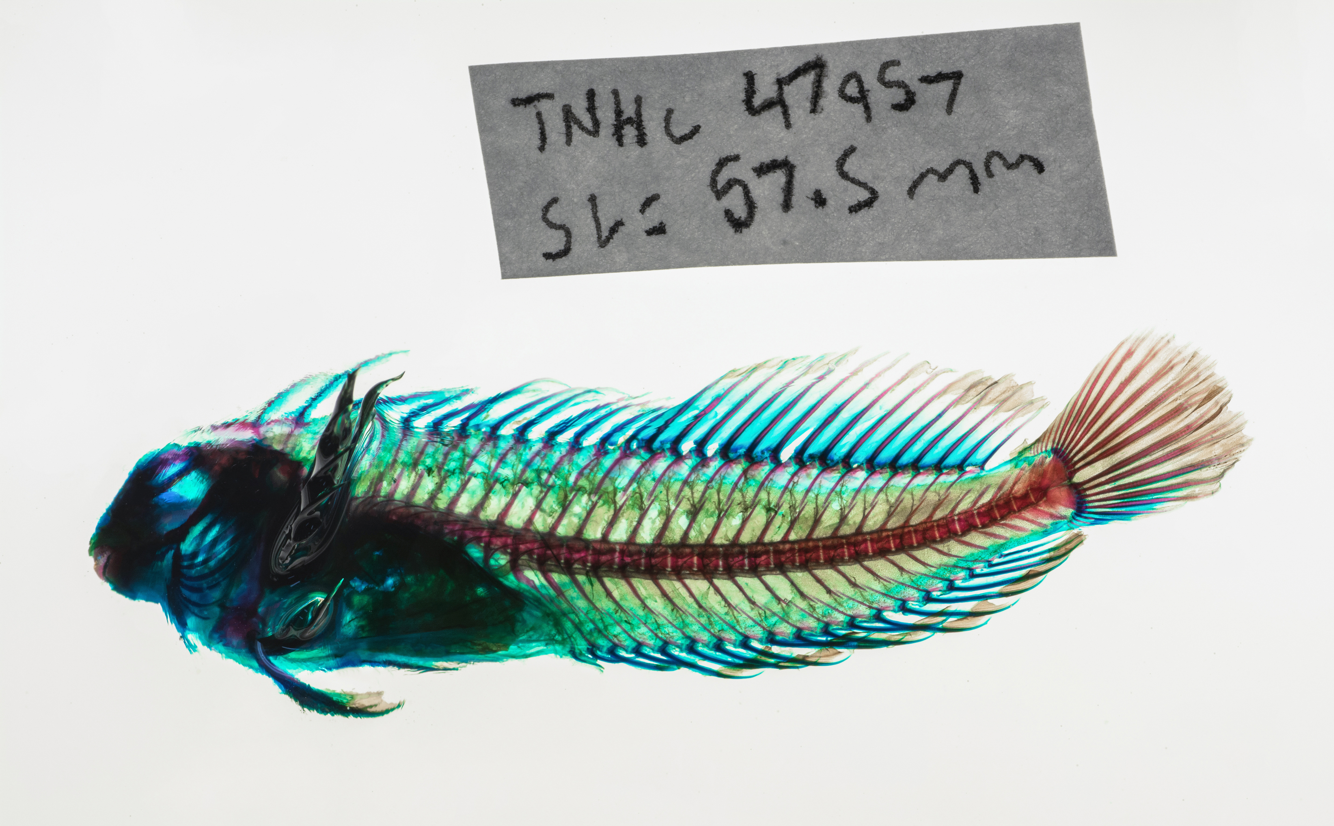
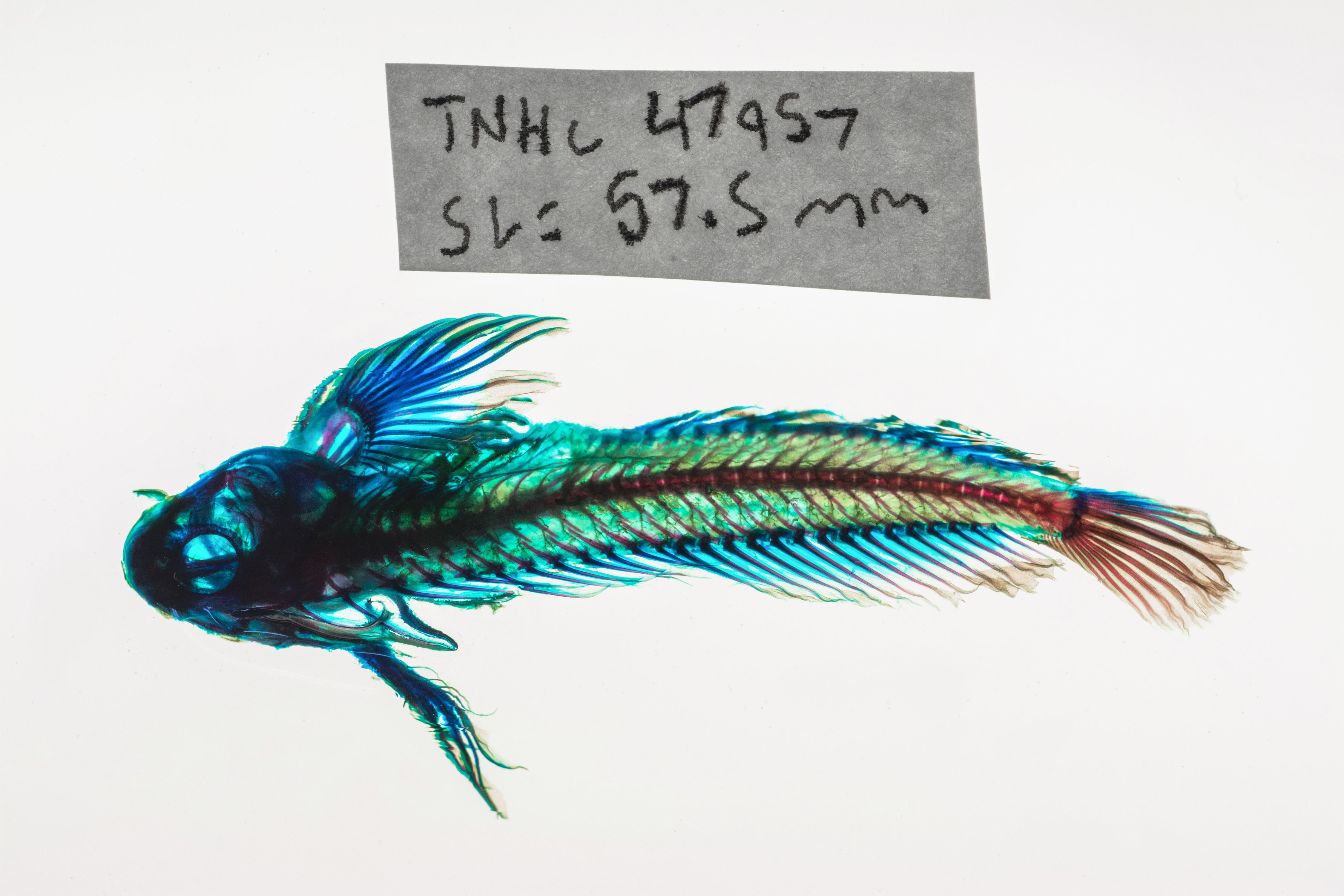
TNHCi_47957
Not suspect, not examinedPhotos
Map
Location
27.67599° N, 97.16532° W
(± 45
m)
Taxonomy
FamilyBlenniidae
GenusScartella
Speciescristata
Specimen
Num Specimens60
PreparationFluid - 58; C&S skeleton - 2
Identification
Identified ByMartin, Floyd
Date Identified2011.10.8
Collection Event
CollectorMartin, Floyd; Cohen, Adam; Mosier, Doyle
Collected Date2011.9.24
Field NumberFDM20110924-1
Event Remarkslooking for cling fish by scraping rocks with dip nets
Geography
CountryUnited States
StateTexas
CountyNueces
Localitygranite groin at surf on Mustang Island State Park
Latitude27.67599
Longitude-97.16532
DatumWGS84
Record
Occurrence RemarksFor one C&S specimen, SL is 39.47 mm and TL is 48.03 mm. For second C&S specimen, SL is 55.69 mm and TL is 66.60 mm. For other C&S specimen, SL is 57.73 mm and TL is 68.95 mm.
Record Source
Source
Texas Natural History Collections
(type: specimens)
Institution
Texas Natural History Collections
(type: museum)
Curator
Dean Hendrickson
Record Added
June 24, 2020
Record Last Modified
March 23, 2026
Data Processing Track
Track 3
From Data Set Received
5/2017 to 11/2017
Identification
Suspect Notes
None
Count
60
Current Determination
Determiner
Unknown
Determination Date
Unknown
Determination Type
Unspecified
Identification Comments
None
Identification Confidence
Unknown
Collecting Event
Collected
Sept. 24, 2011
Collector(s)
Collecting Event ID
402257
Field Notes
There are no field notes available.
Locality
Jurisdiction
Gulf of Mexico, North America
Name
granite groin at surf on Mustang Island State Park
Hydrography
Not available
Captive
no
Locality Photos
No locality photos available.
HUC
—
Georeferencing Remarks
Georeference needs verification/refinement; coordinates provided by donor
Georeferencing Annotation
—
Has not been Georeferenced because
This record, being part of the track 3 import, is not formally georeferenced by FoTX staff at this time. However, to allow mapping and visualization of this record, locality information has been provisionally accepted if provided by the donor or if location text could be matched to previously georeferenced records by FoTX team or donor data. For many records spatial error is either accepted from the donor (when provided) or derived based on coordinate precision.
Comments On TNHCi_47957