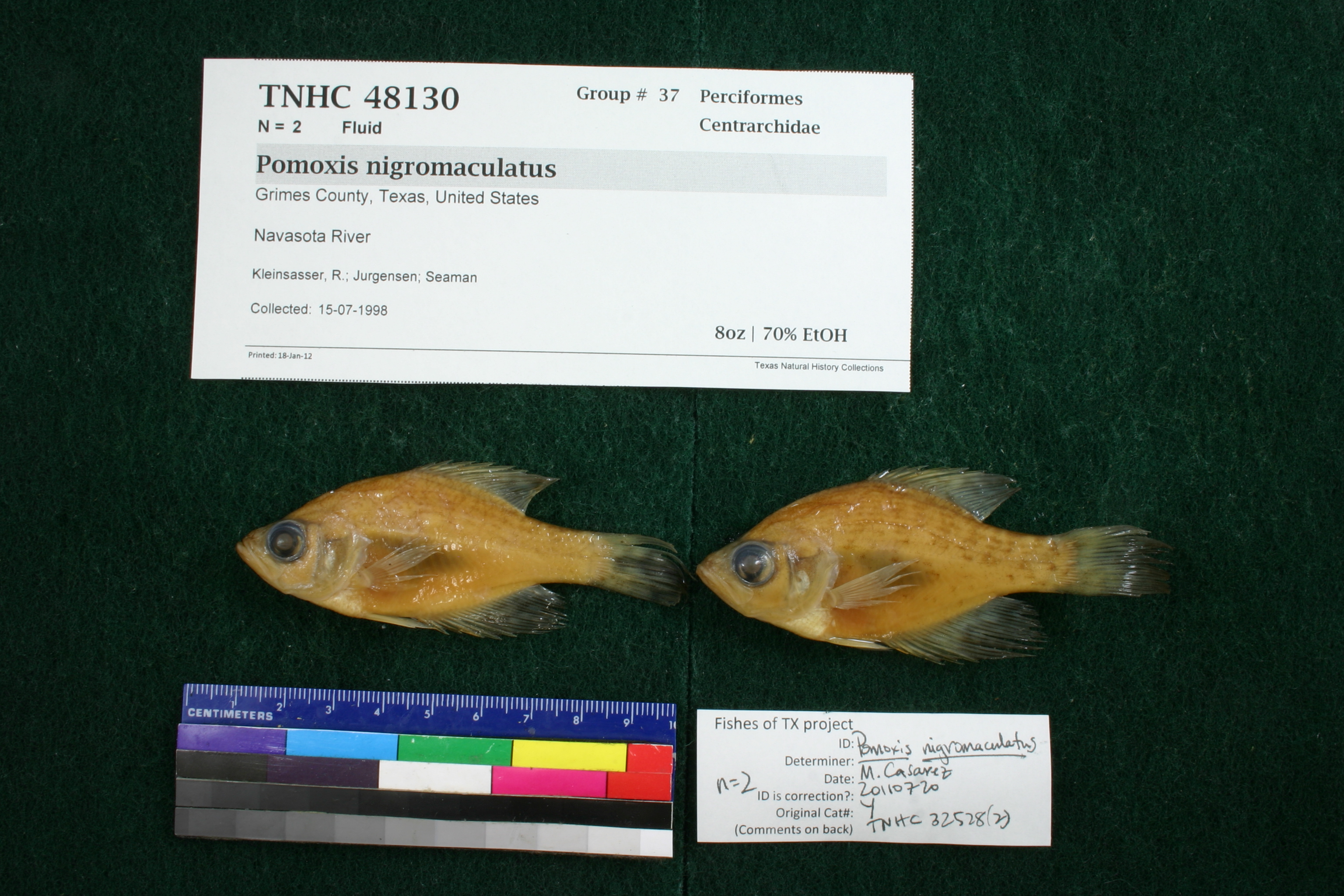
TNHCi_48130
Not suspect, not examinedPhotos
Map
Location
30.57769° N, 96.16994° W
(± 27572.9
m)
Taxonomy
FamilyCentrarchidae
GenusPomoxis
Speciesnigromaculatus
Specimen
Num Specimens2
PreparationFluid - 2
Identification
Identification RemarksCasarez's notes: 7 dorsal spines
Identified ByCasarez, Melissa
Date Identified2011.7.20
Collection Event
CollectorKleinsasser, R.; Jurgensen; Seaman
Collected Date1998.7.15
Field Numberz32152
Event RemarksRemap 46. Backpack shocker sample.- Bottle 236. Old coll. method: : Backpack shocker
Geography
CountryUnited States
StateTexas
CountyGrimes
LocalityNavasota River
Latitude30.5776895
Longitude-96.1699379
DatumWGS84
Error27572.89075
Record
Occurrence Remarksoriginally from TNHC# 32528. Removed due to redetermination.
Record Source
Source
Texas Natural History Collections
(type: specimens)
Institution
Texas Natural History Collections
(type: museum)
Curator
Dean Hendrickson
Record Added
June 24, 2020
Record Last Modified
March 23, 2026
Data Processing Track
Track 3
From Data Set Received
5/2017 to 11/2017
Identification
Suspect Notes
None
Count
2
Current Determination
Determiner
Unknown
Determination Date
Unknown
Determination Type
Unspecified
Identification Comments
None
Identification Confidence
Unknown
Collecting Event
Collected
July 15, 1998
Collector(s)
Collecting Event ID
354769
Field Notes
There are no field notes available.
Locality
Jurisdiction
Grimes, Texas
Name
Navasota River
Hydrography
Texas-Gulf Region
Lower Brazos
Lower Brazos
Navasota
Gibbons Creek-Navasota River
Carters Creek-Navasota River
Captive
no
Locality Photos
No locality photos available.
HUC 12
120701030704
Georeferencing Remarks
Georeference needs verification/refinement; coordinates provided by donor
Georeferencing Annotation
—
Has not been Georeferenced because
This record, being part of the track 3 import, is not formally georeferenced by FoTX staff at this time. However, to allow mapping and visualization of this record, locality information has been provisionally accepted if provided by the donor or if location text could be matched to previously georeferenced records by FoTX team or donor data. For many records spatial error is either accepted from the donor (when provided) or derived based on coordinate precision.
Comments On TNHCi_48130