TNHCi_48370
Not suspect, not examinedPhotos
Map
Location
29.84441° N, 93.91032° W
(± 7016.7
m)
Taxonomy
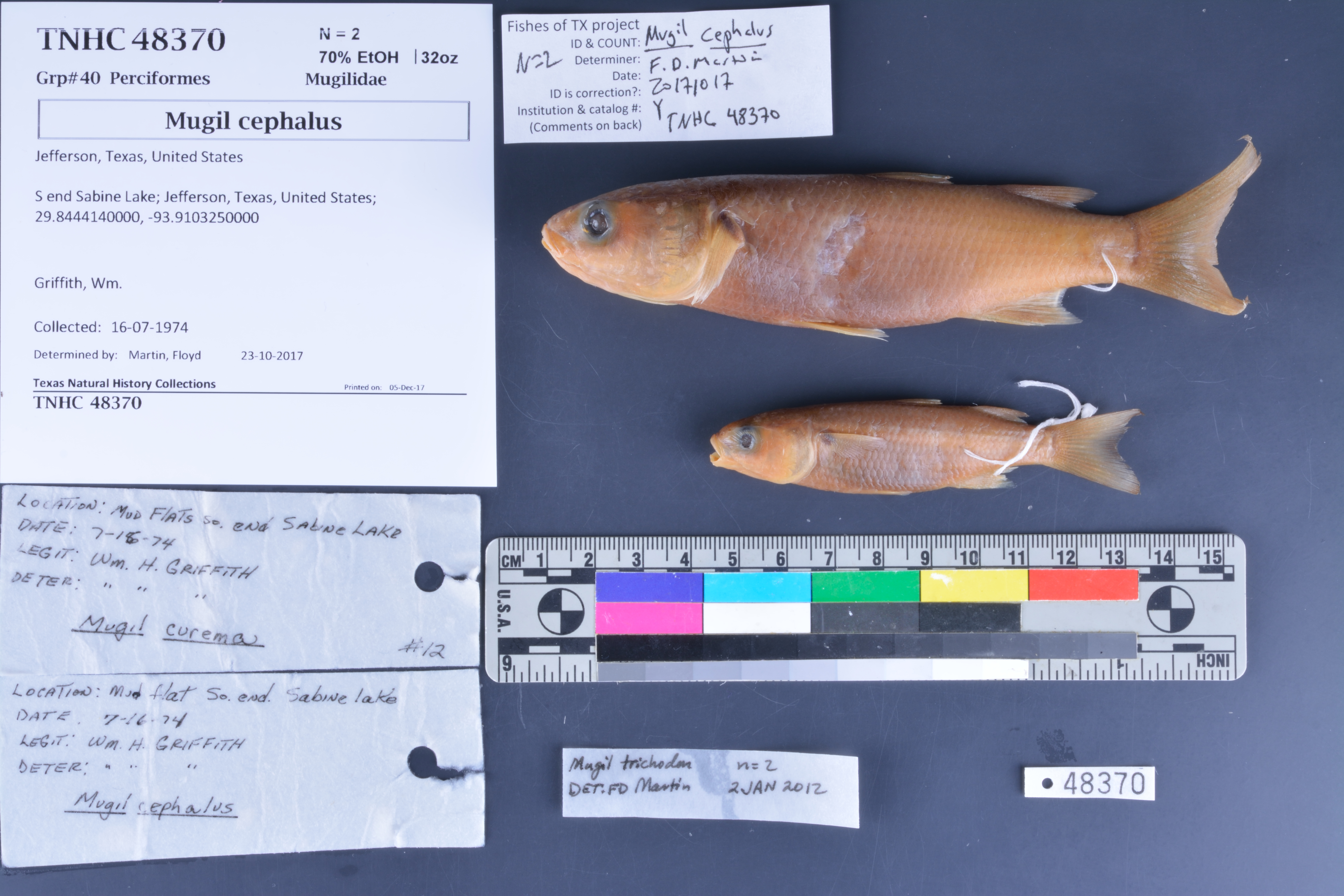
FamilyMugilidae
GenusMugil
Speciescephalus
Specimen
Num Specimens2
PreparationFluid - 2
Identification
Identified ByMartin, Floyd
Date Identified2017.10.23
Collection Event
CollectorGriffith, Wm.
Collected Date1974.7.16
Field Numberz48370
Event Remarksno county or state info provided - assuming TX because Lamar University donation
Geography
CountryUnited States
StateTexas
CountyJefferson
LocalityS end Sabine Lake
Latitude29.844414
Longitude-93.910325
DatumWGS84
Error7016.74202
Georeferencing
Georeference RemarksCould not locate mud flats on map. Measured length of Sabine Lake and split into N and S end. Measured length of S end of Sabine Lake and placed coordinates halfway. Error is half the distance
Record
Occurrence Remarks2 specimens with 2 originally different ID's (Mugil curema and Mugil cephalus) but same locality tags in jar
Record Source
Source
Texas Natural History Collections
(type: specimens)
Institution
Texas Natural History Collections
(type: museum)
Curator
Dean Hendrickson
Record Added
June 24, 2020
Record Last Modified
March 23, 2026
Data Processing Track
Track 3
From Data Set Received
5/2017 to 11/2017
Identification
Suspect Notes
None
Count
2
Current Determination
Determiner
Floyd Douglas Martin
Determination Date
Feb. 11, 2016
Determination Type
specimen examination
Identification Comments
ID complete
Identification Confidence
High
Collecting Event
Collected
July 16, 1974
Collector(s)
Collecting Event ID
298754
Field Notes
There are no field notes available.
Locality
Jurisdiction
Jefferson, Texas
Name
S end Sabine Lake
Hydrography
Texas-Gulf Region
Galveston Bay-San Jacinto
Galveston Bay-Sabine Lake
Sabine Lake
Old River Bayou
Old River Bayou
Captive
no
Locality Photos
No locality photos available.
HUC 12
120402010500
Georeferencing Remarks
Georeference needs verification/refinement; coordinates provided by donor
Georeferencing Annotation
—
Has not been Georeferenced because
This record, being part of the track 3 import, is not formally georeferenced by FoTX staff at this time. However, to allow mapping and visualization of this record, locality information has been provisionally accepted if provided by the donor or if location text could be matched to previously georeferenced records by FoTX team or donor data. For many records spatial error is either accepted from the donor (when provided) or derived based on coordinate precision.
Comments On TNHCi_48370