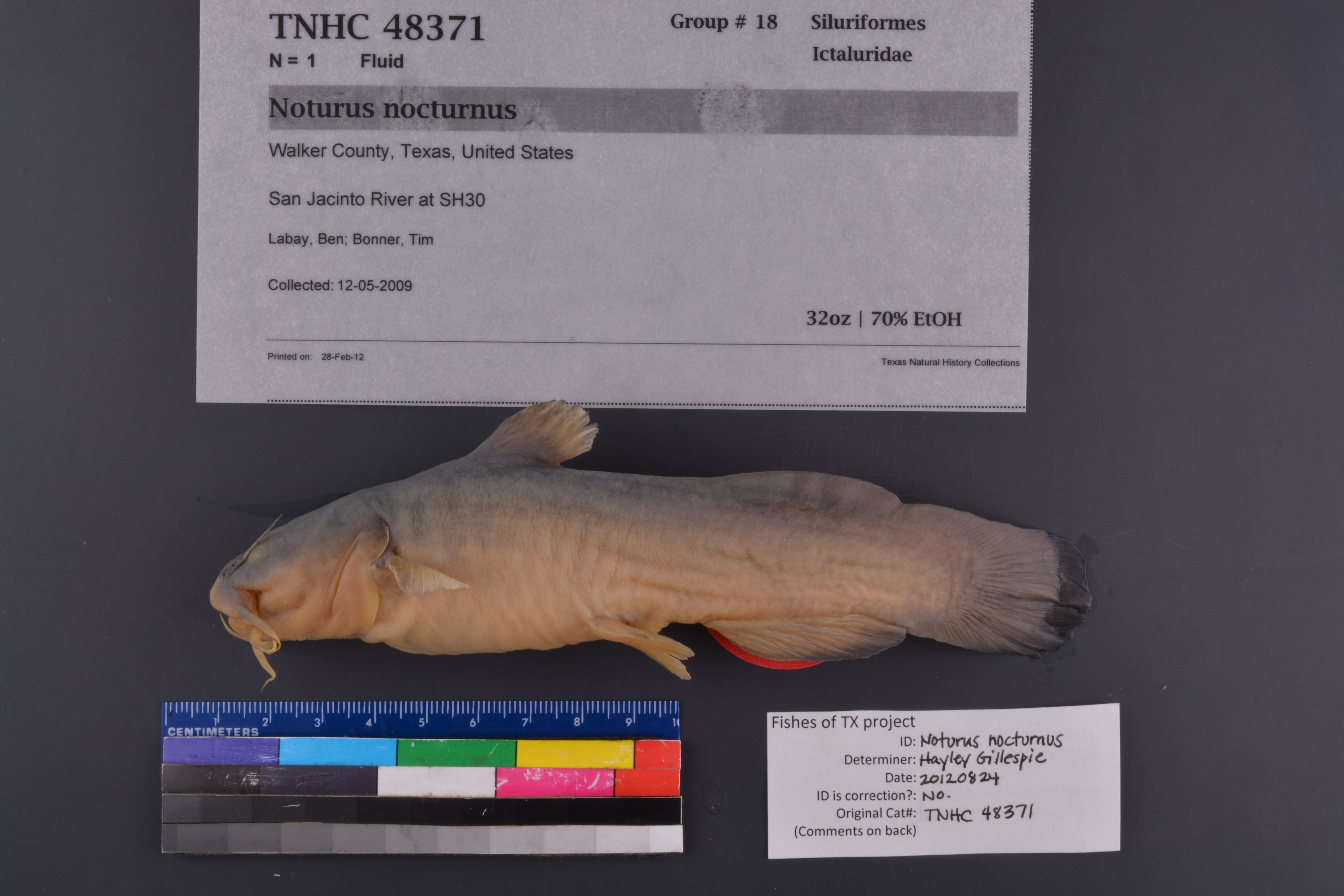
TNHCi_48371
Not suspect, not examinedPhotos
Map
Location
30.68593° N, 95.69319° W
(± 45
m)
Taxonomy
FamilyIctaluridae
GenusNoturus
Speciesnocturnus
Specimen
Num Specimens1
PreparationFluid - 1
Identification
Identified ByLabay, Ben
Date Identified..
Collection Event
CollectorLabay, Ben; Bonner, Tim
Collected Date2009.5.12
Field Numberz48371
Geography
CountryUnited States
StateTexas
CountyWalker
LocalitySan Jacinto River at SH30
Latitude30.685927
Longitude-95.693186
DatumWGS84
Record
Occurrence RemarksSpecimen maintained in aquaria until 03 Jan 2012. Preserved in 10% formalin.
Record Source
Source
Texas Natural History Collections
(type: specimens)
Institution
Texas Natural History Collections
(type: museum)
Curator
Dean Hendrickson
Record Added
June 24, 2020
Record Last Modified
March 23, 2026
Data Processing Track
Track 3
From Data Set Received
5/2017 to 11/2017
Identification
Suspect Notes
None
Count
1
Current Determination
Determiner
Jennifer Hayley Gillespie
Determination Date
Feb. 11, 2016
Determination Type
specimen examination
Identification Comments
Specimen examined and Id'ed for FoTX project. | ID notes: lower jaw tucked under upper jaw; maintained in aquarium and preserved 1/3/12; MinSL(mm): 140; MaxSL(mm): ; Jar: 32 oz; Specimen condition: good; Mutations: none; Count Male: ; Count female: ; Extern parasites: n
Identification Confidence
High
Collecting Event
Collected
May 12, 2009
Collector(s)
Collecting Event ID
396433
Field Notes
There are no field notes available.
Locality
Jurisdiction
Walker, Texas
Name
San Jacinto River at SH30
Hydrography
Texas-Gulf Region
Galveston Bay-San Jacinto
San Jacinto
West Fork San Jacinto
West Fork San Jacinto River
Rocky Creek-West Fork San Jacinto River
Captive
no
Locality Photos
No locality photos available.
HUC 12
120401010101
Georeferencing Remarks
Georeference needs verification/refinement; coordinates provided by donor
Georeferencing Annotation
—
Has not been Georeferenced because
This record, being part of the track 3 import, is not formally georeferenced by FoTX staff at this time. However, to allow mapping and visualization of this record, locality information has been provisionally accepted if provided by the donor or if location text could be matched to previously georeferenced records by FoTX team or donor data. For many records spatial error is either accepted from the donor (when provided) or derived based on coordinate precision.
Comments On TNHCi_48371