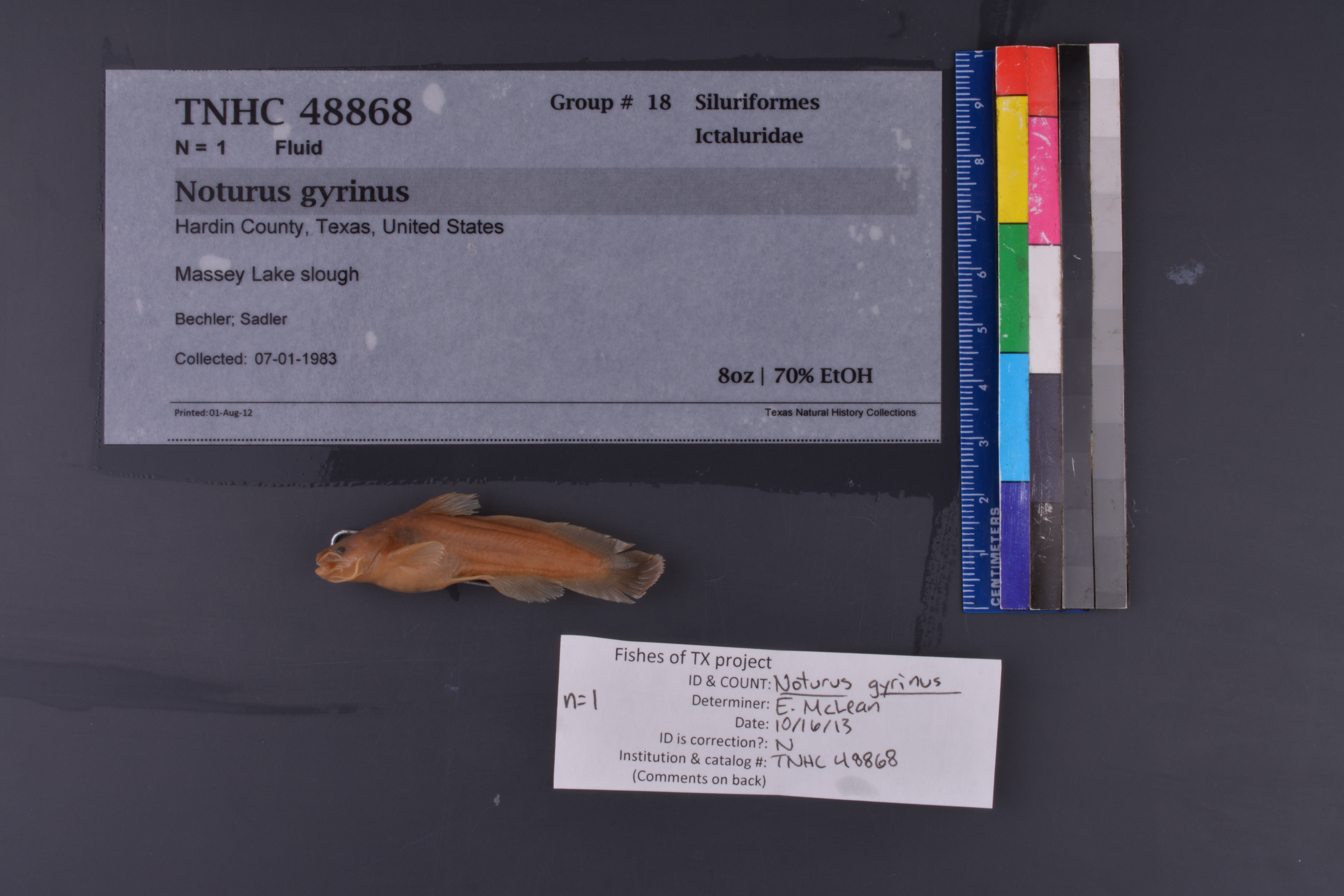
TNHCi_48868
Not suspect, not examinedPhotos
Map
Location
30.28976° N, 94.14425° W
(± 2133
m)
Taxonomy
FamilyIctaluridae
GenusNoturus
Speciesgyrinus
Specimen
Num Specimens1
PreparationFluid - 1
Identification
Identification Remarksverified by: F.D. Martin, 21Nov2011
Date Identified..
Collection Event
CollectorBechler; Sadler
Collected Date1983.1.7
Field Numberz48868
Geography
CountryUnited States
StateTexas
CountyHardin
LocalityMassey Lake slough
Latitude30.28976
Longitude-94.14425
DatumWGS84
Error2133.0
Record Source
Source
Texas Natural History Collections
(type: specimens)
Institution
Texas Natural History Collections
(type: museum)
Curator
Dean Hendrickson
Record Added
June 24, 2020
Record Last Modified
March 23, 2026
Data Processing Track
Track 3
From Data Set Received
5/2017 to 11/2017
Identification
Suspect Notes
None
Count
1
Current Determination
Determiner
Elizabeth Sarah McLean
Determination Date
Feb. 11, 2016
Determination Type
specimen examination
Identification Comments
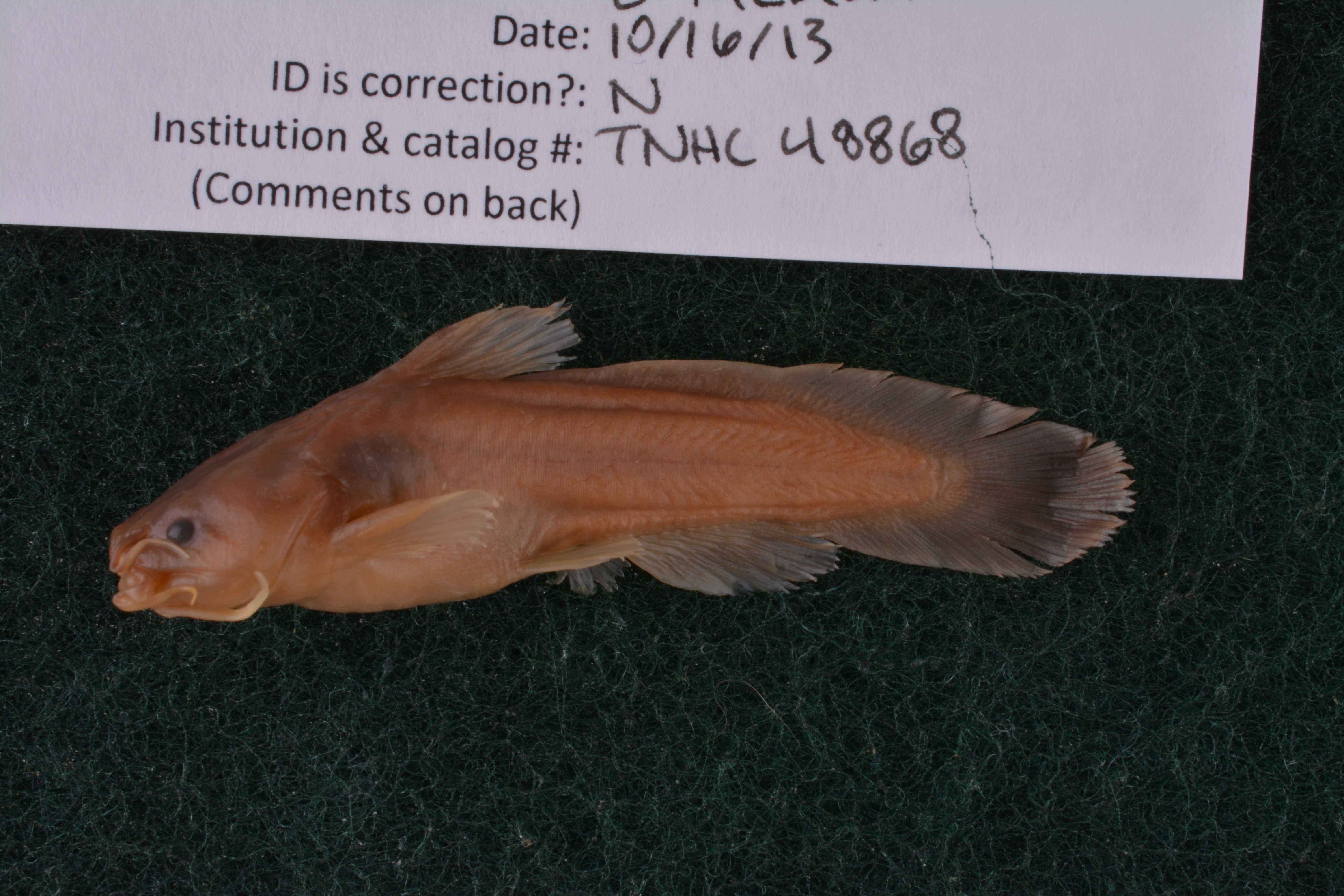
Specimen examined and Id'ed for FoTX project. | ID notes: even mouth; tapered caudal; MinSL(mm): 48.63; MaxSL(mm): ; Jar: 8 oz; Specimen condition: good; Mutations: none; Count Male: ; Count female: ; Extern parasites: n
Identification Confidence
High
Collecting Event
Collected
Jan. 7, 1983
Collecting Event ID
312367
Field Notes
There are no field notes available.
Locality
Jurisdiction
Hardin, Texas
Name
Massey Lake slough
Hydrography
Texas-Gulf Region
Neches
Neches
Lower Neches
Tenmile Creek-Neches River
The Cutoff-Neches River
Captive
no
Locality Photos
No locality photos available.
HUC 12
120200030401
Georeferencing Remarks
Georeference needs verification/refinement; coordinates provided by donor
Georeferencing Annotation
—
Has not been Georeferenced because
This record, being part of the track 3 import, is not formally georeferenced by FoTX staff at this time. However, to allow mapping and visualization of this record, locality information has been provisionally accepted if provided by the donor or if location text could be matched to previously georeferenced records by FoTX team or donor data. For many records spatial error is either accepted from the donor (when provided) or derived based on coordinate precision.
Comments On TNHCi_48868