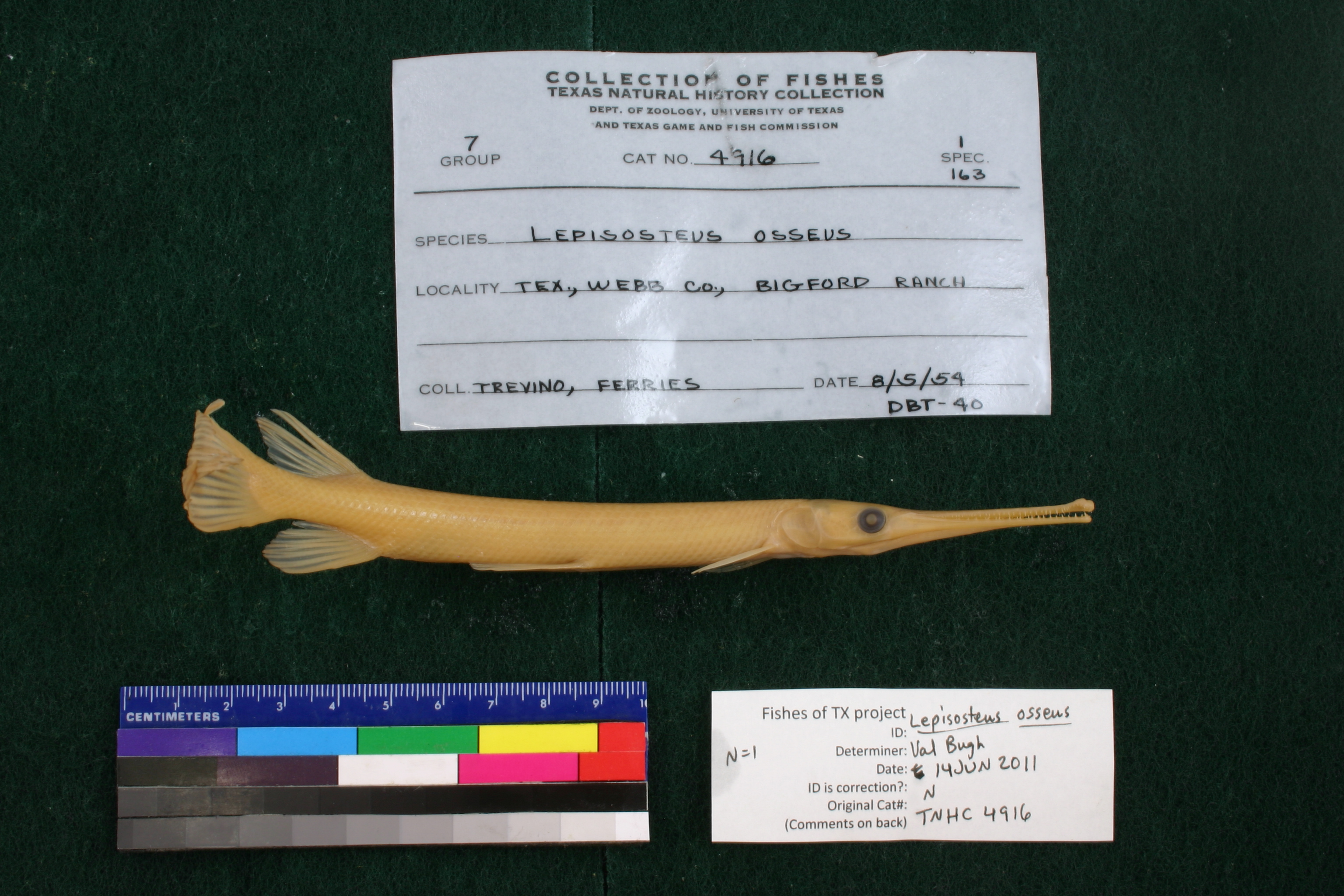
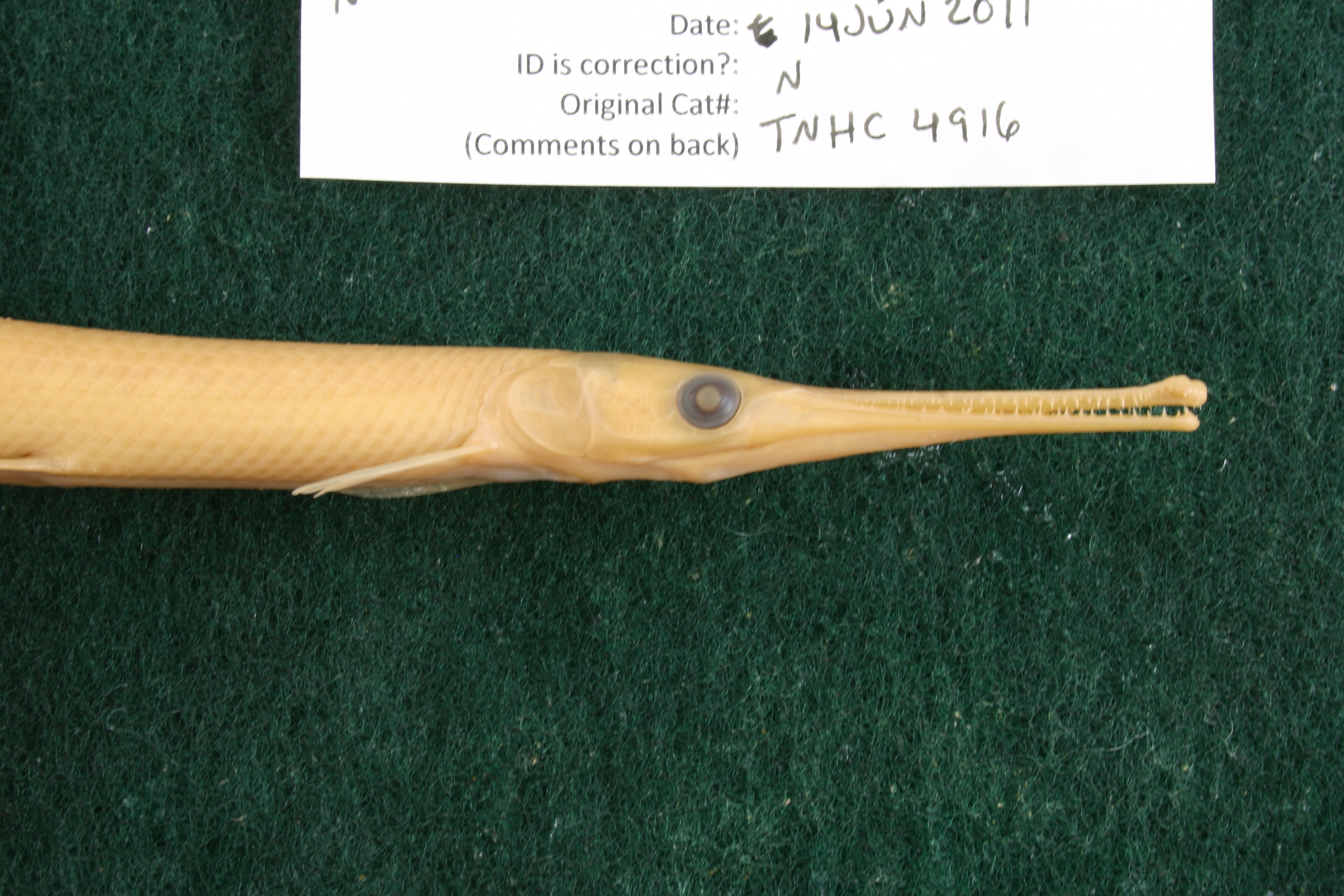
TNHCi_4916
Not suspect, examinedPhotos
Map
Location
27.98172° N, 99.93260° W
(± 25000
m)
Taxonomy
GenusLepisosteus
Speciesosseus
Specimen
Num Specimens1
Collection Event
CollectorTrevino
Collected Date1954.8.4
Geography
CountryUSA
StateTexas
CountyWebb
LocalityBig Ford Ranch
Record Source
Source
Texas Natural History Collections
(type: specimens)
Institution
Texas Natural History Collections
(type: museum)
Curator
Dean Hendrickson
Record Added
May 13, 2010
Record Last Modified
March 23, 2026
Data Processing Track
Track 2
From Data Set Received
04/2009 to 10/2010
Identification
Suspect Notes
None
Count
1
Current Determination
Determiner
Melissa Casarez
Determination Date
Feb. 11, 2016
Determination Type
specimen examination
Identification Comments
Specimen examined and Id'ed for FoTX project. | ID notes: lateral line scales: 59; *note for SL measurements that gar have heterocercal tails - all length measurements are based on SL and are approximate; MinSL(mm): 161; MaxSL(mm): ; Jar: 32 oz; Specimen condition: good; Mutations: none; Count Male: ; Count female: ; Extern parasites: n
Identification Confidence
High
Collecting Event
Collected
Aug. 5, 1954
Collector(s)
Collecting Event ID
7526
Field Notes
There are no field notes available.
Locality
Region
South Texas Brush Country
Jurisdiction
Webb, Texas
Name
Bigford Ranch
Hydrography
Rio Grande Region
Rio Grande-Falcon
Rio Grande-Falcon
San Ambrosia-Santa Isabel
Chacon Creek-Rio Grande
San Ygnacio Creek
Captive
no
Locality Photos
No locality photos available.
flag (suspect/examine)
suspect: noexamination: yes
date
date_range: 8/5/1954-8/5/1954
collectors
collectors: Trevino, D.B. Trevino, D. Ferries, D.
collectors
collectors: D. Trevino
date
date_range: 8/4/1954-8/4/1954
staff comment
ID Status: Not flagged for specimen examination. By default we accept donor specimen determinations (after synonymization to our taxonomy). If georeferenced to TX this record has been considered in spatial context with other occurences of this species and accepted as correct.
ID Comments: NAGeoref Remark: Assumed measured by stream starting at SH 418 in Georgetown
georeference
Error: 3250.87487998605Remarks: Assumed measured by stream starting at SH 418 in GeorgetownLocality: North Fork San Gabriel River, 5 miles west of GeorgetownCoordinates: 30.677645058;-97.739190573Georeferencer: AECGeographic note: Inland USA Texas
Assumed measured by stream starting at SH 418 in Georgetown
Comments On TNHCi_4916