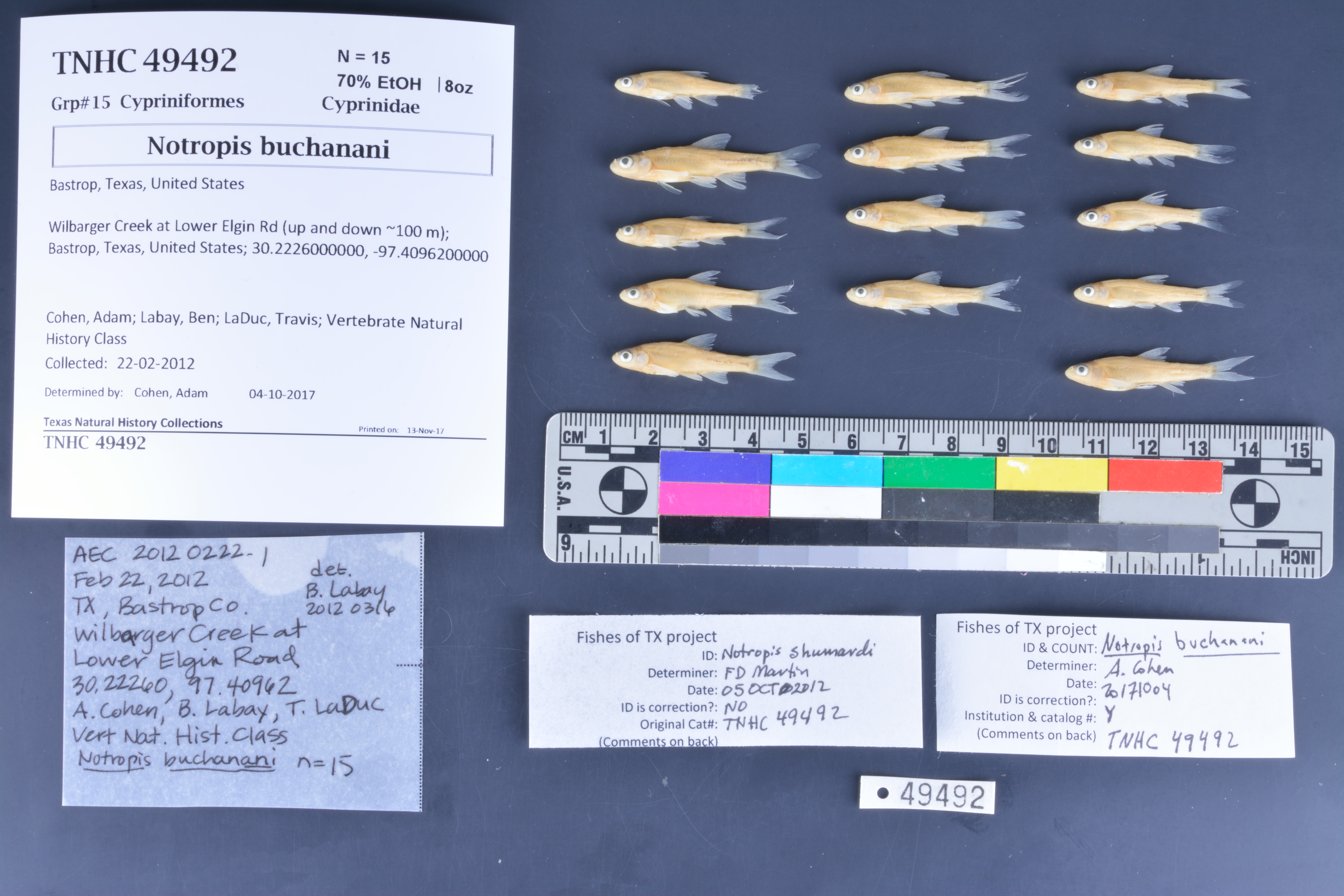
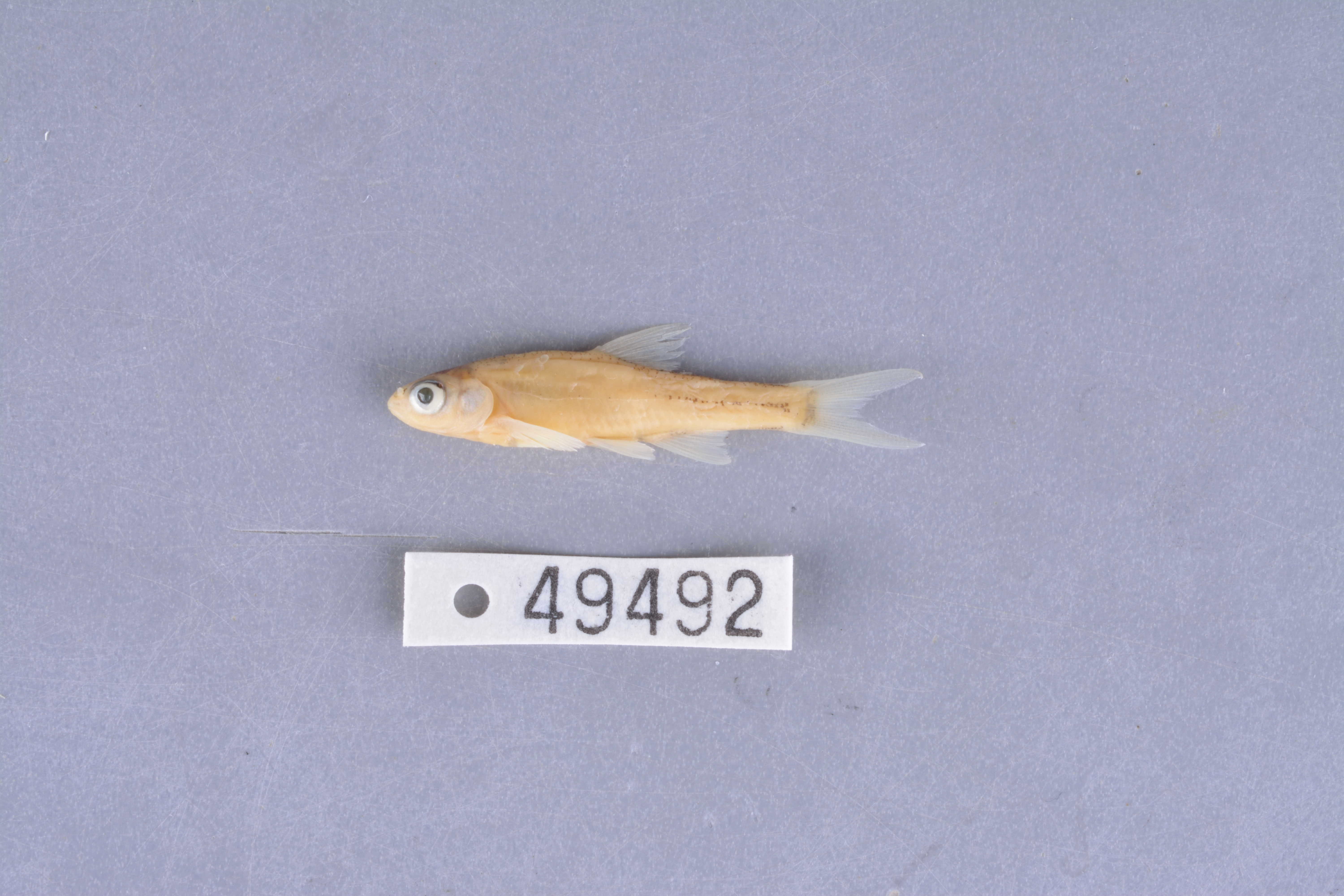
TNHCi_49492
Not suspect, not examinedPhotos
Map
Location
30.22260° N, 97.40947° W
(± 45
m)
Taxonomy
FamilyCyprinidae
GenusNotropis
Speciesbuchanani
Specimen
Num Specimens15
PreparationFluid - 15
Identification
Identification RemarksAEC notes: no infraorbital canal (1)
Identified ByCohen, Adam
Date Identified2017.10.4
Collection Event
CollectorCohen, Adam; Labay, Ben; LaDuc, Travis; Vertebrate Natural History Class
Collected Date2012.2.22
Field NumberAEC20120222-1
Event Remarksseine and dipnets used as well; field notes available; sampled one year prior, water much higher now.
Geography
CountryUnited States
StateTexas
CountyBastrop
LocalityWilbarger Creek at Lower Elgin Rd (up and down ~100 m)
Latitude30.2226
Longitude-97.40947
DatumWGS84
Record Source
Source
Texas Natural History Collections
(type: specimens)
Institution
Texas Natural History Collections
(type: museum)
Curator
Dean Hendrickson
Record Added
June 24, 2020
Record Last Modified
March 23, 2026
Data Processing Track
Track 3
From Data Set Received
5/2017 to 11/2017
Identification
Suspect Notes
None
Count
15
Current Determination
Determiner
Floyd Douglas Martin
Determination Date
Feb. 11, 2016
Determination Type
specimen examination
Identification Comments
Specimen examined and Id'ed for FoTX project.
Identification Confidence
High
Previous Determination
Determiner
Adam Cohen
Determination Date
Feb. 11, 2016
Determination Type
specimen examination
Identification Comments
ID complete | no infraorbital canal (1)
Identification Confidence
High
Collecting Event
Collected
Feb. 22, 2012
Collecting Event ID
403018
Field Notes
There are no field notes available.
Locality
Jurisdiction
Bastrop, Texas
Name
Wilbarger Creek at Lower Elgin Rd (up and down ~100 m)
Hydrography
Texas-Gulf Region
Lower Colorado-San Bernard Coastal
Lower Colorado
Lower Colorado-Cummins
Willbarger Creek-Colorado River
Lower Wilbarger Creek
Captive
no
Locality Photos
No locality photos available.
HUC 12
120903010105
Georeferencing Remarks
Georeference needs verification/refinement; coordinates provided by donor
Georeferencing Annotation
—
Has not been Georeferenced because
This record, being part of the track 3 import, is not formally georeferenced by FoTX staff at this time. However, to allow mapping and visualization of this record, locality information has been provisionally accepted if provided by the donor or if location text could be matched to previously georeferenced records by FoTX team or donor data. For many records spatial error is either accepted from the donor (when provided) or derived based on coordinate precision.
Comments On TNHCi_49492