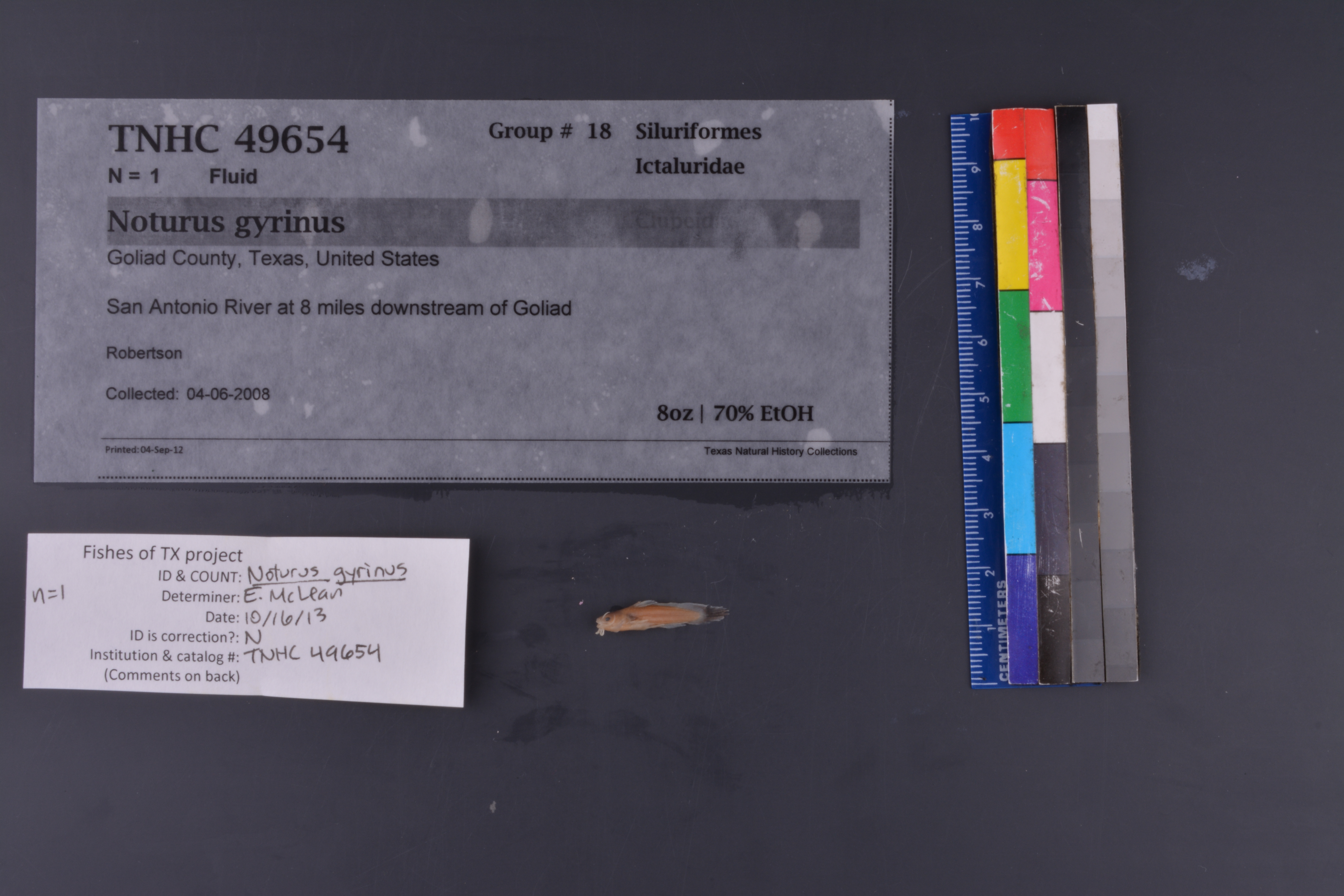
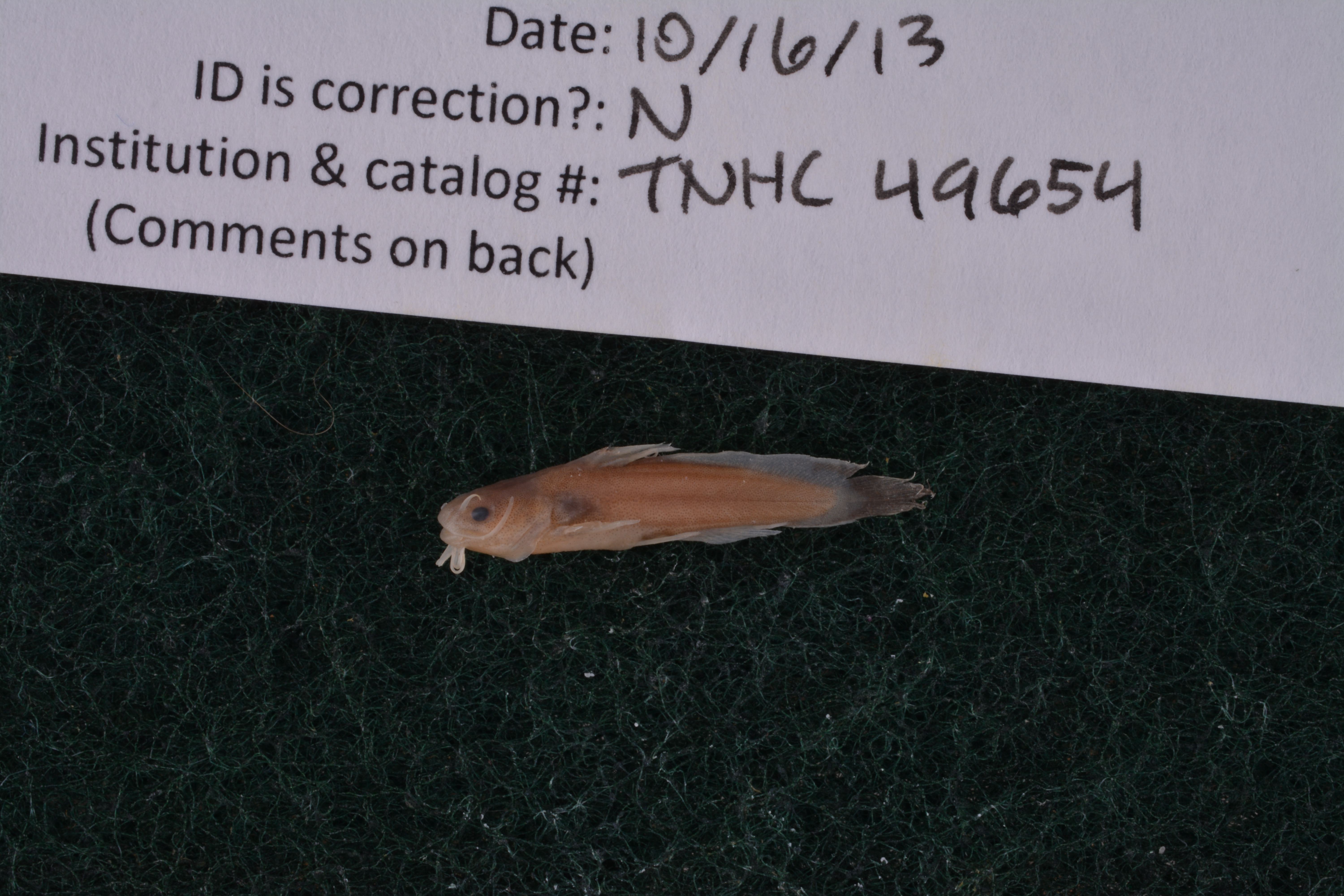
TNHCi_49654
Not suspect, not examinedPhotos
Map
Location
28.63085° N, 97.31731° W
(± 1945.4
m)
Taxonomy
FamilyIctaluridae
GenusNoturus
Speciesgyrinus
Specimen
Num Specimens1
PreparationFluid - 1
Identification
Date Identified..
Collection Event
CollectorRobertson
Collected Date2008.6.4
Field Numberz49203
Event RemarksSite 19030, S-1, S-2, S-3, S-4, S-5, S-6, S-7, S-8, S-9, S-10
Geography
CountryUnited States
StateTexas
CountyGoliad
LocalitySan Antonio River, 8 mi downstream of Goliad
Latitude28.63085
Longitude-97.317314
DatumWGS84
Error1945.38
Record Source
Source
Texas Natural History Collections
(type: specimens)
Institution
Texas Natural History Collections
(type: museum)
Curator
Dean Hendrickson
Record Added
June 24, 2020
Record Last Modified
March 23, 2026
Data Processing Track
Track 3
From Data Set Received
5/2017 to 11/2017
Identification
Suspect Notes
None
Count
1
Current Determination
Determiner
Elizabeth Sarah McLean
Determination Date
Feb. 11, 2016
Determination Type
specimen examination
Identification Comments
Specimen examined and Id'ed for FoTX project. | ID notes: even mouth; tapered caudal; MinSL(mm): 18.04; MaxSL(mm): ; Jar: 8 oz; Specimen condition: good; Mutations: none; Count Male: ; Count female: ; Extern parasites: n
Identification Confidence
High
Collecting Event
Collected
June 4, 2008
Collector(s)
Collecting Event ID
394388
Field Notes
There are no field notes available.
Locality
Jurisdiction
Goliad, Texas
Name
San Antonio River, 8 mi downstream of Goliad
Hydrography
Texas-Gulf Region
Central Texas Coastal
San Antonio
Lower San Antonio
San Antonio River-Guadalupe River
Cadena Creek-San Antonio River
Captive
no
Locality Photos
No locality photos available.
HUC 12
121003030604
Georeferencing Remarks
Georeference needs verification/refinement; coordinates provided by donor
Georeferencing Annotation
—
Has not been Georeferenced because
This record, being part of the track 3 import, is not formally georeferenced by FoTX staff at this time. However, to allow mapping and visualization of this record, locality information has been provisionally accepted if provided by the donor or if location text could be matched to previously georeferenced records by FoTX team or donor data. For many records spatial error is either accepted from the donor (when provided) or derived based on coordinate precision.
Comments On TNHCi_49654