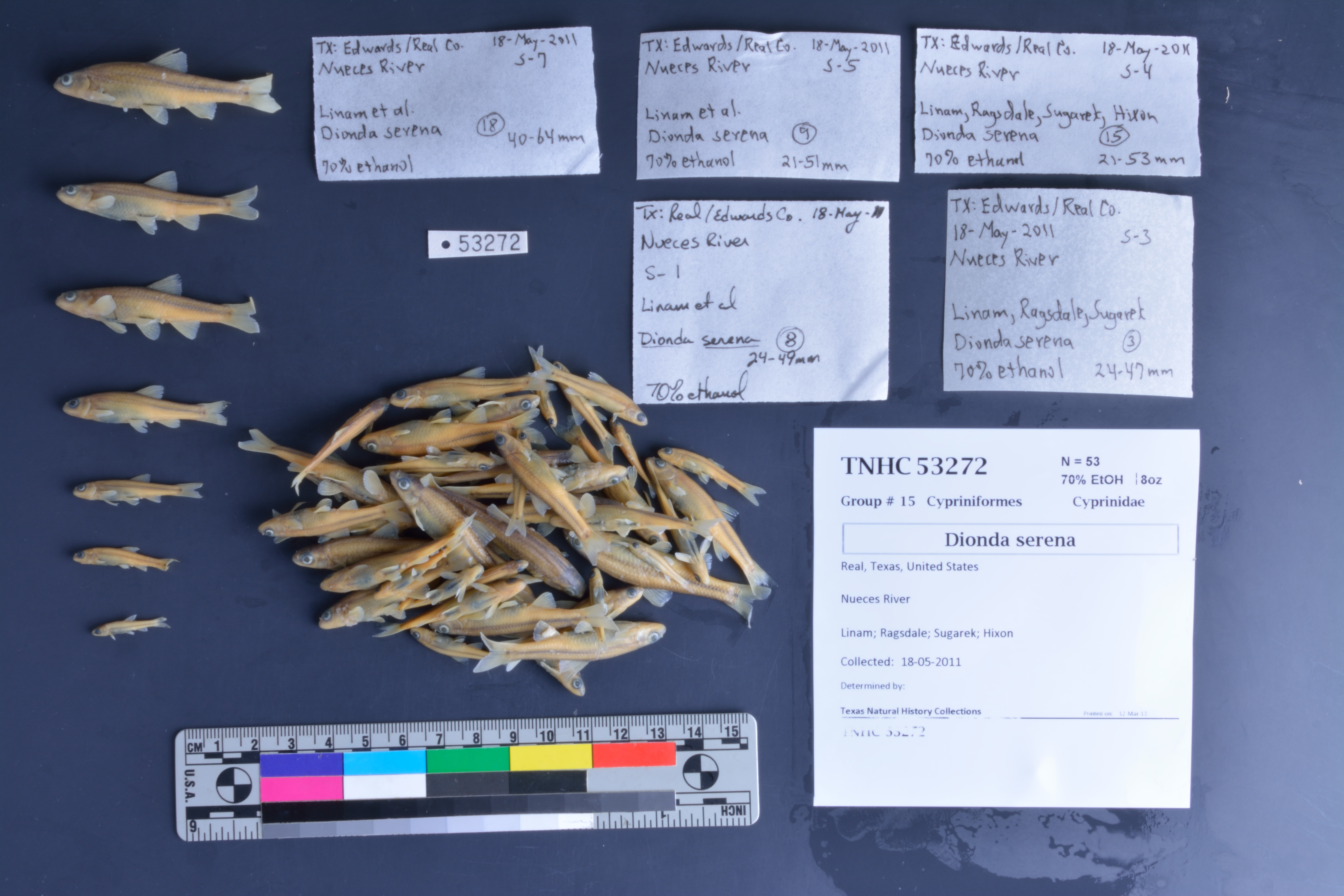
TNHCi_53272
Not suspect, not examinedPhotos
Map
Location
29.85178° N, 100.02320° W
(± 24957.7
m)
Taxonomy
FamilyCyprinidae
GenusDionda
Speciesserena
Specimen
Num Specimens53
PreparationFluid - 53
Identification
Date Identified..
Collection Event
CollectorLinam; Ragsdale; Sugarek; Hixon
Collected Date2011.5.18
Field Numberz53259
Event RemarksAlso in Edwards Co.
Geography
CountryUnited States
StateTexas
CountyReal
LocalityNueces River
Latitude29.8517774
Longitude-100.0231963
DatumWGS84
Error24957.70675
Georeferencing
Georeference RemarksCan't find Morris Spring so treated as Nueces River.
Record Source
Source
Texas Natural History Collections
(type: specimens)
Institution
Texas Natural History Collections
(type: museum)
Curator
Dean Hendrickson
Record Added
June 24, 2020
Record Last Modified
March 23, 2026
Data Processing Track
Track 3
From Data Set Received
5/2017 to 11/2017
Identification
Suspect Notes
None
Count
53
Current Determination
Determiner
Unknown
Determination Date
Unknown
Determination Type
Unspecified
Identification Comments
None
Identification Confidence
Unknown
Collecting Event
Collected
May 18, 2011
Collector(s)
Collecting Event ID
401426
Field Notes
There are no field notes available.
Locality
Jurisdiction
Real, Texas
Name
Nueces River
Hydrography
Texas-Gulf Region
Nueces-Southwestern Texas Coastal
Nueces
Nueces Headwaters
Headwaters Nueces River
Ruth Draw Nueces River
Captive
no
Locality Photos
No locality photos available.
HUC 12
121101010301
Georeferencing Remarks
Georeference needs verification/refinement; coordinates provided by donor
Georeferencing Annotation
—
Has not been Georeferenced because
This record, being part of the track 3 import, is not formally georeferenced by FoTX staff at this time. However, to allow mapping and visualization of this record, locality information has been provisionally accepted if provided by the donor or if location text could be matched to previously georeferenced records by FoTX team or donor data. For many records spatial error is either accepted from the donor (when provided) or derived based on coordinate precision.
Comments On TNHCi_53272