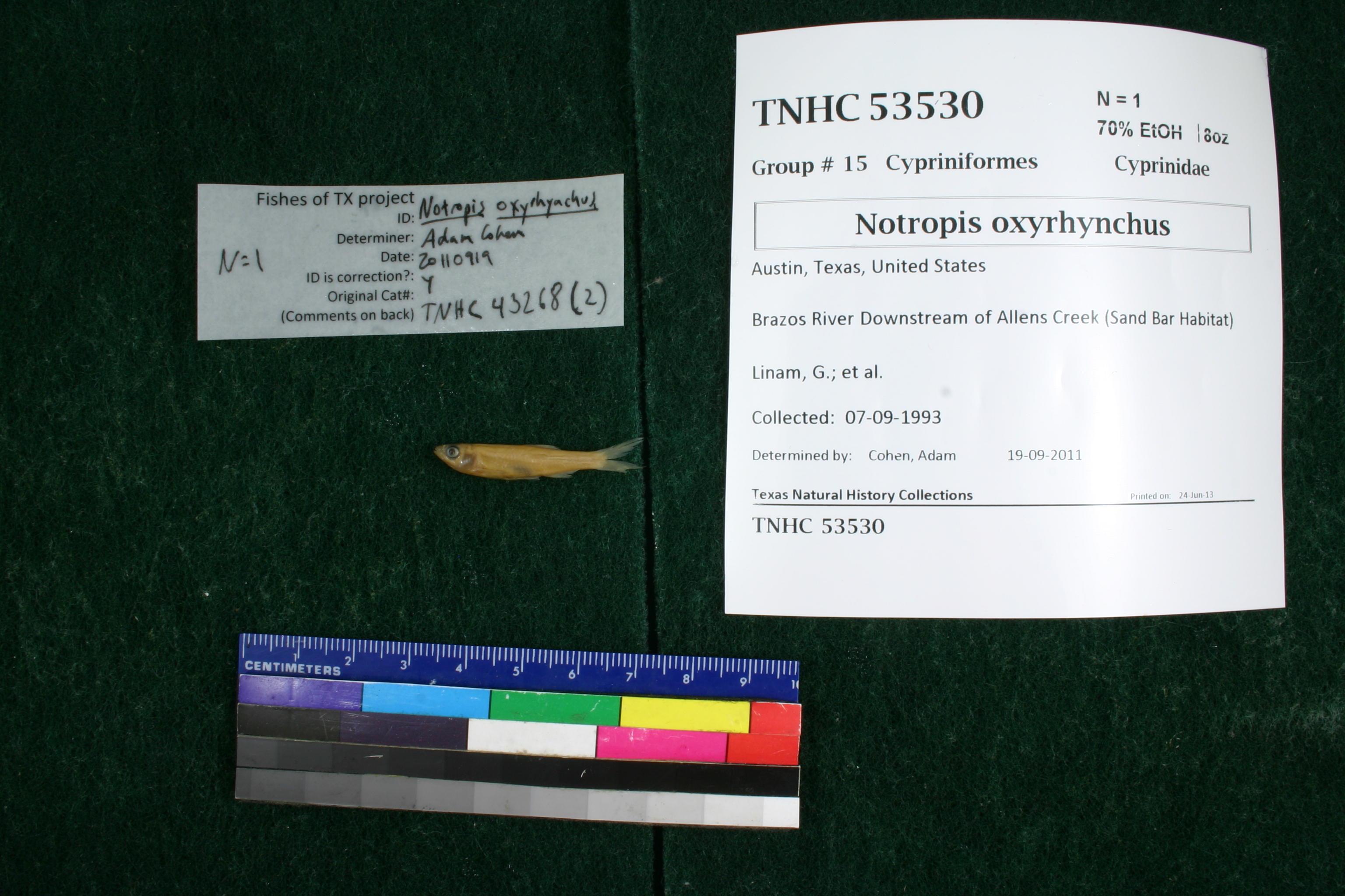
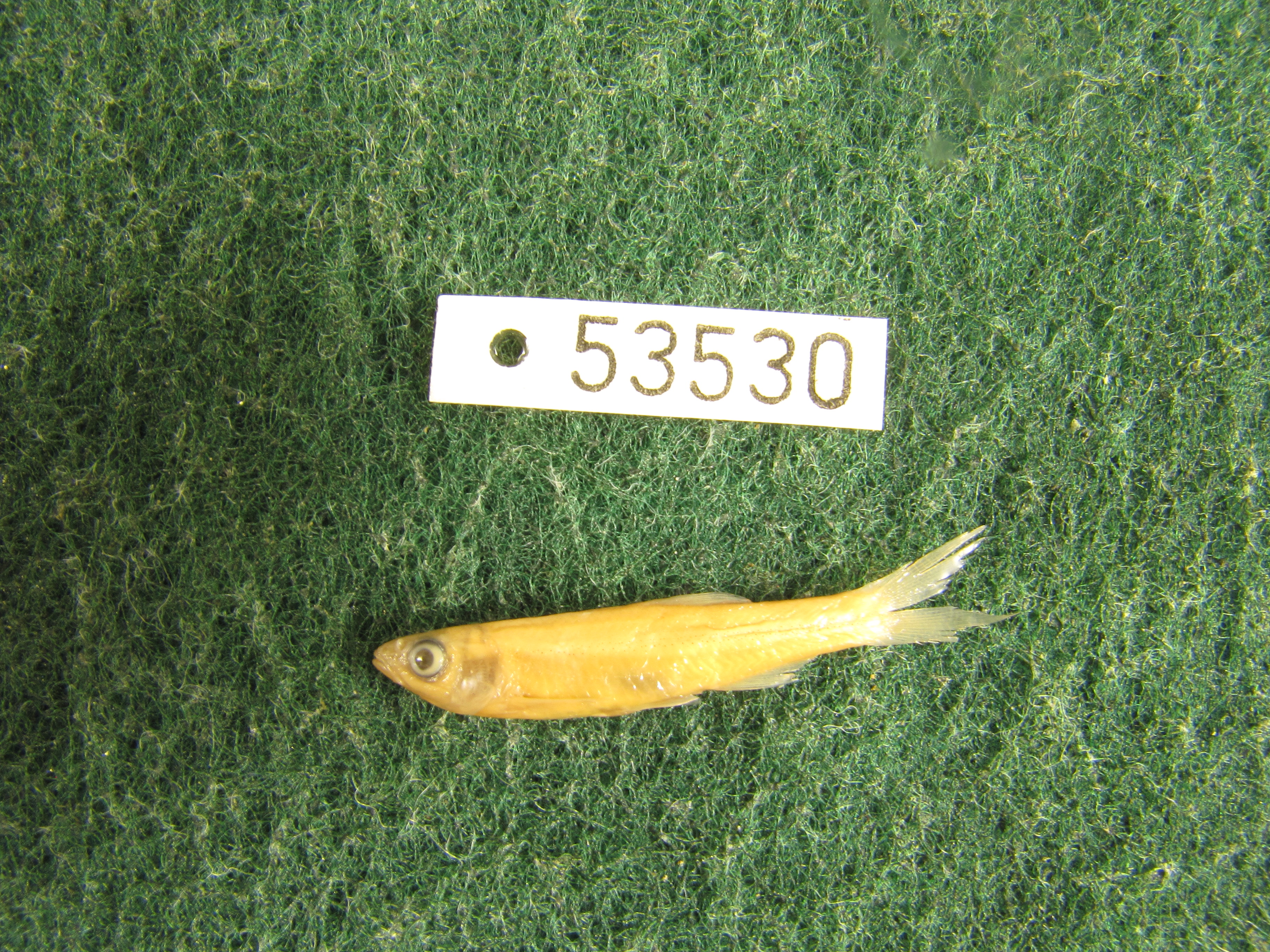
TNHCi_53530
Not suspect, not examinedPhotos
Map
Location
29.67304° N, 96.03539° W
(± 1385.3
m)
Taxonomy
FamilyCyprinidae
GenusNotropis
Speciesoxyrhynchus
Specimen
Num Specimens1
PreparationFluid - 1
Identification
Identification RemarksAEC notes: 11 anal rays
Identified ByCohen, Adam
Date Identified2011.9.19
Collection Event
CollectorLinam, G.; et al.
Collected Date1993.9.7
Field Numberz43267
Event RemarksOld coll. method: : Seine
Geography
CountryUnited States
StateTexas
CountyAustin
LocalityBrazos River, downstream of Allens Creek confluence
Latitude29.6730405
Longitude-96.0353851
DatumWGS84
Error1385.263574
Georeferencing
Georeference RemarksPoint is placed halfway to next downstream crossing (FM 1093 crossing)
Record
Occurrence RemarksRemoved from TNHC 43268 due to redetermination
Record Source
Source
Texas Natural History Collections
(type: specimens)
Institution
Texas Natural History Collections
(type: museum)
Curator
Dean Hendrickson
Record Added
June 24, 2020
Record Last Modified
March 23, 2026
Data Processing Track
Track 3
From Data Set Received
5/2017 to 11/2017
Identification
Suspect Notes
None
Count
1
Current Determination
Determiner
Unknown
Determination Date
Unknown
Determination Type
Unspecified
Identification Comments
None
Identification Confidence
Unknown
Collecting Event
Collected
Sept. 7, 1993
Collector(s)
Collecting Event ID
335789
Field Notes
There are no field notes available.
Locality
Jurisdiction
Fort Bend, Texas
Name
Brazos River, downstream of Allens Creek confluence
Hydrography
Texas-Gulf Region
Lower Brazos
Lower Brazos
Lower Brazos
Bessies Creek-Brazos River
Cottonwood Creek-Brazos River
Captive
no
Locality Photos
No locality photos available.
HUC 12
120701040309
Georeferencing Remarks
Georeference needs verification/refinement; coordinates provided by donor
Georeferencing Annotation
—
Has not been Georeferenced because
This record, being part of the track 3 import, is not formally georeferenced by FoTX staff at this time. However, to allow mapping and visualization of this record, locality information has been provisionally accepted if provided by the donor or if location text could be matched to previously georeferenced records by FoTX team or donor data. For many records spatial error is either accepted from the donor (when provided) or derived based on coordinate precision.
Comments On TNHCi_53530