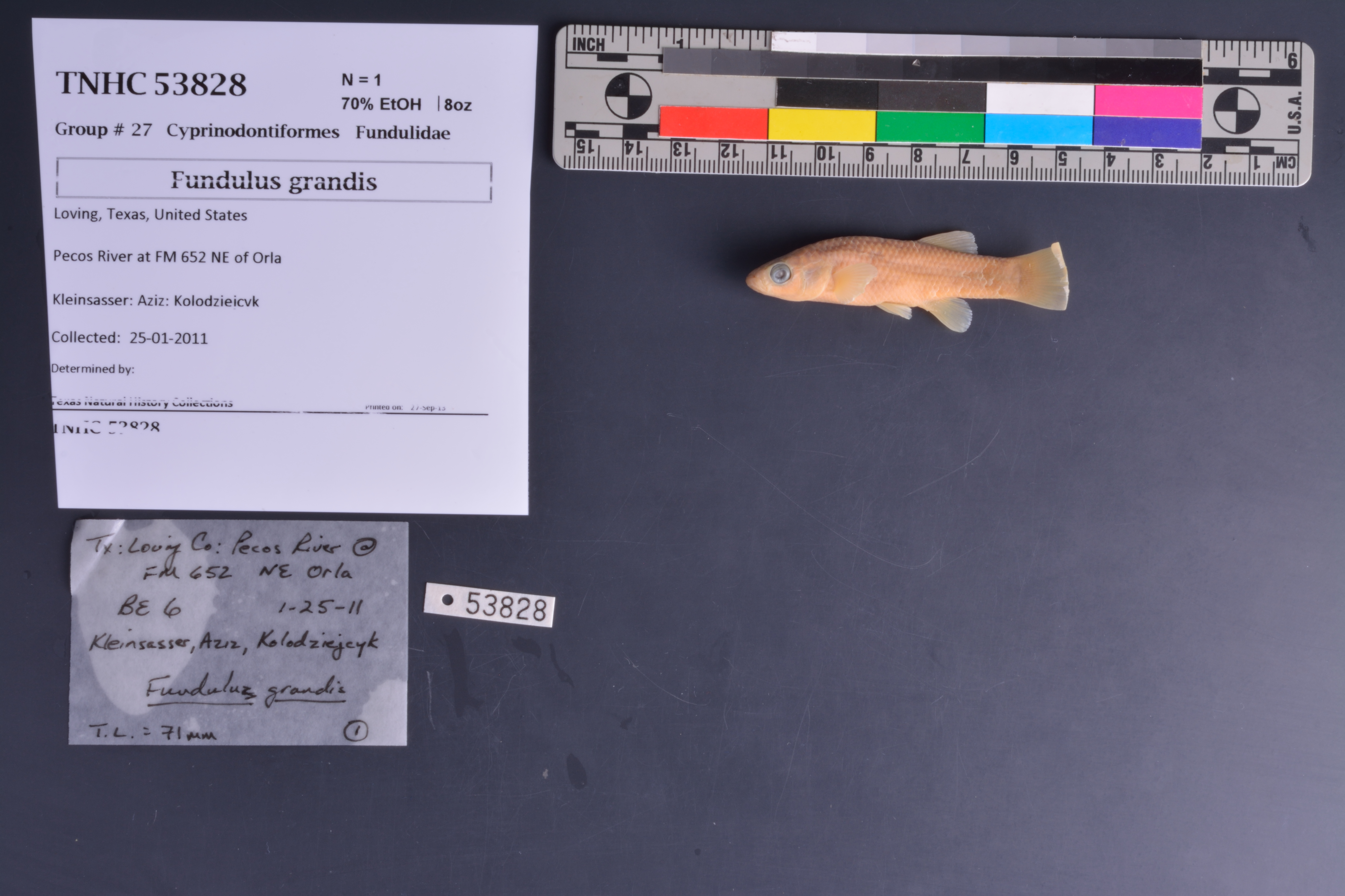
TNHCi_53828
Not suspect, not examinedPhotos
Map
Location
31.87264° N, 103.83169° W
(± 46.5
m)
Taxonomy
FamilyFundulidae
GenusFundulus
Speciesgrandis
Specimen
Num Specimens1
PreparationFluid - 1
Identification
Date Identified..
Collection Event
CollectorKleinsasser; Aziz; Kolodziejcyk
Collected Date2011.1.25
Field Numberz53827
Event RemarksSeine and backpack electroshocker
Geography
CountryUnited States
StateTexas
CountyLoving
LocalityPecos River at FM 652
Latitude31.87264
Longitude-103.831693
DatumWGS84
Error46.458
Georeferencing
Georeference RemarksTreated as named place.
Record Source
Source
Texas Natural History Collections
(type: specimens)
Institution
Texas Natural History Collections
(type: museum)
Curator
Dean Hendrickson
Record Added
June 24, 2020
Record Last Modified
March 23, 2026
Data Processing Track
Track 3
From Data Set Received
5/2017 to 11/2017
Identification
Suspect Notes
None
Count
1
Current Determination
Determiner
Unknown
Determination Date
Unknown
Determination Type
Unspecified
Identification Comments
None
Identification Confidence
Unknown
Collecting Event
Collected
Jan. 25, 2011
Collector(s)
Collecting Event ID
400818
Field Notes
There are no field notes available.
Locality
Jurisdiction
Reeves, Texas
Name
Pecos River at FM 652
Hydrography
Rio Grande Region
Lower Pecos
Lower Pecos
Lower Pecos-Red Bluff Reservoir
Narrow Bow Draw-Pecos River
130700010402
Captive
no
Locality Photos
No locality photos available.
HUC 12
130700010402
Georeferencing Remarks
Georeference needs verification/refinement; coordinates provided by donor
Georeferencing Annotation
—
Has not been Georeferenced because
This record, being part of the track 3 import, is not formally georeferenced by FoTX staff at this time. However, to allow mapping and visualization of this record, locality information has been provisionally accepted if provided by the donor or if location text could be matched to previously georeferenced records by FoTX team or donor data. For many records spatial error is either accepted from the donor (when provided) or derived based on coordinate precision.
Comments On TNHCi_53828