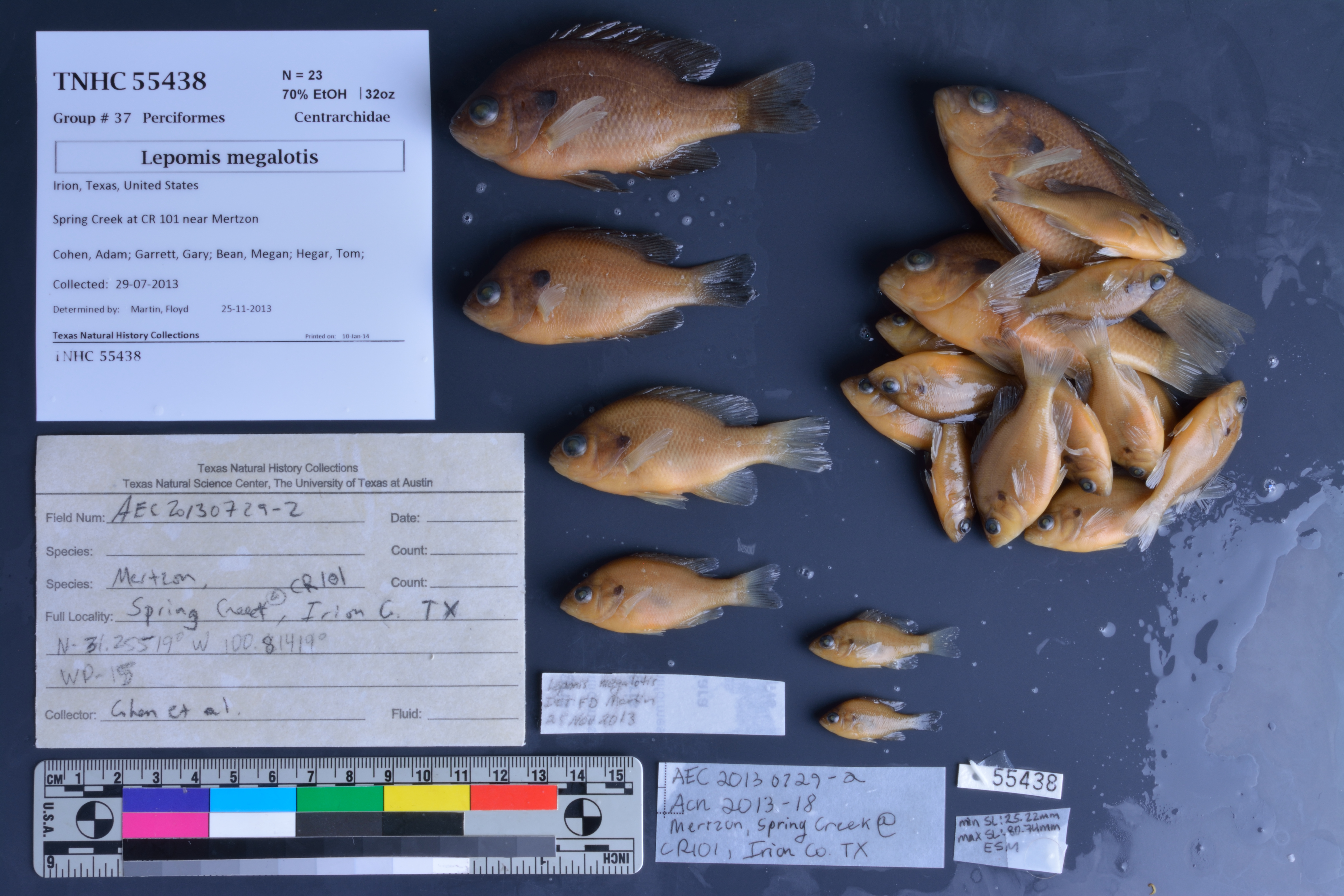
TNHCi_55438
Not suspect, not examinedPhotos
Map
Location
31.25519° N, 100.81419° W
(± 45
m)
Taxonomy
FamilyCentrarchidae
GenusLepomis
Speciesmegalotis
Specimen
Num Specimens23
PreparationFluid - 23
Identification
Identified ByMartin, Floyd
Date Identified2013.11.25
Collection Event
CollectorCohen, Adam; Garrett, Gary; Bean, Megan; Hegar, Tom; Pulliam, Lauren; Sanchez, Olivia; Valley, Erin
Collected Date2013.7.29
Field NumberAEC20130729-2
Event Remarksphotos and field notes available on server
Geography
CountryUnited States
StateTexas
CountyIrion
LocalitySpring Creek at CR 101 near Mertzon
Latitude31.25519
Longitude-100.81419
DatumWGS84
Record Source
Source
Texas Natural History Collections
(type: specimens)
Institution
Texas Natural History Collections
(type: museum)
Curator
Dean Hendrickson
Record Added
June 24, 2020
Record Last Modified
March 23, 2026
Data Processing Track
Track 3
From Data Set Received
5/2017 to 11/2017
Identification
Suspect Notes
None
Count
23
Current Determination
Determiner
Unknown
Determination Date
Unknown
Determination Type
Unspecified
Identification Comments
None
Identification Confidence
Unknown
Collecting Event
Collected
July 29, 2013
Collecting Event ID
406602
Field Notes
There are no field notes available.
Locality
Jurisdiction
Irion, Texas
Name
Spring Creek at CR 101 near Mertzon
Hydrography
Texas-Gulf Region
Lower Colorado-San Bernard Coastal
Middle Colorado-Concho
South Concho
Lower Spring Creek
Lopez Creek-Spring Creek
Captive
no
Locality Photos
No locality photos available.
HUC 12
120901020203
Georeferencing Remarks
Georeference needs verification/refinement; coordinates provided by donor
Georeferencing Annotation
—
Has not been Georeferenced because
This record, being part of the track 3 import, is not formally georeferenced by FoTX staff at this time. However, to allow mapping and visualization of this record, locality information has been provisionally accepted if provided by the donor or if location text could be matched to previously georeferenced records by FoTX team or donor data. For many records spatial error is either accepted from the donor (when provided) or derived based on coordinate precision.
Comments On TNHCi_55438