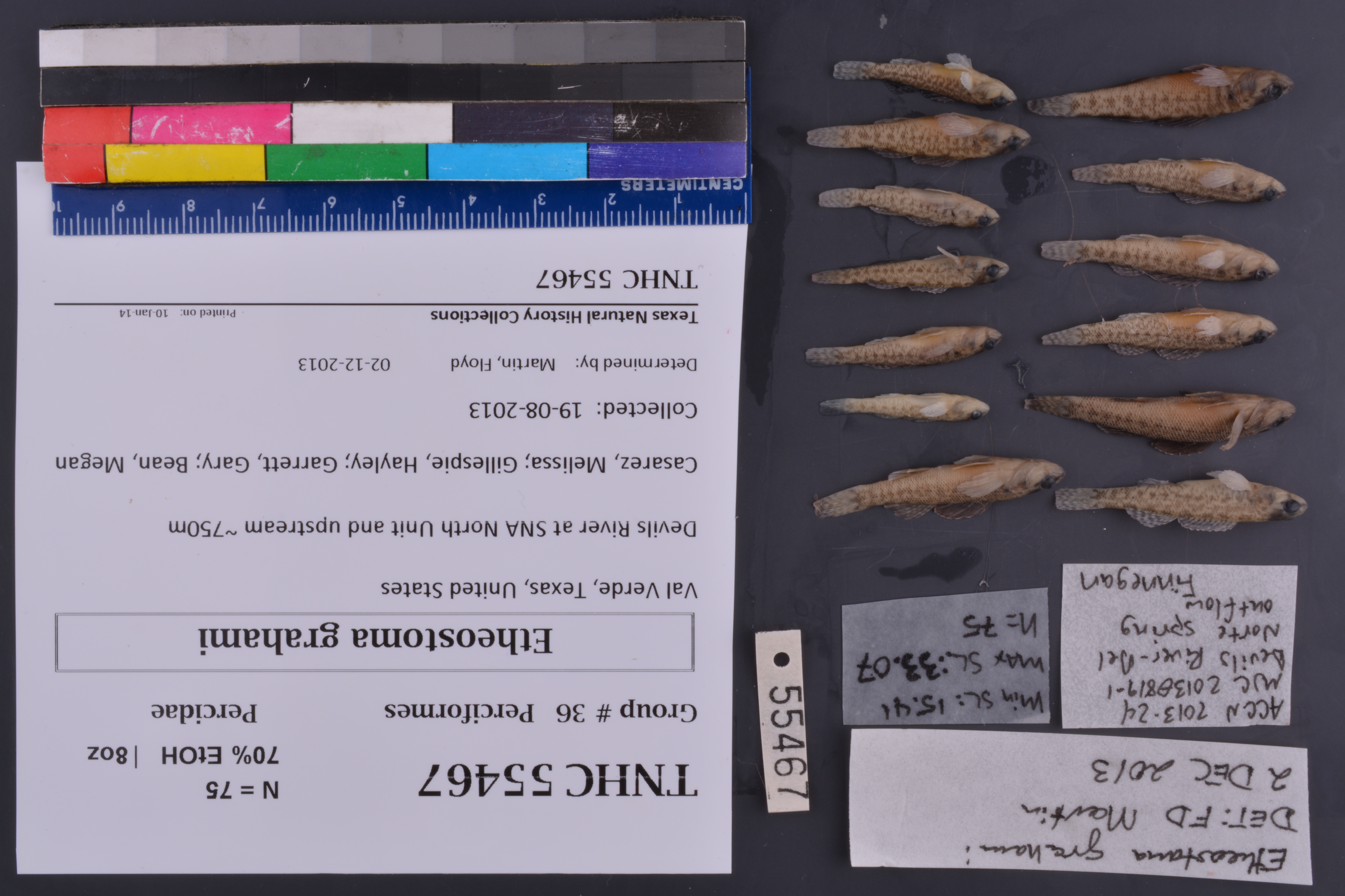
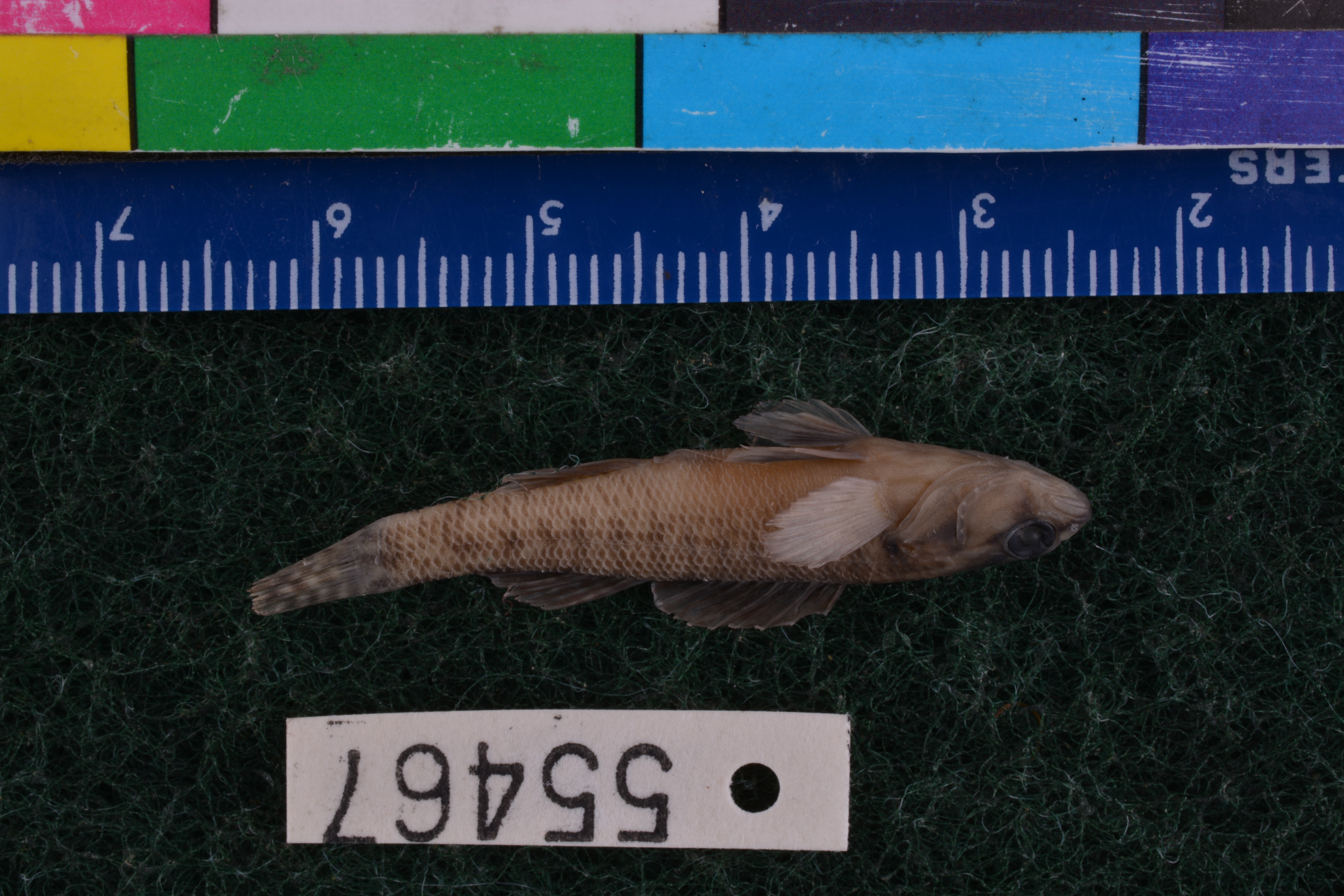
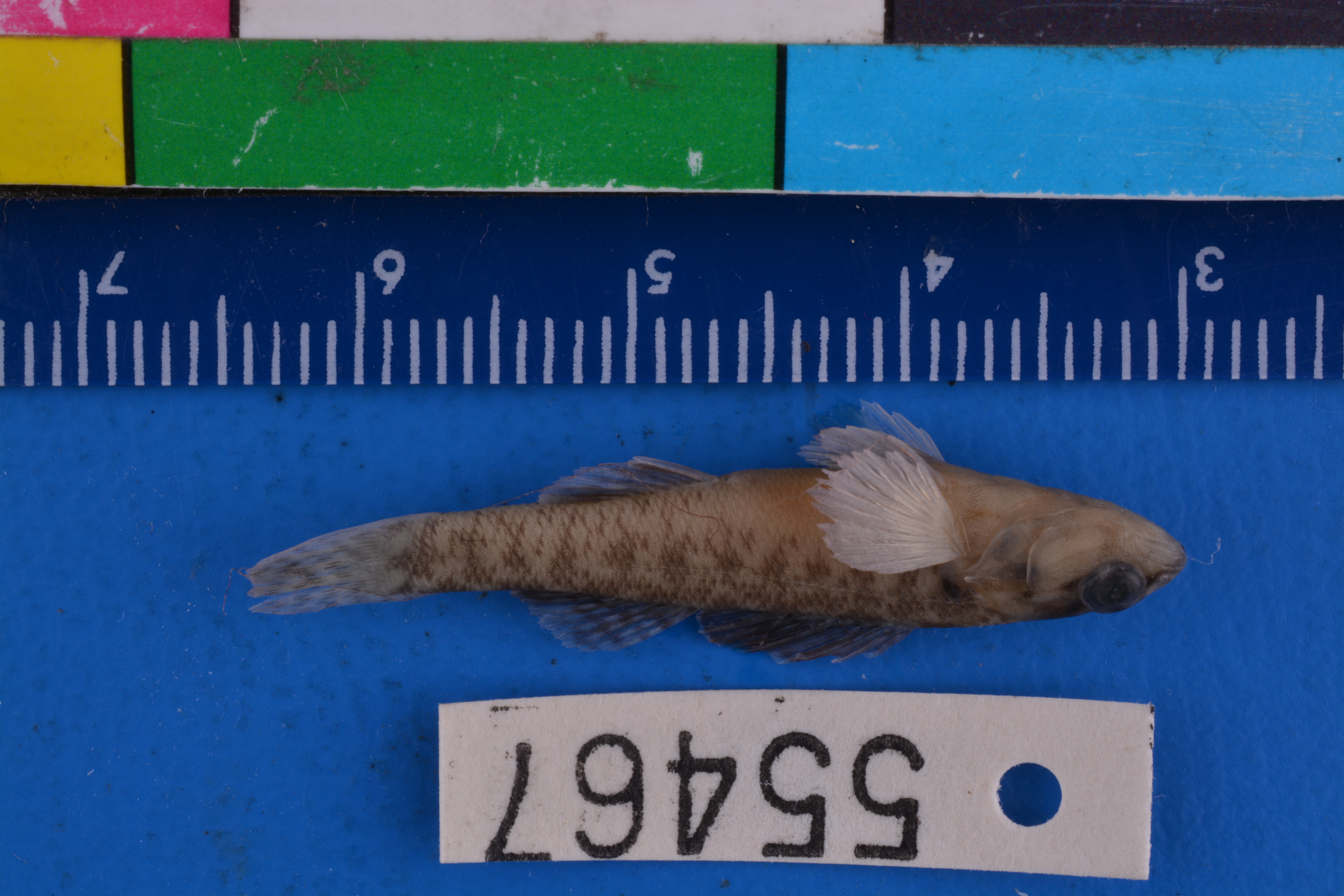
TNHCi_55467
Not suspect, not examinedPhotos
Map
Location
29.89439° N, 100.99546° W
(± 45
m)
Taxonomy
FamilyPercidae
GenusEtheostoma
Speciesgrahami
Specimen
Num Specimens75
PreparationFluid - 75
Identification
Identified ByMartin, Floyd
Date Identified2013.12.2
Collection Event
CollectorCasarez, Melissa; Gillespie, Hayley; Garrett, Gary; Bean, Megan
Collected Date2013.8.19
Field NumberMJC20130819-1
Event Remarksfield notes and photos available on server; TPWD staff (Tom Heger) and interns conducted SVAP surveys alongside fish collections; lots were originally split into 5 separate mesohabitats per TPWD data collection process and later merged, after identifications by mesohabitat were recorded and provided to Gary Garrett and Megan Bean
Geography
CountryUnited States
StateTexas
CountyVal Verde
LocalityDevils River at SNA North Unit and upstream ~750m
Latitude29.89439
Longitude-100.99546
DatumWGS84
Record Source
Source
Texas Natural History Collections
(type: specimens)
Institution
Texas Natural History Collections
(type: museum)
Curator
Dean Hendrickson
Record Added
June 24, 2020
Record Last Modified
March 23, 2026
Data Processing Track
Track 3
From Data Set Received
5/2017 to 11/2017
Identification
Suspect Notes
None
Count
75
Current Determination
Determiner
Unknown
Determination Date
Unknown
Determination Type
Unspecified
Identification Comments
None
Identification Confidence
Unknown
Collecting Event
Collected
Aug. 19, 2013
Collector(s)
Collecting Event ID
406911
Field Notes
There are no field notes available.
Locality
Jurisdiction
Val Verde, Texas
Name
Devils River at SNA North Unit and upstream ~750m
Hydrography
Rio Grande Region
Rio Grande-Amistad
Devils
Lower Devils
Deaton Draw-Devils River
Blue Springs-Devils River
Captive
no
Locality Photos
No locality photos available.
HUC 12
130403020106
Georeferencing Remarks
Georeference needs verification/refinement; coordinates provided by donor
Georeferencing Annotation
—
Has not been Georeferenced because
This record, being part of the track 3 import, is not formally georeferenced by FoTX staff at this time. However, to allow mapping and visualization of this record, locality information has been provisionally accepted if provided by the donor or if location text could be matched to previously georeferenced records by FoTX team or donor data. For many records spatial error is either accepted from the donor (when provided) or derived based on coordinate precision.
Comments On TNHCi_55467