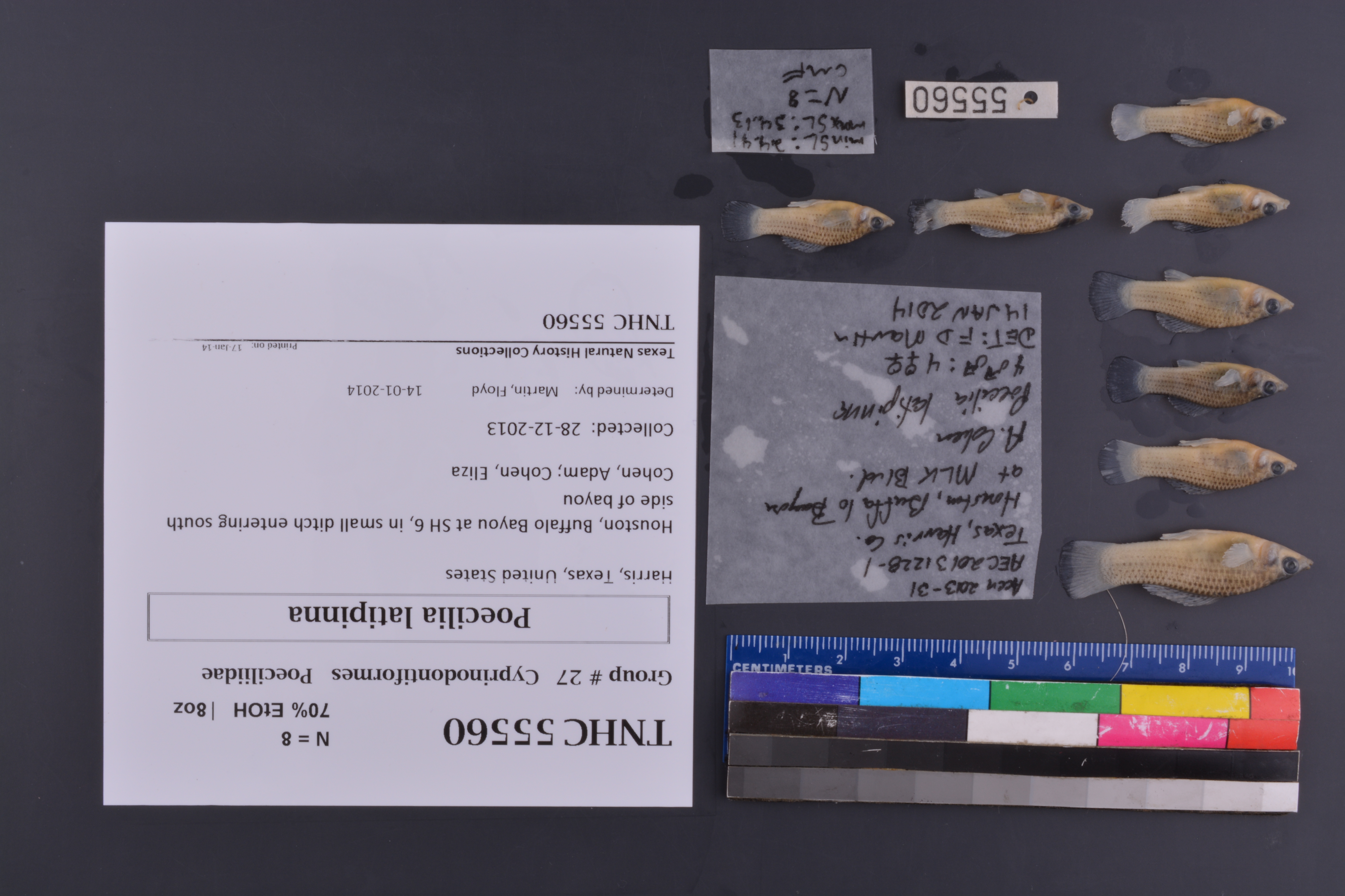
TNHCi_55560
Not suspect, not examined
Sailfin Molly –
Poecilia latipinna
Photos
Map
Location
29.76913° N, 95.64485° W
(± 45
m)
Taxonomy
FamilyPoeciliidae
GenusPoecilia
Specieslatipinna
Specimen
Num Specimens8
PreparationFluid - 8
Identification
Identification RemarksFDM notes: 4 males; 4 females
Identified ByMartin, Floyd
Date Identified2014.1.14
Collection Event
CollectorCohen, Adam; Cohen, Eliza
Collected Date2013.12.28
Field NumberAEC20131228-1
Event Remarksfield notes available on server
Geography
CountryUnited States
StateTexas
CountyHarris
LocalityHouston, Buffalo Bayou at SH 6, in small ditch entering south side of bayou
Latitude29.7691333
Longitude-95.64485
DatumWGS84
Record Source
Source
Texas Natural History Collections
(type: specimens)
Institution
Texas Natural History Collections
(type: museum)
Curator
Dean Hendrickson
Record Added
June 24, 2020
Record Last Modified
March 23, 2026
Data Processing Track
Track 3
From Data Set Received
5/2017 to 11/2017
Identification
Suspect Notes
None
Count
8
Current Determination
Determiner
Unknown
Determination Date
Unknown
Determination Type
Unspecified
Identification Comments
None
Identification Confidence
Unknown
Collecting Event
Collected
Dec. 28, 2013
Collector(s)
Collecting Event ID
407758
Field Notes
There are no field notes available.
Locality
Jurisdiction
Harris, Texas
Name
Houston, Buffalo Bayou at SH 6, in small ditch entering south side of bayou
Hydrography
USGS HUC
Texas-Gulf Region
Galveston Bay-San Jacinto
San Jacinto
Buffalo-San Jacinto
Whiteoak Bayou-Buffalo Bayou
Spring Branch-Buffalo Bayou
HydroBASINS
7515
751500
75150060
7515006091
751500609100
Captive
no
Locality Photos
No locality photos available.
HUC 12
120401040303
Georeferencing Remarks
Georeference needs verification/refinement; coordinates provided by donor
Georeferencing Annotation
—
Has not been Georeferenced because
This record, being part of the track 3 import, is not formally georeferenced by FoTX staff at this time. However, to allow mapping and visualization of this record, locality information has been provisionally accepted if provided by the donor or if location text could be matched to previously georeferenced records by FoTX team or donor data. For many records spatial error is either accepted from the donor (when provided) or derived based on coordinate precision.
Comments On TNHCi_55560