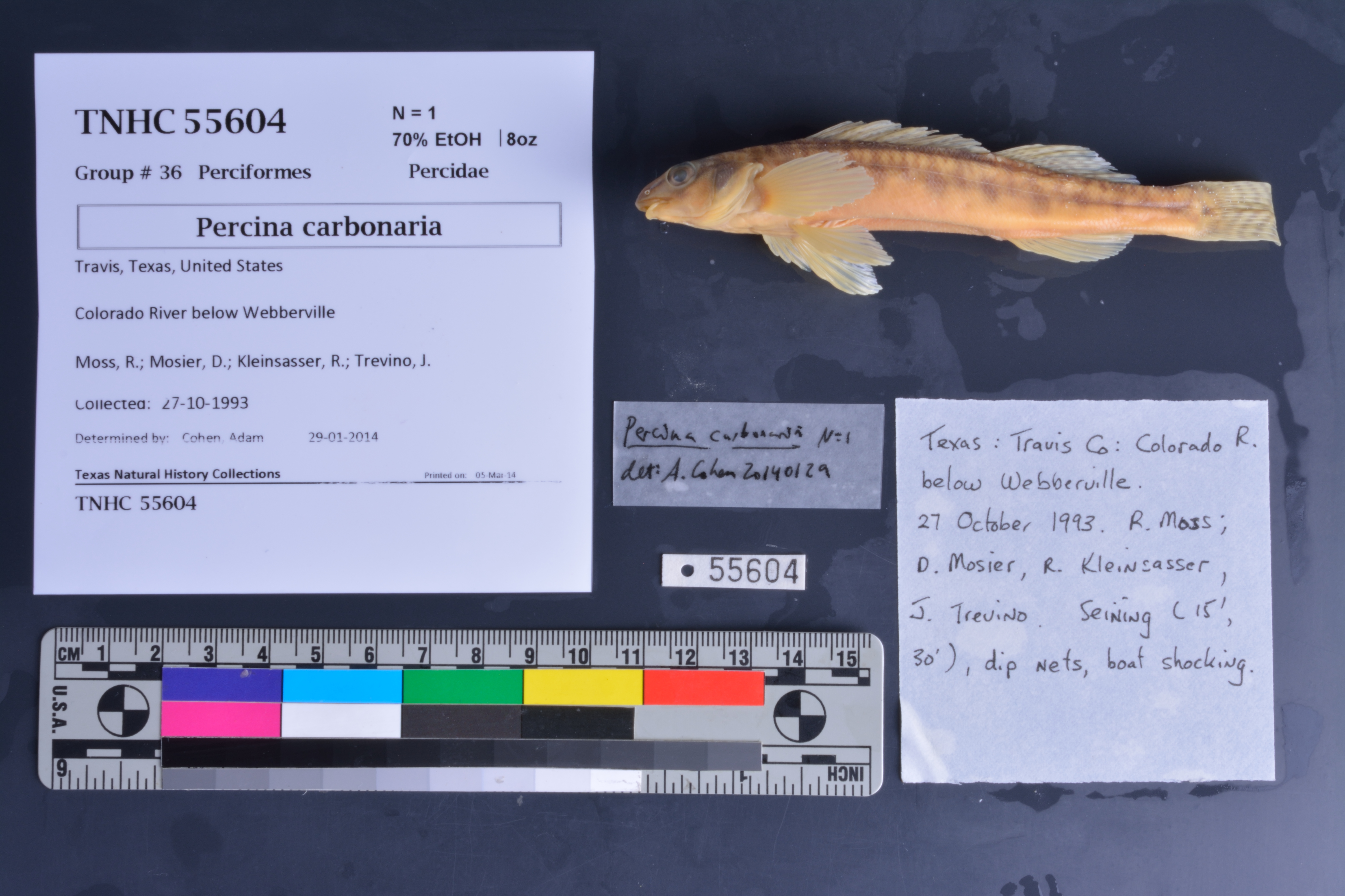
TNHCi_55604
Not suspect, not examinedPhotos
Map
Location
30.21629° N, 97.51537° W
(± 1700
m)
Taxonomy
FamilyPercidae
GenusPercina
Speciescarbonaria
Specimen
Num Specimens1
PreparationFluid - 1
Identification
Identified ByCohen, Adam
Date Identified2014.1.29
Collection Event
CollectorMoss, R.; Mosier, D.; Kleinsasser, R.; Trevino, J.
Collected Date1993.10.27
Field Numberz55604
Event Remarks15', 30' seine
Geography
CountryUnited States
StateTexas
CountyTravis
LocalityColorado River below Webberville
Latitude30.216292
Longitude-97.515372
DatumWGS84
Error1700.0
Georeferencing
Georeference RemarksCoordinates placed in the middle of the Colorado River S of Webberville, and uncertainty includes all of the river in that general vicinity.
Record Source
Source
Texas Natural History Collections
(type: specimens)
Institution
Texas Natural History Collections
(type: museum)
Curator
Dean Hendrickson
Record Added
June 24, 2020
Record Last Modified
March 23, 2026
Data Processing Track
Track 3
From Data Set Received
5/2017 to 11/2017
Identification
Suspect Notes
None
Count
1
Current Determination
Determiner
Unknown
Determination Date
Unknown
Determination Type
Unspecified
Identification Comments
None
Identification Confidence
Unknown
Collecting Event
Collected
Oct. 27, 1993
Collector(s)
Collecting Event ID
336361
Field Notes
There are no field notes available.
Locality
Jurisdiction
Travis, Texas
Name
Colorado River below Webberville
Hydrography
Texas-Gulf Region
Lower Colorado-San Bernard Coastal
Lower Colorado
Lower Colorado-Cummins
Willbarger Creek-Colorado River
Coleman Branch-Colorado River
Captive
no
Locality Photos
No locality photos available.
HUC 12
120903010108
Georeferencing Remarks
Georeference needs verification/refinement; coordinates provided by donor
Georeferencing Annotation
—
Has not been Georeferenced because
This record, being part of the track 3 import, is not formally georeferenced by FoTX staff at this time. However, to allow mapping and visualization of this record, locality information has been provisionally accepted if provided by the donor or if location text could be matched to previously georeferenced records by FoTX team or donor data. For many records spatial error is either accepted from the donor (when provided) or derived based on coordinate precision.
Comments On TNHCi_55604