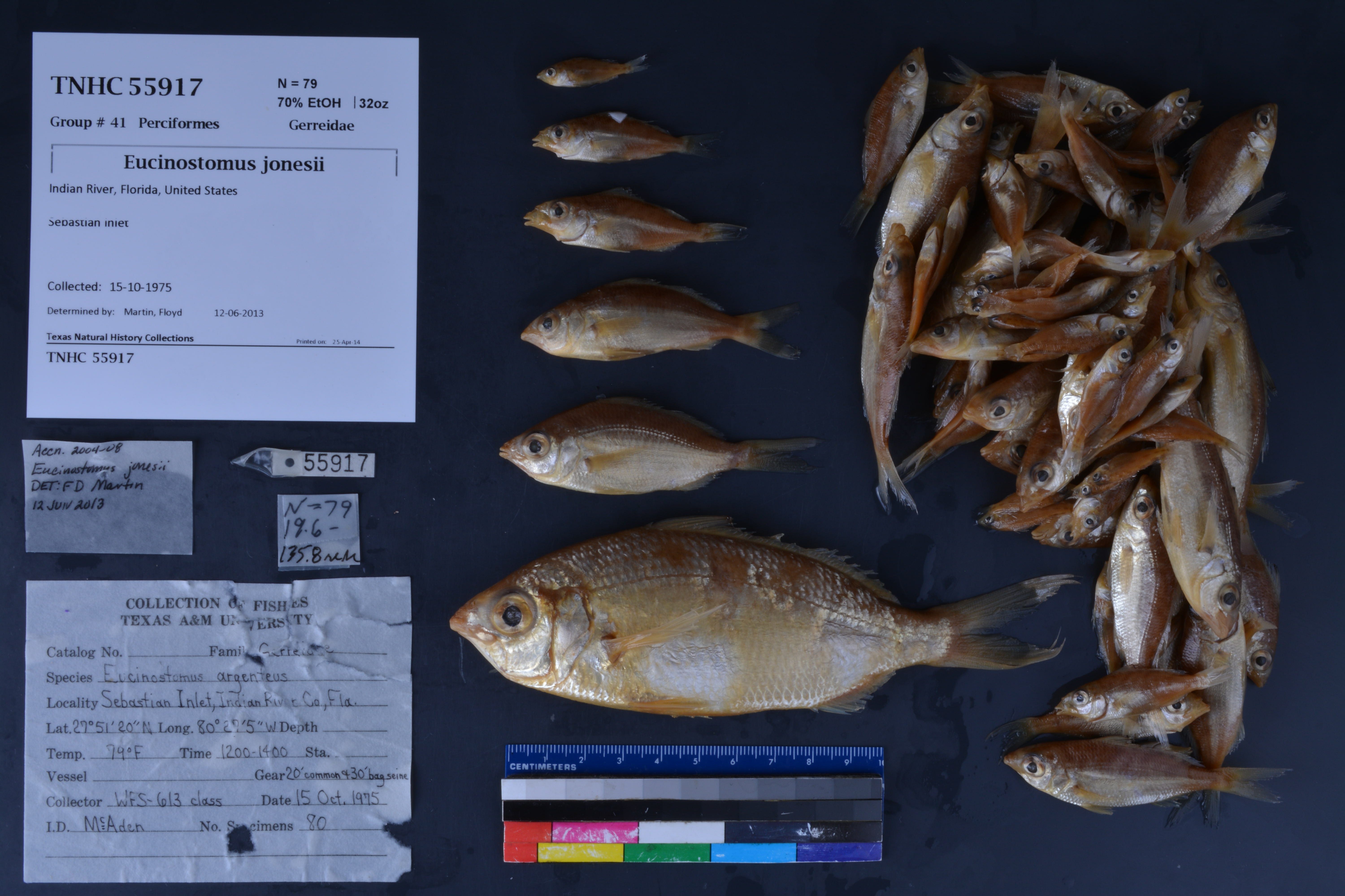
TNHCi_55917
Not suspect, not examinedPhotos
Map
Location
27.51200° N, 80.27500° W
(± 45
m)
Taxonomy
FamilyGerreidae
GenusEucinostomus
Speciesjonesii
Specimen
Num Specimens79
PreparationFluid - 79
Identification
Identified ByMartin, Floyd
Date Identified2013.6.12
Collection Event
Collectorclass, WFS-613
Collected Date1975.10.15
Field Numberz55917
Event RemarksTemp 79 F; gear 20' common and 30' common bag seines; collected by WFS-613 class; Part of the old TX A&M collection; known information is very limited and based on labels found in the jars
Geography
CountryUnited States
StateFlorida
CountyIndian River
LocalitySebastian Inlet
Latitude27.512
Longitude-80.275
DatumWGS84
Error45.0
Record Source
Source
Texas Natural History Collections
(type: specimens)
Institution
Texas Natural History Collections
(type: museum)
Curator
Dean Hendrickson
Record Added
June 24, 2020
Record Last Modified
March 23, 2026
Data Processing Track
Track 3
From Data Set Received
5/2017 to 11/2017
Identification
Suspect Notes
None
Count
79
Current Determination
Determiner
Unknown
Determination Date
Unknown
Determination Type
Unspecified
Identification Comments
None
Identification Confidence
Unknown
Collecting Event
Collected
Oct. 15, 1975
Collector(s)
Collecting Event ID
300257
Field Notes
There are no field notes available.
Locality
Jurisdiction
Unknown
Name
Sebastian Inlet
Hydrography
Not available
Captive
no
Locality Photos
No locality photos available.
HUC
—
Georeferencing Remarks
Georeference needs verification/refinement; coordinates provided by donor
Georeferencing Annotation
—
Has not been Georeferenced because
This record, being part of the track 3 import, is not formally georeferenced by FoTX staff at this time. However, to allow mapping and visualization of this record, locality information has been provisionally accepted if provided by the donor or if location text could be matched to previously georeferenced records by FoTX team or donor data. For many records spatial error is either accepted from the donor (when provided) or derived based on coordinate precision.
Comments On TNHCi_55917