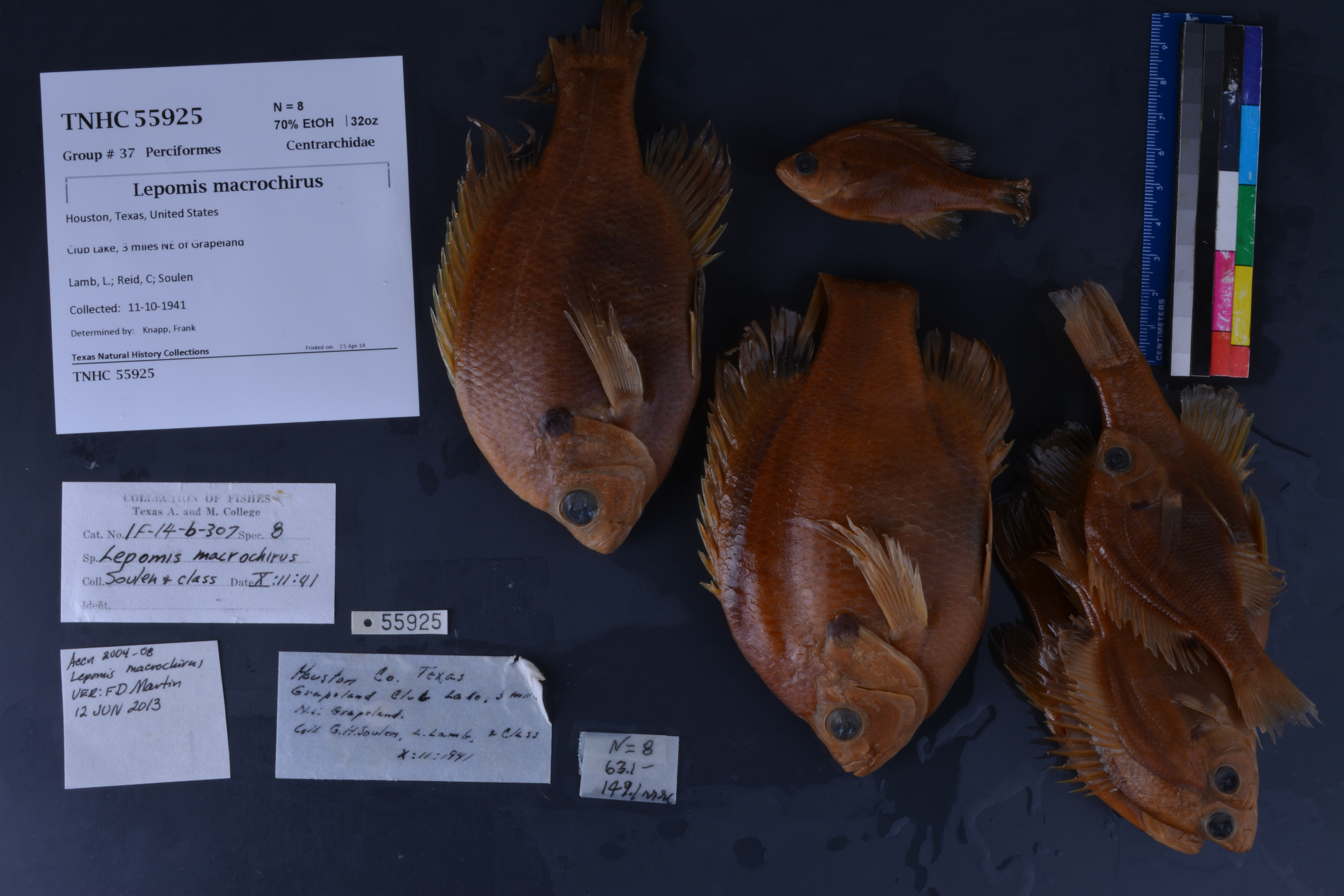
TNHCi_55925
Not suspect, not examinedPhotos
Map
Location
31.52307° N, 95.48175° W
(± 2355.1
m)
Taxonomy
FamilyCentrarchidae
GenusLepomis
Speciesmacrochirus
Specimen
Num Specimens8
PreparationFluid - 8
Identification
Identification RemarksVerified by FD Martin; 12 Jun 2013
Identified ByKnapp, Frank
Date Identified..
Collection Event
CollectorLamb, L.; Reid, C; Soulen; class
Collected Date1941.10.11
Field Numberz55925
Event RemarksPart of the old TX A&M collection; known information is very limited and based on labels found in the jars
Geography
CountryUnited States
StateTexas
CountyHouston
LocalityGrapeland, 3 mi NE
Latitude31.523068
Longitude-95.481753
DatumWGS84
Error2355.064
Georeferencing
Georeference RemarksTreated as measure by air. Likely Grapeland Lake, though not certain.
Record
Occurrence RemarksIF-14-6-307 ... prev cat #; OTHER previous catalog #s include: 15292, 15348, and 272
Record Source
Source
Texas Natural History Collections
(type: specimens)
Institution
Texas Natural History Collections
(type: museum)
Curator
Dean Hendrickson
Record Added
June 24, 2020
Record Last Modified
March 23, 2026
Data Processing Track
Track 3
From Data Set Received
5/2017 to 11/2017
Identification
Suspect Notes
None
Count
8
Current Determination
Determiner
Unknown
Determination Date
Unknown
Determination Type
Unspecified
Identification Comments
None
Identification Confidence
Unknown
Collecting Event
Collected
Oct. 11, 1941
Collecting Event ID
274695
Field Notes
There are no field notes available.
Locality
Jurisdiction
Houston, Texas
Name
Grapeland, 3 mi NE
Hydrography
Texas-Gulf Region
Neches
Neches
Upper Neches
San Pedro Creek-Neches River
Stowe Creek-San Pedro Creek
Captive
no
Locality Photos
No locality photos available.
HUC 12
120200010701
Georeferencing Remarks
Georeference needs verification/refinement; coordinates provided by donor
Georeferencing Annotation
—
Has not been Georeferenced because
This record, being part of the track 3 import, is not formally georeferenced by FoTX staff at this time. However, to allow mapping and visualization of this record, locality information has been provisionally accepted if provided by the donor or if location text could be matched to previously georeferenced records by FoTX team or donor data. For many records spatial error is either accepted from the donor (when provided) or derived based on coordinate precision.
Comments On TNHCi_55925