TNHCi_55982
Not suspect, not examinedPhotos
Map
Location
30.22260° N, 97.40947° W
(± 45
m)
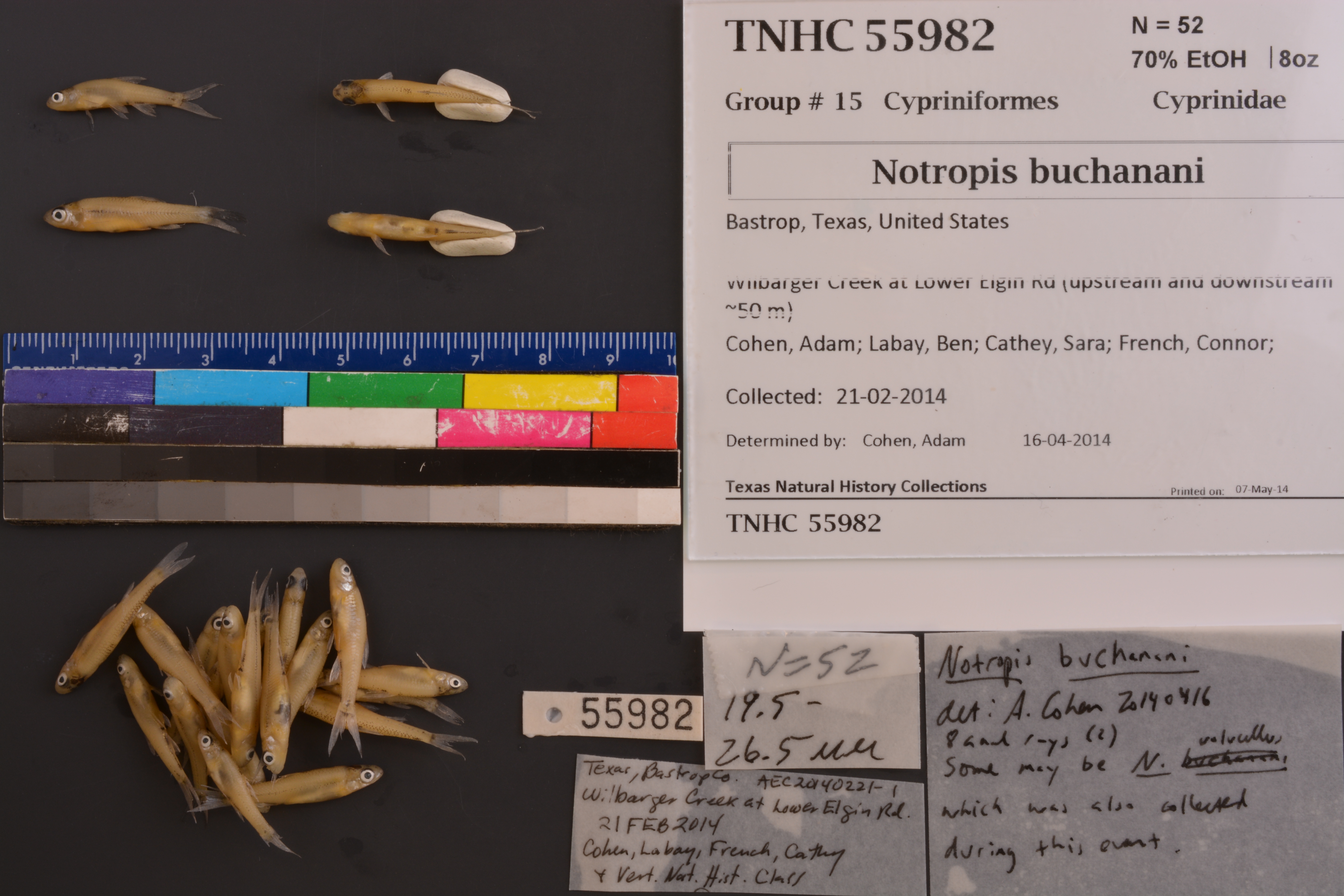
Taxonomy
FamilyCyprinidae
GenusNotropis
Speciesbuchanani
Specimen
Num Specimens52
PreparationFluid - 52
Identification
Identification Remarks8 anal rays (2); some may be N. Volucellus, which was also collected during this event
Identified ByCohen, Adam
Date Identified2014.4.16
Collection Event
CollectorCohen, Adam; Labay, Ben; Cathey, Sara; French, Connor; Vertebrate Natural History Class
Collected Date2014.2.21
Field NumberAEC20140221-1
Event Remarksalso used backpack electroshocker and net; collected by vertebral natural history class @ UT Austin
Geography
CountryUnited States
StateTexas
CountyBastrop
LocalityWilbarger Creek at Lower Elgin Rd (upstream and downstream ~50 m)
Latitude30.222595
Longitude-97.409466
DatumWGS84
Record Source
Source
Texas Natural History Collections
(type: specimens)
Institution
Texas Natural History Collections
(type: museum)
Curator
Dean Hendrickson
Record Added
June 24, 2020
Record Last Modified
March 23, 2026
Data Processing Track
Track 3
From Data Set Received
5/2017 to 11/2017
Identification
Suspect Notes
None
Count
52
Current Determination
Determiner
Unknown
Determination Date
Unknown
Determination Type
Unspecified
Identification Comments
None
Identification Confidence
Unknown
Collecting Event
Collected
Feb. 21, 2014
Collector(s)
Collecting Event ID
408384
Field Notes
There are no field notes available.
Locality
Jurisdiction
Bastrop, Texas
Name
Wilbarger Creek at Lower Elgin Rd (upstream and downstream ~50 m)
Hydrography
USGS HUC
Texas-Gulf Region
Lower Colorado-San Bernard Coastal
Lower Colorado
Lower Colorado-Cummins
Willbarger Creek-Colorado River
Lower Wilbarger Creek
HydroBASINS
7518
751810
75181030
7518103041
751810304100
Captive
no
Locality Photos
No locality photos available.
HUC 12
120903010105
Georeferencing Remarks
Georeference needs verification/refinement; coordinates provided by donor
Georeferencing Annotation
—
Has not been Georeferenced because
This record, being part of the track 3 import, is not formally georeferenced by FoTX staff at this time. However, to allow mapping and visualization of this record, locality information has been provisionally accepted if provided by the donor or if location text could be matched to previously georeferenced records by FoTX team or donor data. For many records spatial error is either accepted from the donor (when provided) or derived based on coordinate precision.
Comments On TNHCi_55982