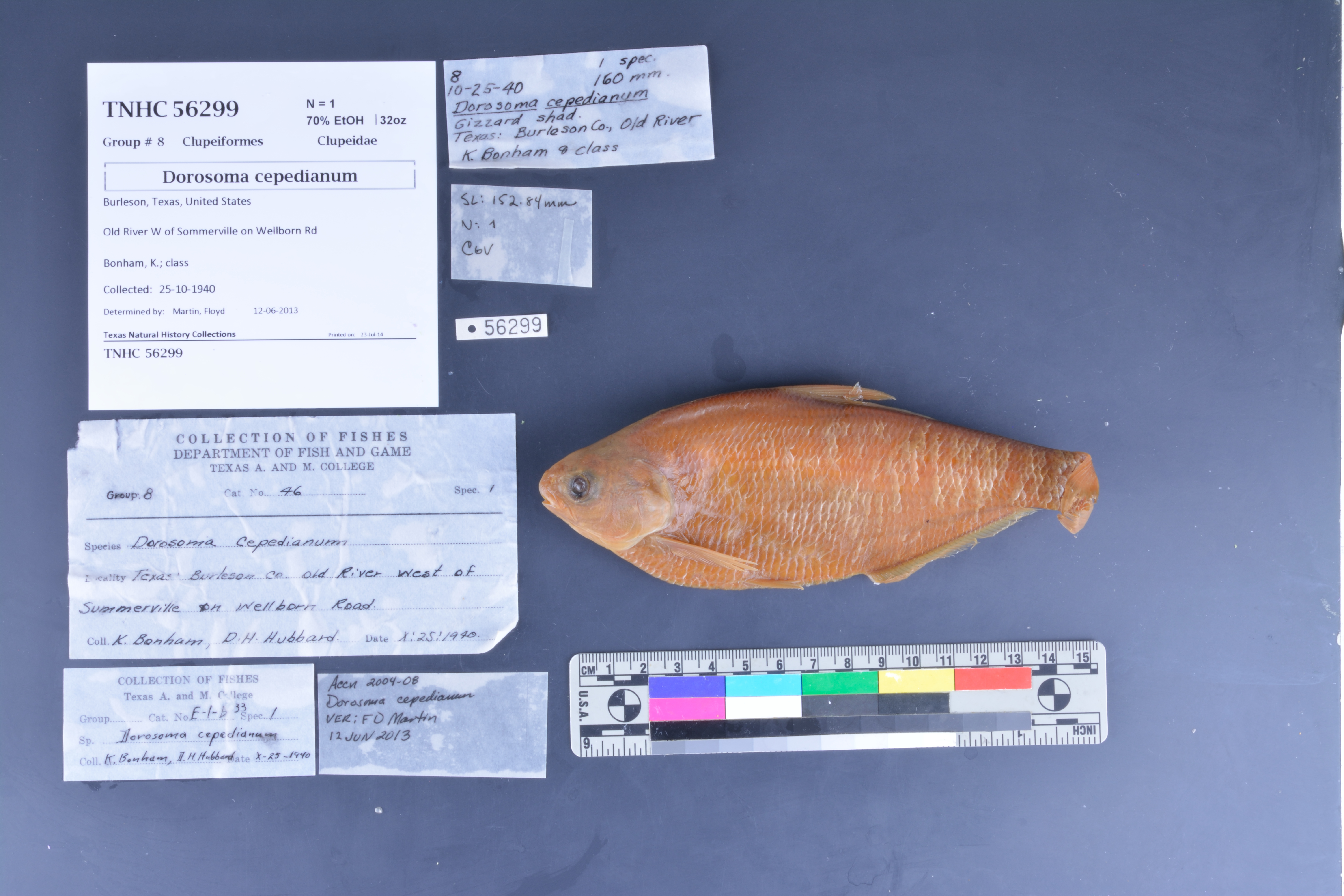
TNHCi_56299
Not suspect, not examinedPhotos
Map
Location
30.51324° N, 96.43604° W
(± 22925.1
m)
Taxonomy
FamilyClupeidae
GenusDorosoma
Speciescepedianum
Specimen
Num Specimens1
PreparationFluid - 1
Identification
Identified ByMartin, Floyd
Date Identified2013.6.12
Collection Event
CollectorBonham, K.; class
Collected Date1940.10.25
Field Numberz56299
Geography
CountryUnited States
StateTexas
CountyBurleson
LocalityOld River
Latitude30.513235
Longitude-96.436043
DatumWGS84
Error22925.1124
Georeferencing
Georeference RemarksWellburn Rd is in Brazos Co. and never crosses Old River. Old River is E of Somerville. Measured length of Old River within Burleson Co. and placed coordinates halfway. Error is half the distance
Record Source
Source
Texas Natural History Collections
(type: specimens)
Institution
Texas Natural History Collections
(type: museum)
Curator
Dean Hendrickson
Record Added
June 24, 2020
Record Last Modified
March 23, 2026
Data Processing Track
Track 3
From Data Set Received
5/2017 to 11/2017
Identification
Suspect Notes
None
Count
1
Current Determination
Determiner
Unknown
Determination Date
Unknown
Determination Type
Unspecified
Identification Comments
None
Identification Confidence
Unknown
Collecting Event
Collected
Oct. 25, 1940
Collecting Event ID
274568
Field Notes
There are no field notes available.
Locality
Jurisdiction
Burleson, Texas
Name
Old River
Hydrography
Texas-Gulf Region
Lower Brazos
Lower Brazos
Lower Brazos-Little Brazos
Old River-Brazos River
White Creek-Brazos River
Captive
no
Locality Photos
No locality photos available.
HUC 12
120701010705
Georeferencing Remarks
Georeference needs verification/refinement; coordinates provided by donor
Georeferencing Annotation
—
Has not been Georeferenced because
This record, being part of the track 3 import, is not formally georeferenced by FoTX staff at this time. However, to allow mapping and visualization of this record, locality information has been provisionally accepted if provided by the donor or if location text could be matched to previously georeferenced records by FoTX team or donor data. For many records spatial error is either accepted from the donor (when provided) or derived based on coordinate precision.
Comments On TNHCi_56299