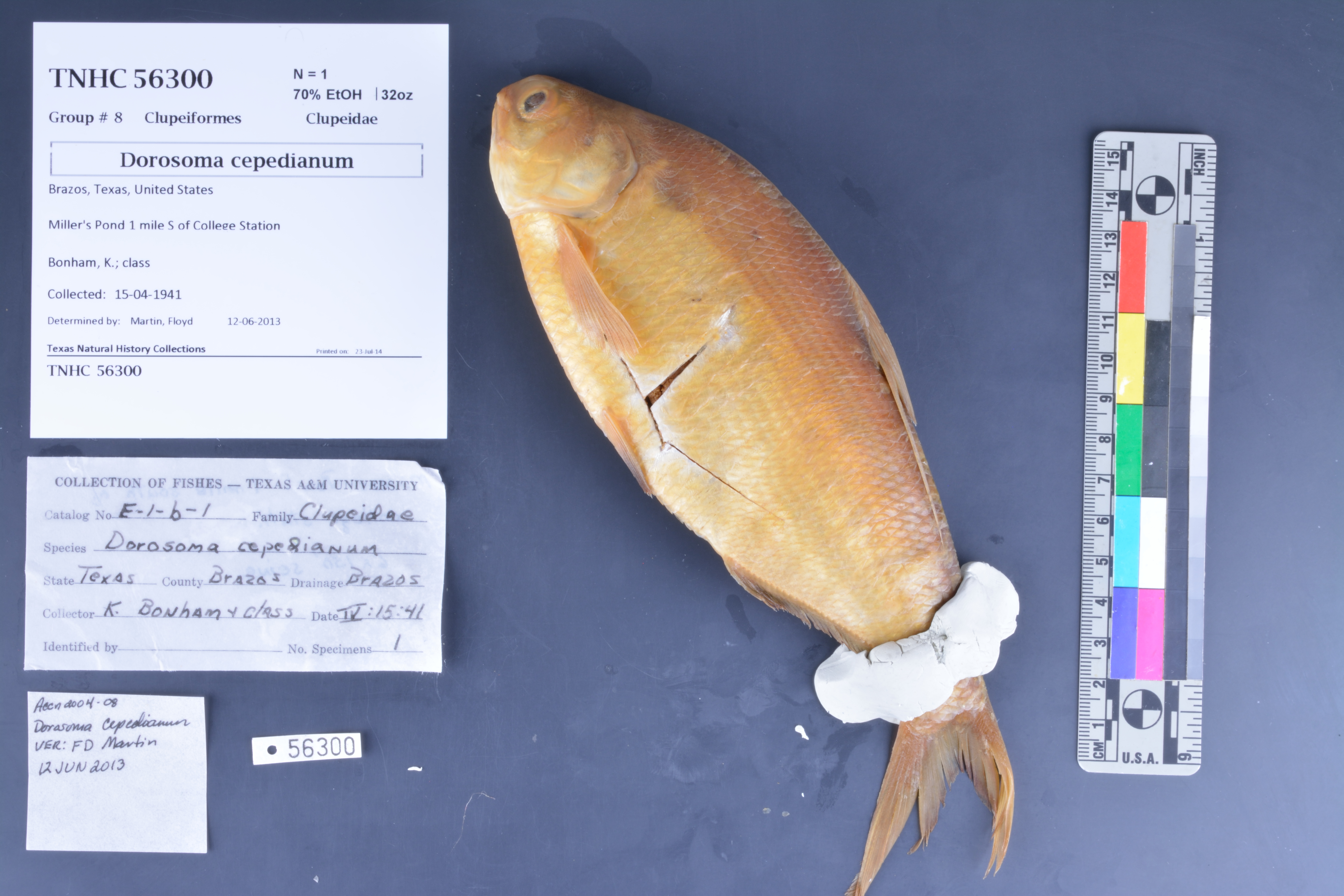
TNHCi_56300
Not suspect, not examinedPhotos
Map
Location
30.61423° N, 96.33226° W
(± 1497
m)
Taxonomy
FamilyClupeidae
GenusDorosoma
Speciescepedianum
Specimen
Num Specimens1
PreparationFluid - 1
Identification
Identified ByMartin, Floyd
Date Identified2013.6.12
Collection Event
CollectorBonham, K.; class
Collected Date1941.4.15
Field Numberz56300
Event RemarksSeine was 6 X 150'
Geography
CountryUnited States
StateTexas
CountyBrazos
LocalityCollege Station, 1 mi S
Latitude30.614234
Longitude-96.332255
DatumWGS84
Error1497.0
Georeferencing
Georeference RemarksCould not find a Miller's Pond, so I found the point on any water source which was closest to 1 mi S of College Station and measured around it to the center of College Station and to the edges of the arc created by finding 1 mi SE and 1 mi SW of College Station.
Record
Occurrence RemarksOriginal tag says catalog number: E-1-6-1.
Record Source
Source
Texas Natural History Collections
(type: specimens)
Institution
Texas Natural History Collections
(type: museum)
Curator
Dean Hendrickson
Record Added
June 24, 2020
Record Last Modified
March 23, 2026
Data Processing Track
Track 3
From Data Set Received
5/2017 to 11/2017
Identification
Suspect Notes
None
Count
1
Current Determination
Determiner
Unknown
Determination Date
Unknown
Determination Type
Unspecified
Identification Comments
None
Identification Confidence
Unknown
Collecting Event
Collected
April 15, 1941
Collecting Event ID
274633
Field Notes
There are no field notes available.
Locality
Jurisdiction
Brazos, Texas
Name
College Station, 1 mi S
Hydrography
Texas-Gulf Region
Lower Brazos
Lower Brazos
Navasota
Gibbons Creek-Navasota River
Bee Creek-Carters Creek
Captive
no
Locality Photos
No locality photos available.
HUC 12
120701030702
Georeferencing Remarks
Georeference needs verification/refinement; coordinates provided by donor
Georeferencing Annotation
—
Has not been Georeferenced because
This record, being part of the track 3 import, is not formally georeferenced by FoTX staff at this time. However, to allow mapping and visualization of this record, locality information has been provisionally accepted if provided by the donor or if location text could be matched to previously georeferenced records by FoTX team or donor data. For many records spatial error is either accepted from the donor (when provided) or derived based on coordinate precision.
Comments On TNHCi_56300