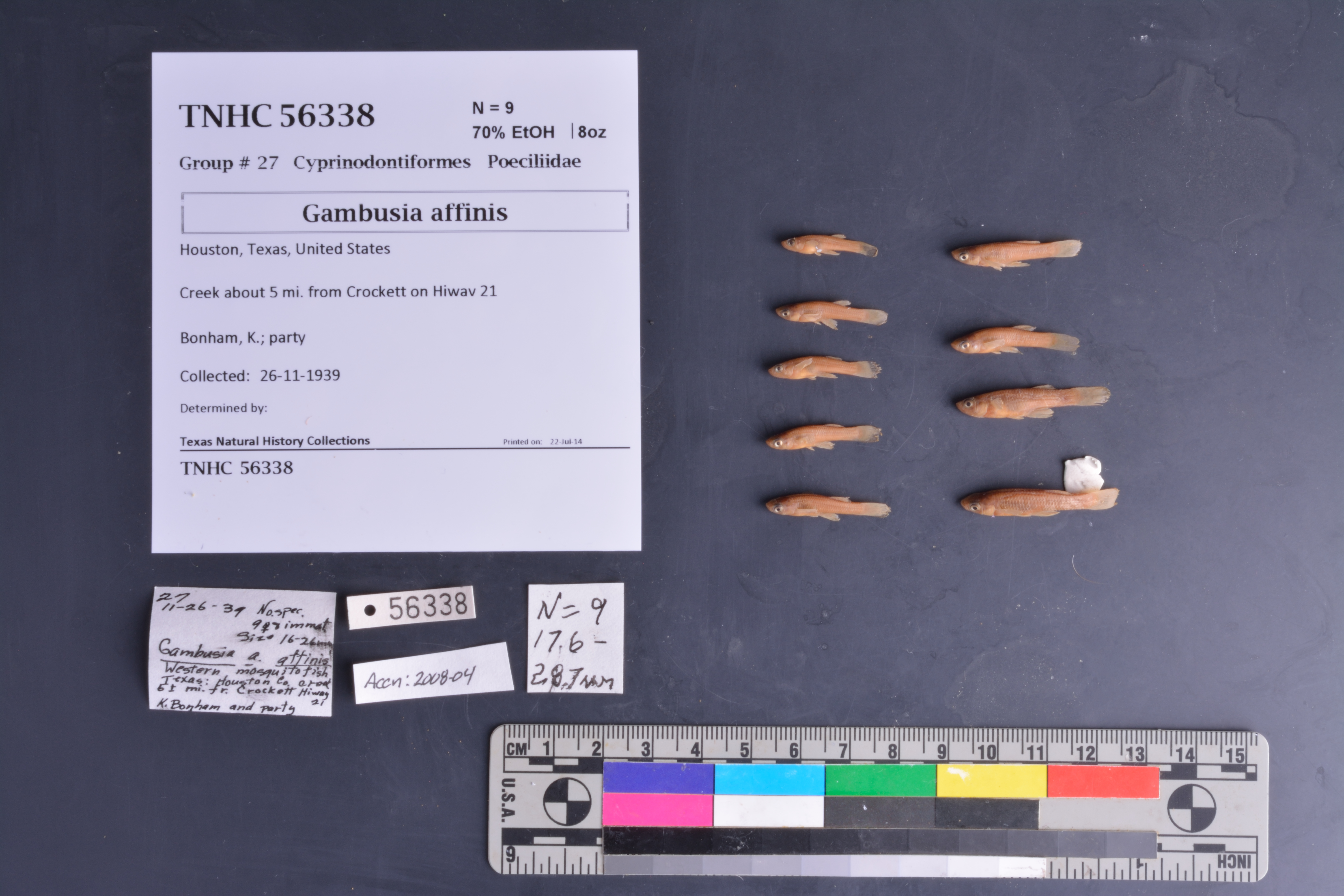
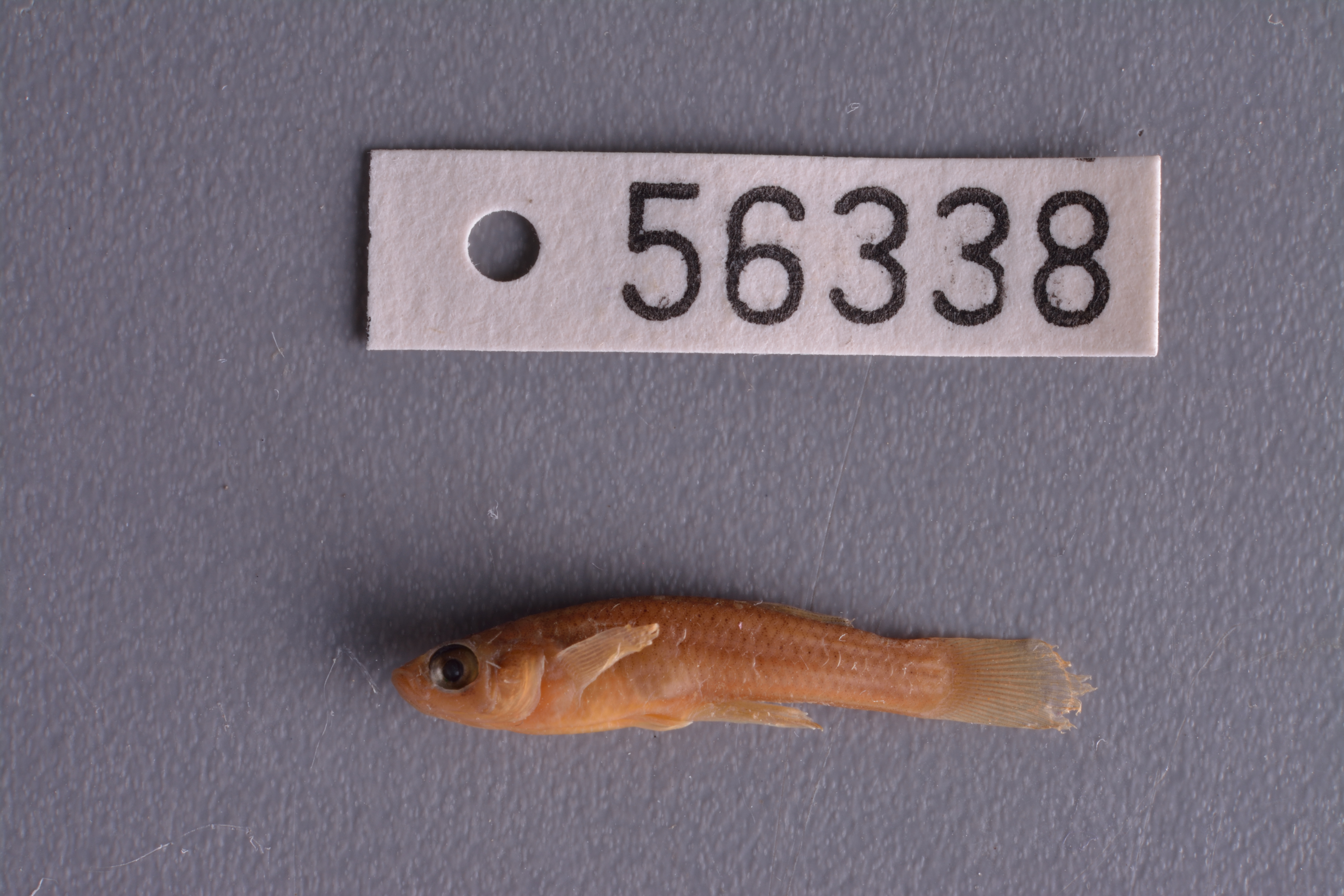
TNHCi_56338
Not suspect, not examinedPhotos
Map
Location
31.36134° N, 95.39555° W
(± 2402.0
m)
Taxonomy
FamilyPoeciliidae
GenusGambusia
Speciesaffinis
Specimen
Num Specimens9
PreparationFluid - 9
Identification
Identification RemarksThe ID for this lot was not verified before it was cataloged.
Date Identified..
Collection Event
CollectorBonham, K.; party
Collected Date1939.11.26
Field Numberz56338
Geography
CountryUnited States
StateTexas
CountyHouston
LocalitySH 21, 5 mi from Crockett
Latitude31.36134
Longitude-95.395546
DatumWGS84
Error2401.961
Georeferencing
Georeference RemarksTreated as measure along a path. Used extent for Cherokee. This should cover several creeks along SH 21.
Record
Occurrence RemarksNo previous A&M catalog number. Information taken only from original tag.
Record Source
Source
Texas Natural History Collections
(type: specimens)
Institution
Texas Natural History Collections
(type: museum)
Curator
Dean Hendrickson
Record Added
June 24, 2020
Record Last Modified
March 23, 2026
Data Processing Track
Track 3
From Data Set Received
5/2017 to 11/2017
Identification
Suspect Notes
None
Count
9
Current Determination
Determiner
Unknown
Determination Date
Unknown
Determination Type
Unspecified
Identification Comments
None
Identification Confidence
Unknown
Collecting Event
Collected
Nov. 26, 1939
Collecting Event ID
274179
Field Notes
There are no field notes available.
Locality
Jurisdiction
Houston, Texas
Name
SH 21, 5 mi from Crockett
Hydrography
Texas-Gulf Region
Trinity
Lower Trinity
Lower Trinity-Tehuacana
Big Elkhart Creek-Trinity River
Upper Hurricane Bayou
Captive
no
Locality Photos
No locality photos available.
HUC 12
120302010705
Georeferencing Remarks
Georeference needs verification/refinement; coordinates provided by donor
Georeferencing Annotation
—
Has not been Georeferenced because
This record, being part of the track 3 import, is not formally georeferenced by FoTX staff at this time. However, to allow mapping and visualization of this record, locality information has been provisionally accepted if provided by the donor or if location text could be matched to previously georeferenced records by FoTX team or donor data. For many records spatial error is either accepted from the donor (when provided) or derived based on coordinate precision.
Comments On TNHCi_56338