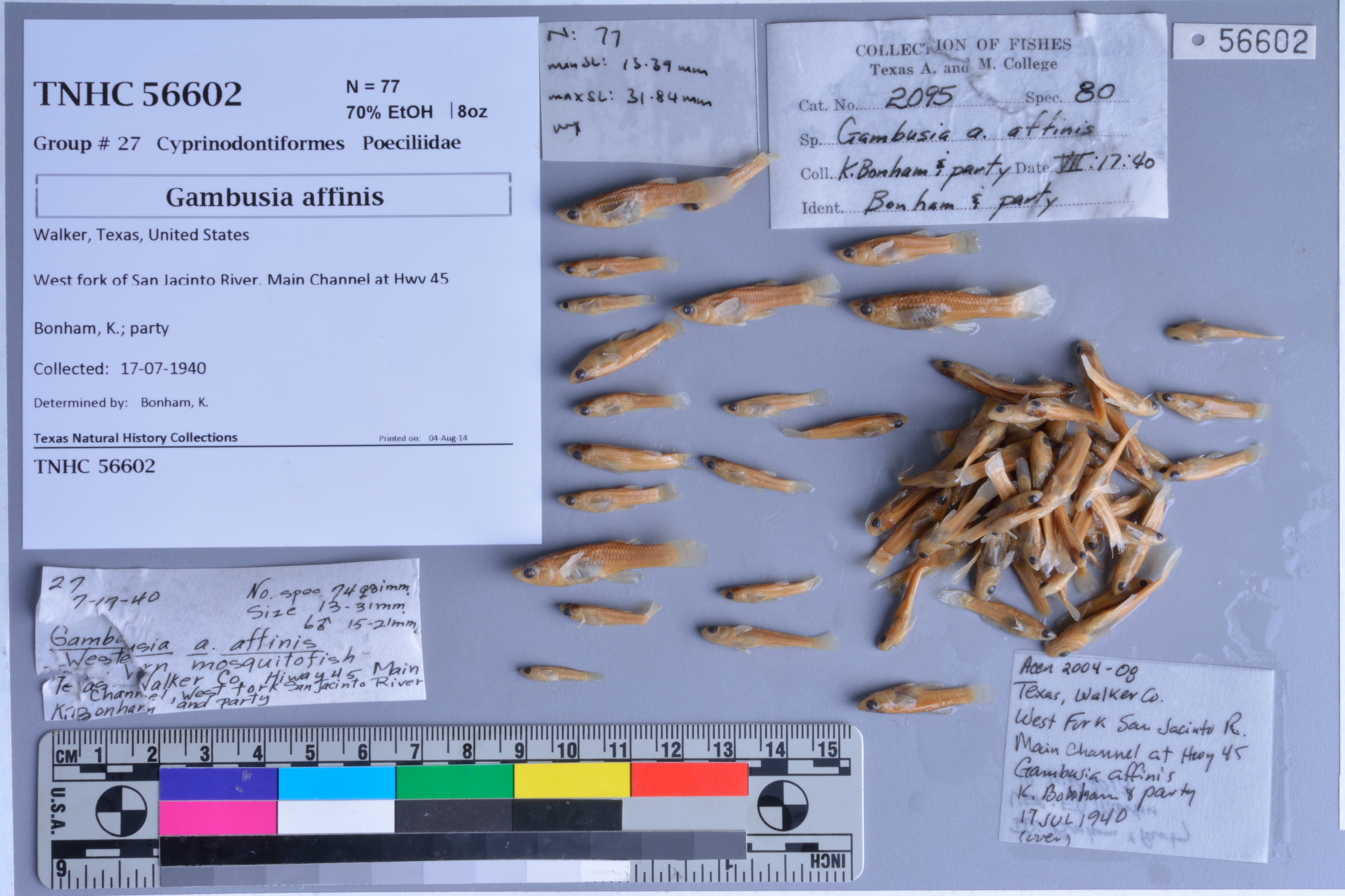
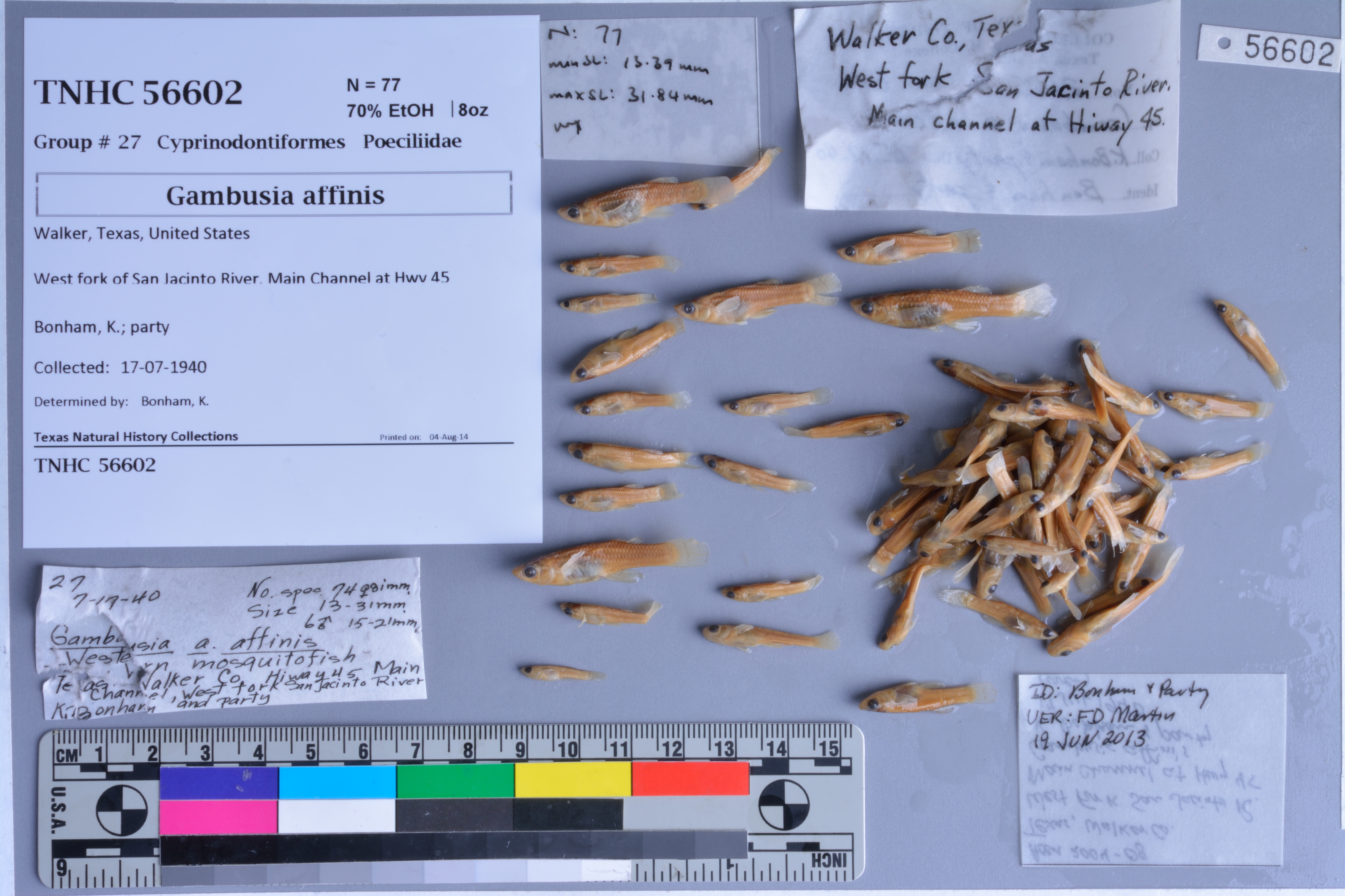
TNHCi_56602
Not suspect, not examinedPhotos
Map
Location
30.24489° N, 95.45747° W
(± 46.5
m)
Taxonomy
FamilyPoeciliidae
GenusGambusia
Speciesaffinis
Specimen
Num Specimens77
PreparationFluid - 77
Identification
Identification RemarksVerified by FD Martin on 19Jun2013
Identified ByBonham, K.
Date Identified..
Collection Event
CollectorBonham, K.; party
Collected Date1940.7.17
Field Numberz56602
Event RemarksPart of the old TX A&M collection; known information is very limited and based on labels found in the jars.
Geography
CountryUnited States
StateTexas
CountyWalker
LocalityWest Fork San Jacinto River, Main Channel at IH 45
Latitude30.244894
Longitude-95.45747
DatumWGS84
Error46.468
Georeferencing
Georeference RemarksTreated as named place. West Fork San Jacinto River does not cross IH 45 until S of Conroe, in Montgomery Co.
Record
Occurrence RemarksPrevious A&M catalog number: 2095.
Record Source
Source
Texas Natural History Collections
(type: specimens)
Institution
Texas Natural History Collections
(type: museum)
Curator
Dean Hendrickson
Record Added
June 24, 2020
Record Last Modified
March 23, 2026
Data Processing Track
Track 3
From Data Set Received
5/2017 to 11/2017
Identification
Suspect Notes
None
Count
77
Current Determination
Determiner
Unknown
Determination Date
Unknown
Determination Type
Unspecified
Identification Comments
None
Identification Confidence
Unknown
Collecting Event
Collected
July 17, 1940
Collecting Event ID
274467
Field Notes
There are no field notes available.
Locality
Jurisdiction
Montgomery, Texas
Name
West Fork San Jacinto River, Main Channel at IH 45
Hydrography
Texas-Gulf Region
Galveston Bay-San Jacinto
San Jacinto
West Fork San Jacinto
Crystal Creek-West Fork San Jacinto River
Stewarts Creek-West Fork San Jacinto River
Captive
no
Locality Photos
No locality photos available.
HUC 12
120401010401
Georeferencing Remarks
Georeference needs verification/refinement; coordinates provided by donor
Georeferencing Annotation
—
Has not been Georeferenced because
This record, being part of the track 3 import, is not formally georeferenced by FoTX staff at this time. However, to allow mapping and visualization of this record, locality information has been provisionally accepted if provided by the donor or if location text could be matched to previously georeferenced records by FoTX team or donor data. For many records spatial error is either accepted from the donor (when provided) or derived based on coordinate precision.
Comments On TNHCi_56602