TNHCi_56608
Not suspect, not examinedPhotos
Map
Location
29.60192° N, 96.08984° W
(± 100
m)
Taxonomy
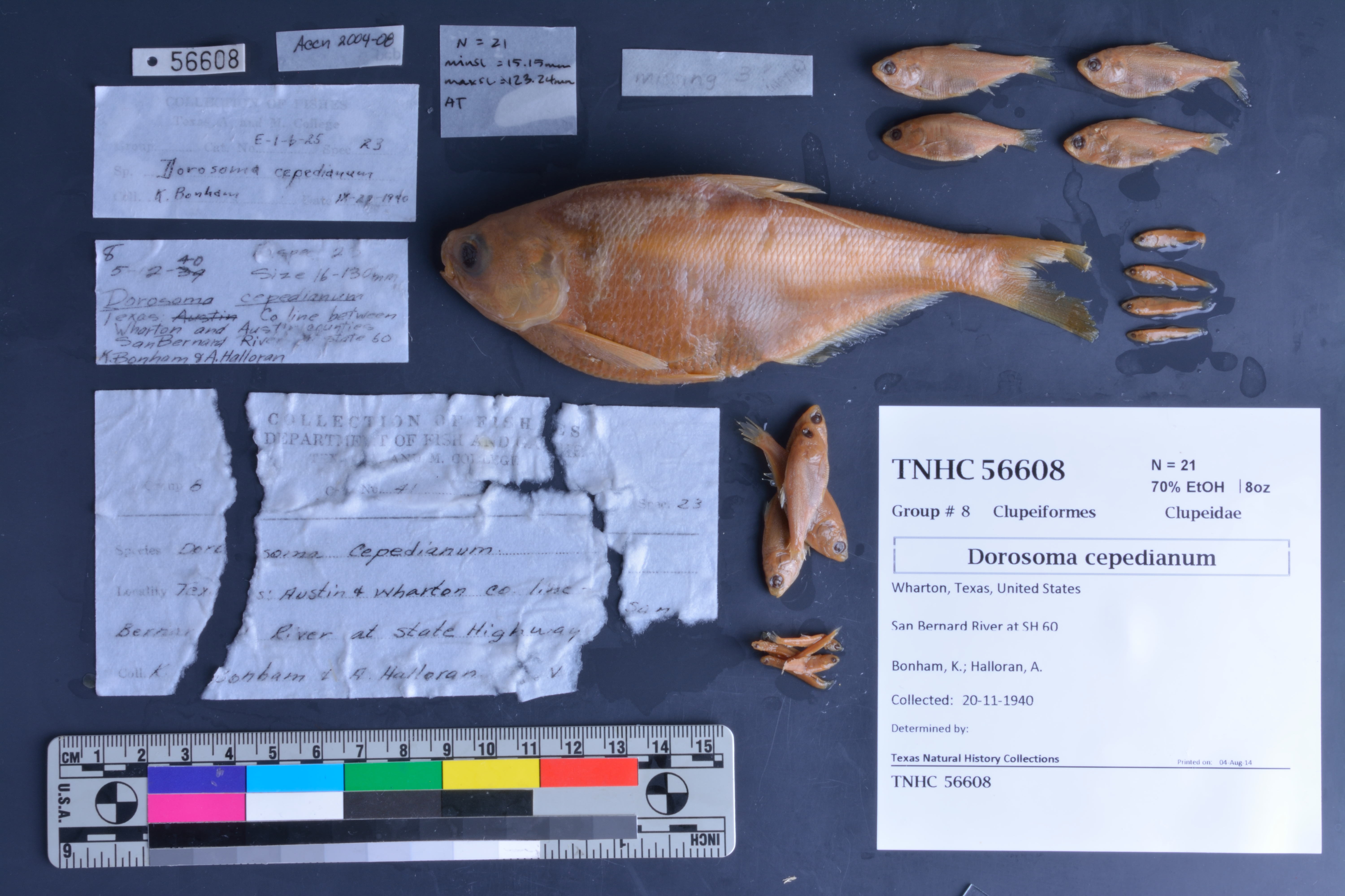
FamilyClupeidae
GenusDorosoma
Speciescepedianum
Specimen
Num Specimens21
PreparationFluid - 21
Identification
Identification RemarksThe ID for this lot was not verified.
Date Identified..
Collection Event
CollectorBonham, K.; Halloran, A.
Collected Date1940.11.20
Field Numberz56608
Event RemarksConflicting collection dates; other is 05-12-1940. Part of the old TX A&M collection; known information is very limited and based on labels found in the jars.
Geography
CountryUnited States
StateTexas
CountyWharton
LocalitySan Bernard River at SH 60
Latitude29.601918
Longitude-96.089839
DatumWGS84
Error100.0
Georeferencing
Georeference RemarksCoordinates placed in the middle of the San Bernard River at its intersection with SH 60, and the uncertainty includes the area around the intersection.
Record
Occurrence RemarksPrevious A&M catalog numbers: 21 and E-1-b-25.
Record Source
Source
Texas Natural History Collections
(type: specimens)
Institution
Texas Natural History Collections
(type: museum)
Curator
Dean Hendrickson
Record Added
June 24, 2020
Record Last Modified
March 23, 2026
Data Processing Track
Track 3
From Data Set Received
5/2017 to 11/2017
Identification
Suspect Notes
None
Count
21
Current Determination
Determiner
Unknown
Determination Date
Unknown
Determination Type
Unspecified
Identification Comments
None
Identification Confidence
Unknown
Collecting Event
Collected
Nov. 20, 1940
Collector(s)
Collecting Event ID
274574
Field Notes
There are no field notes available.
Locality
Jurisdiction
Fort Bend, Texas
Name
San Bernard River at SH 60
Hydrography
Texas-Gulf Region
Lower Colorado-San Bernard Coastal
San Bernard Coastal
San Bernard
Upper San Bernard River
Elm Slough-San Bernard River
Captive
no
Locality Photos
No locality photos available.
HUC 12
120904010109
Georeferencing Remarks
Georeference needs verification/refinement; coordinates provided by donor
Georeferencing Annotation
—
Has not been Georeferenced because
This record, being part of the track 3 import, is not formally georeferenced by FoTX staff at this time. However, to allow mapping and visualization of this record, locality information has been provisionally accepted if provided by the donor or if location text could be matched to previously georeferenced records by FoTX team or donor data. For many records spatial error is either accepted from the donor (when provided) or derived based on coordinate precision.
Comments On TNHCi_56608