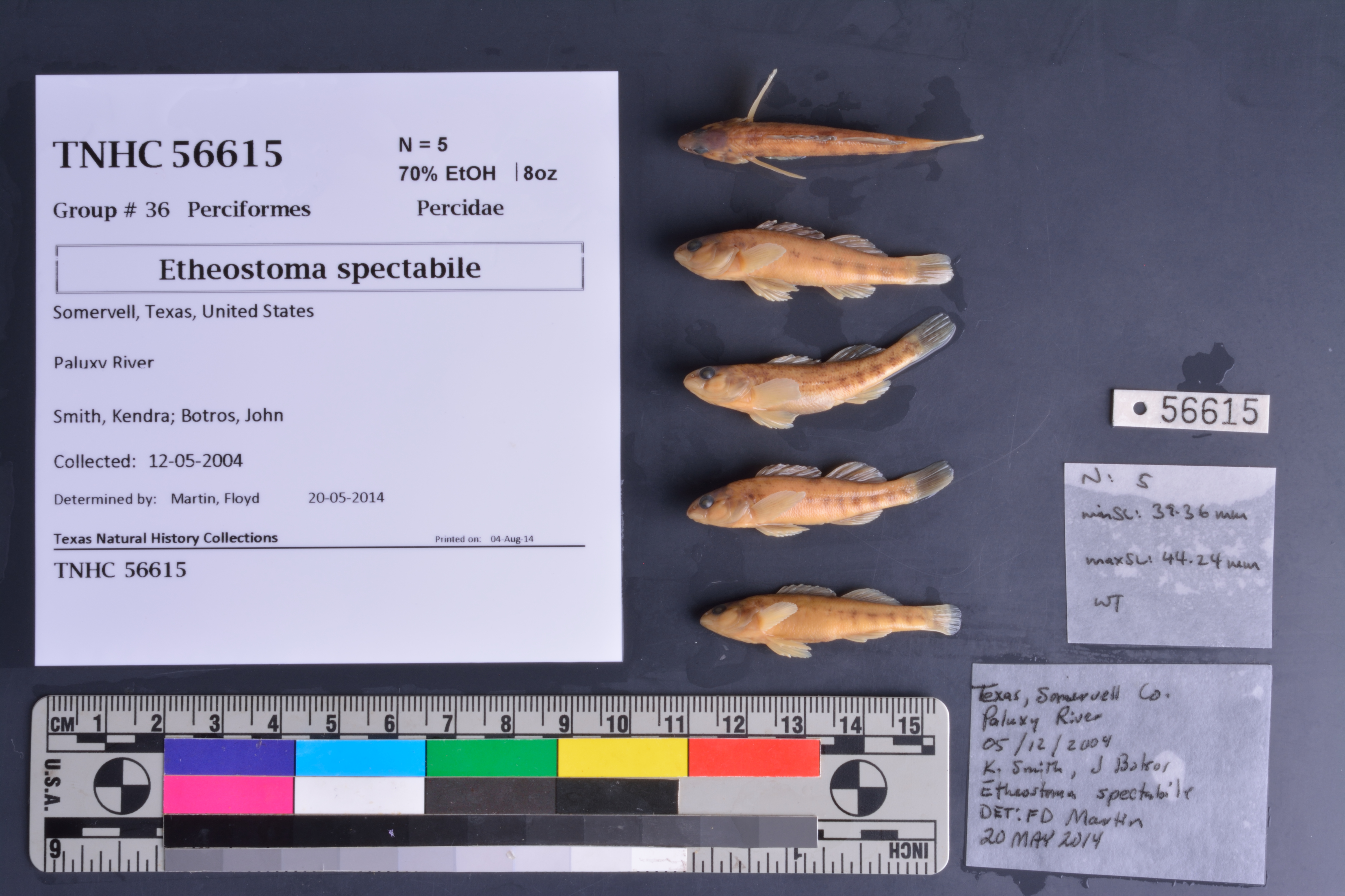
TNHCi_56615
Not suspect, not examinedPhotos
Map
Location
32.25008° N, 97.81003° W
(± 8601.5
m)
Taxonomy
FamilyPercidae
GenusEtheostoma
Speciesspectabile
Specimen
Num Specimens5
PreparationFluid - 5
Identification
Identified ByMartin, Floyd
Date Identified2014.5.20
Collection Event
CollectorSmith, Kendra; Botros, John
Collected Date2004.5.12
Field Numberz56609
Geography
CountryUnited States
StateTexas
CountySomervell
LocalityPaluxy River
Latitude32.250081
Longitude-97.810027
DatumWGS84
Error8601.455
Georeferencing
Georeference RemarksTreated as named place. Measured from county line to mouth at Brazos River.
Record Source
Source
Texas Natural History Collections
(type: specimens)
Institution
Texas Natural History Collections
(type: museum)
Curator
Dean Hendrickson
Record Added
June 24, 2020
Record Last Modified
March 23, 2026
Data Processing Track
Track 3
From Data Set Received
5/2017 to 11/2017
Identification
Suspect Notes
None
Count
5
Current Determination
Determiner
Unknown
Determination Date
Unknown
Determination Type
Unspecified
Identification Comments
None
Identification Confidence
Unknown
Collecting Event
Collected
May 12, 2004
Collector(s)
Collecting Event ID
380914
Field Notes
There are no field notes available.
Locality
Jurisdiction
Somervell, Texas
Name
Paluxy River
Hydrography
Texas-Gulf Region
Middle Brazos
Middle Brazos-Bosque
Middle Brazos-Lake Whitney
Paluxy River
Bowden Branch-Paluxy River
Captive
no
Locality Photos
No locality photos available.
HUC 12
120602020111
Georeferencing Remarks
Georeference needs verification/refinement; coordinates provided by donor
Georeferencing Annotation
—
Has not been Georeferenced because
This record, being part of the track 3 import, is not formally georeferenced by FoTX staff at this time. However, to allow mapping and visualization of this record, locality information has been provisionally accepted if provided by the donor or if location text could be matched to previously georeferenced records by FoTX team or donor data. For many records spatial error is either accepted from the donor (when provided) or derived based on coordinate precision.
Comments On TNHCi_56615