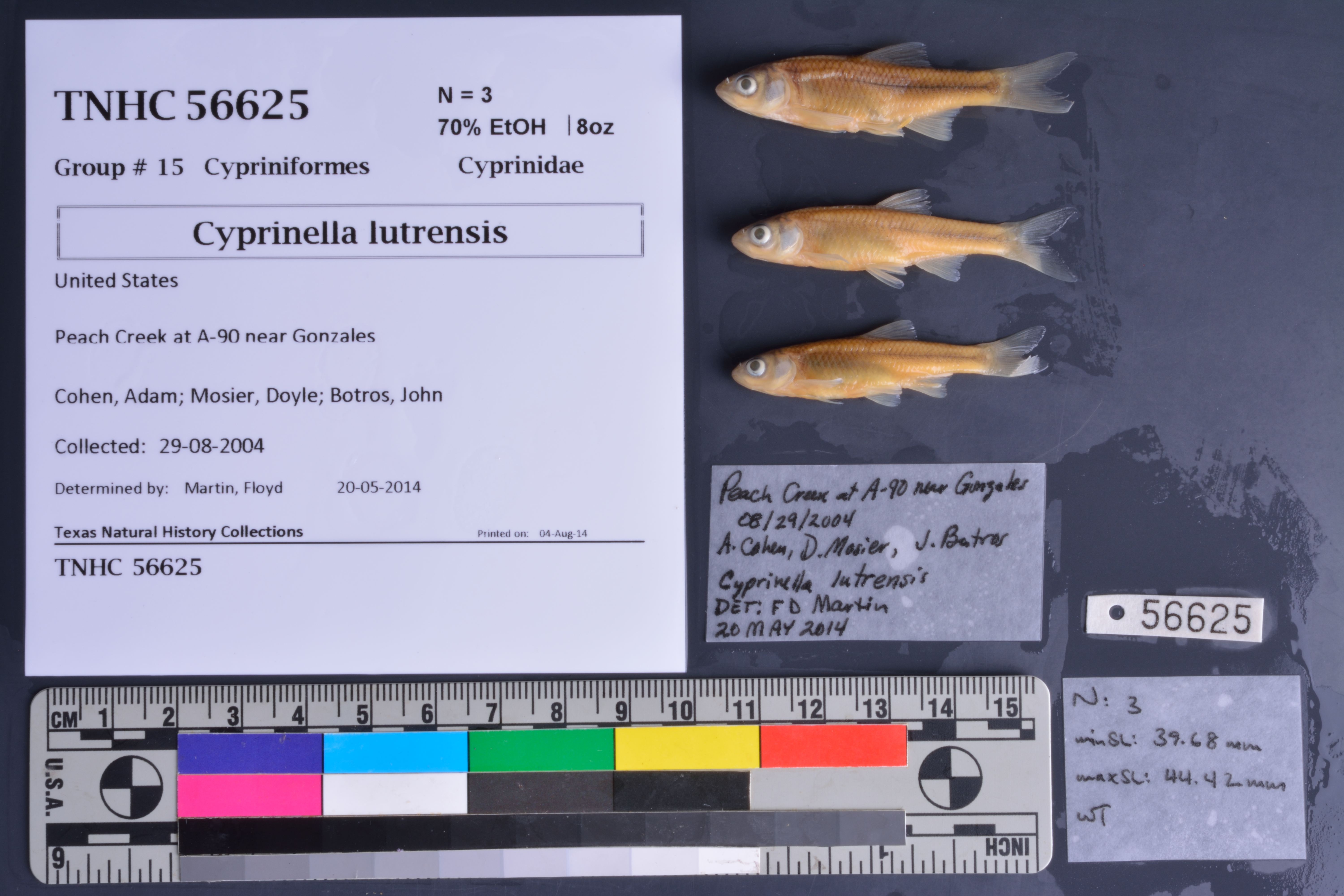
TNHCi_56625
Not suspect, not examinedPhotos
Map
Location
29.47427° N, 97.31642° W
(± 46.5
m)
Taxonomy
FamilyCyprinidae
GenusCyprinella
Specieslutrensis
Specimen
Num Specimens3
PreparationFluid - 3
Identification
Identified ByMartin, Floyd
Date Identified2014.5.20
Collection Event
CollectorCohen, Adam; Mosier, Doyle; Botros, John
Collected Date2004.8.24
Field Numberz56623
Event RemarksNo geography provided. State assumed because of accession number. Original jar labels indicated collection date was 29Aug2014, but TCEQ sample data log and A. Cohen's field notes confirm date to be 24Aug2004.
Geography
CountryUnited States
StateTexas
LocalityPeach Creek at US 90 Alternate
Latitude29.474272
Longitude-97.316421
DatumWGS84
Error46.473
Georeferencing
Georeference RemarksTreated as named place.
Record Source
Source
Texas Natural History Collections
(type: specimens)
Institution
Texas Natural History Collections
(type: museum)
Curator
Dean Hendrickson
Record Added
June 24, 2020
Record Last Modified
March 23, 2026
Data Processing Track
Track 3
From Data Set Received
5/2017 to 11/2017
Identification
Suspect Notes
None
Count
3
Current Determination
Determiner
Unknown
Determination Date
July 26, 2022
Determination Type
taxonomic adjustment
Identification Comments
correction of taxonomic change
Identification Confidence
Unknown
Previous Determination
Determiner
Unknown
Determination Date
May 23, 2022
Determination Type
Unspecified
Identification Comments
Specimen not examined. Species determination change based on taxonomic change as defined by published literature or other standard
Identification Confidence
Unknown
Previous Determination
Determiner
Unknown
Determination Date
Unknown
Determination Type
Unspecified
Identification Comments
None
Identification Confidence
Unknown
Collecting Event
Collected
Aug. 24, 2004
Collector(s)
Collecting Event ID
382867
Field Notes
There are no field notes available.
Locality
Jurisdiction
Gonzales, Texas
Name
Peach Creek at US 90 Alternate
Hydrography
Texas-Gulf Region
Central Texas Coastal
Guadalupe
Middle Guadalupe
Peach Creek
Mitchell Creek-Peach Creek
Captive
no
Locality Photos
No locality photos available.
HUC 12
121002020311
Georeferencing Remarks
Georeference needs verification/refinement; coordinates provided by donor
Georeferencing Annotation
—
Has not been Georeferenced because
This record, being part of the track 3 import, is not formally georeferenced by FoTX staff at this time. However, to allow mapping and visualization of this record, locality information has been provisionally accepted if provided by the donor or if location text could be matched to previously georeferenced records by FoTX team or donor data. For many records spatial error is either accepted from the donor (when provided) or derived based on coordinate precision.
Comments On TNHCi_56625