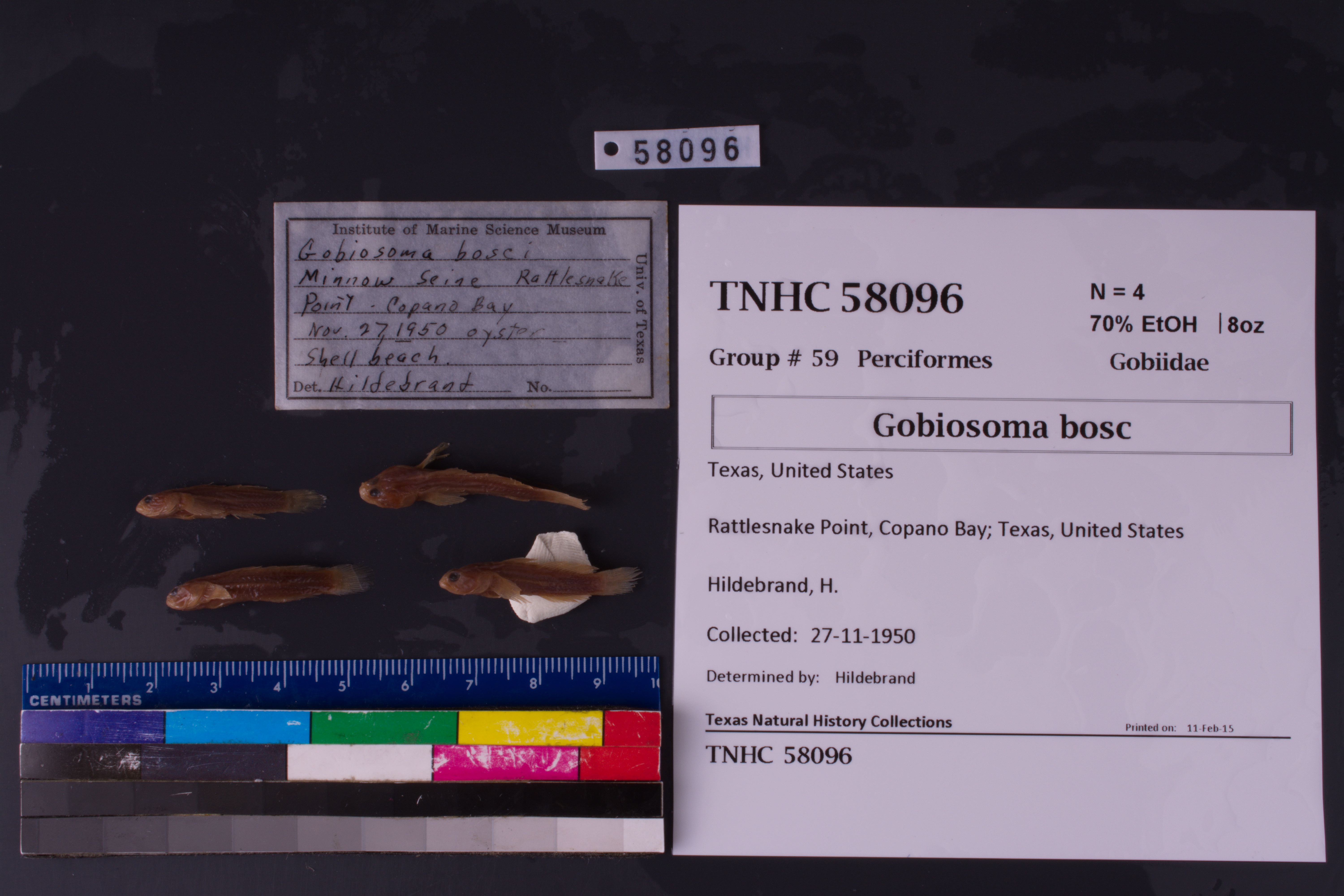
TNHCi_58096
Not suspect, not examinedPhotos
Map
Location
28.05674° N, 97.13139° W
(± 800
m)
Taxonomy
FamilyGobiidae
GenusGobiosoma
Speciesbosc
Specimen
Num Specimens4
PreparationFluid - 4
Identification
Identified ByHildebrand
Date Identified..
Collection Event
CollectorHildebrand, H.
Collected Date1950.11.27
Field Numberz58096
Event Remarksgear: minnow seine; jar label includes: oyster shell beach
Geography
CountryUnited States
StateTexas
CountyAransas
LocalityRattlesnake Point, Copano Bay
Latitude28.056735
Longitude-97.13139
DatumWGS84
Error800.0
Georeferencing
Georeference RemarksCoodinates placed in Copano Bay out from Rattlesnake Point, and the uncertainty covers the entire point.
Record
Occurrence RemarksUpon IMS cleanup project, it was found that TNHC# 19934 contained 13 vials with different locality info (same species). IMS ledger shows 15 entries for IMS# 366. 10 of the vials correspond correctly to a ledger entry for IMS 366. Separated vials into 10 jars and re-catalogued TNHC# 58096 to reflect tenth locality data entry in ledger.
Record Source
Source
Texas Natural History Collections
(type: specimens)
Institution
Texas Natural History Collections
(type: museum)
Curator
Dean Hendrickson
Record Added
June 24, 2020
Record Last Modified
March 23, 2026
Data Processing Track
Track 3
From Data Set Received
5/2017 to 11/2017
Identification
Suspect Notes
None
Count
4
Current Determination
Determiner
Unknown
Determination Date
Unknown
Determination Type
Unspecified
Identification Comments
None
Identification Confidence
Unknown
Collecting Event
Collected
Nov. 27, 1950
Collector(s)
Collecting Event ID
276637
Field Notes
There are no field notes available.
Locality
Jurisdiction
Gulf of Mexico, North America
Name
Rattlesnake Point, Copano Bay
Hydrography
Texas-Gulf Region
Central Texas Coastal
Central Texas Coastal
Aransas Bay
Copano Bay
Swan Lake-Copano Bay
Captive
no
Locality Photos
No locality photos available.
HUC 12
121004050205
Georeferencing Remarks
Georeference needs verification/refinement; coordinates provided by donor
Georeferencing Annotation
—
Has not been Georeferenced because
This record, being part of the track 3 import, is not formally georeferenced by FoTX staff at this time. However, to allow mapping and visualization of this record, locality information has been provisionally accepted if provided by the donor or if location text could be matched to previously georeferenced records by FoTX team or donor data. For many records spatial error is either accepted from the donor (when provided) or derived based on coordinate precision.
Comments On TNHCi_58096