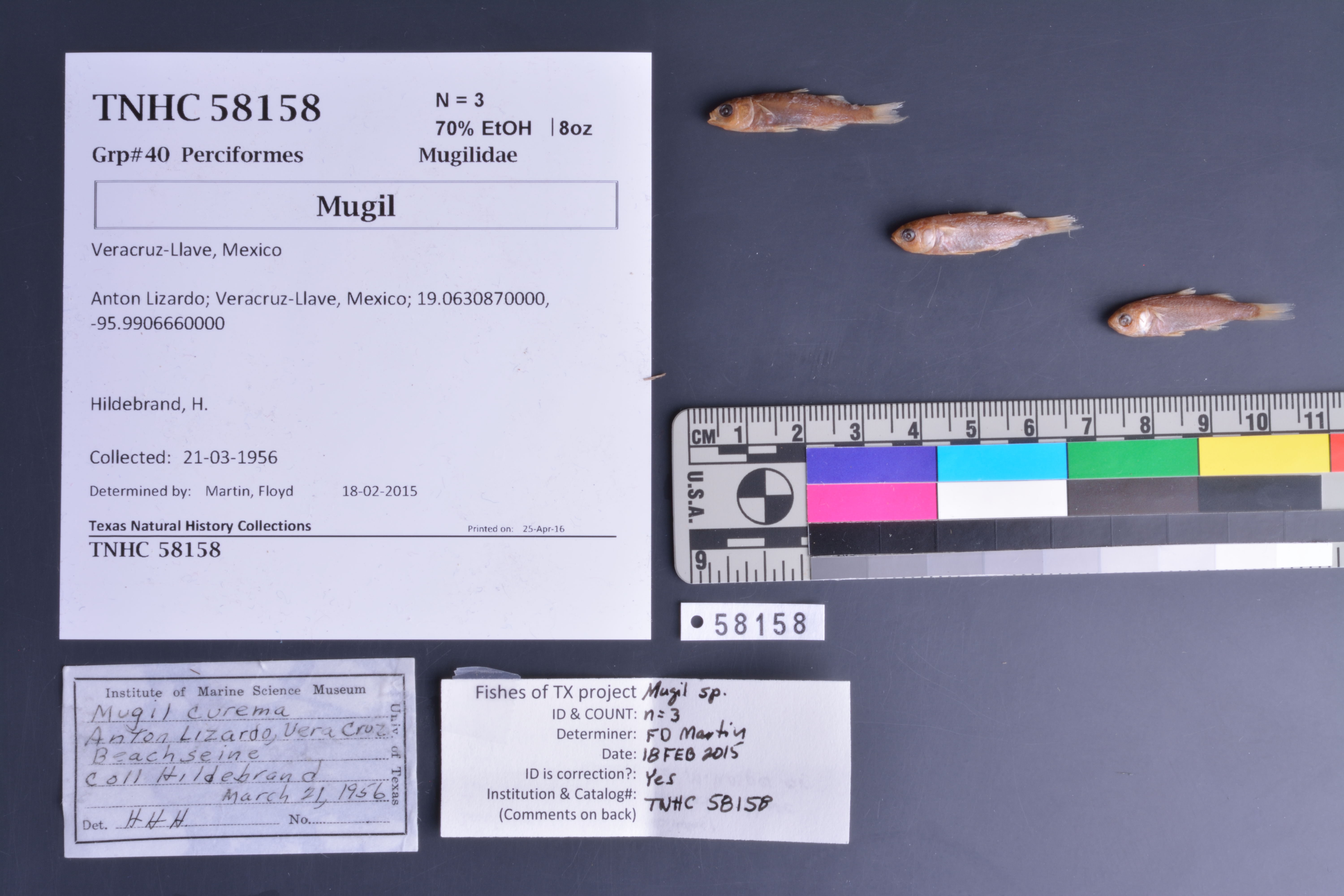
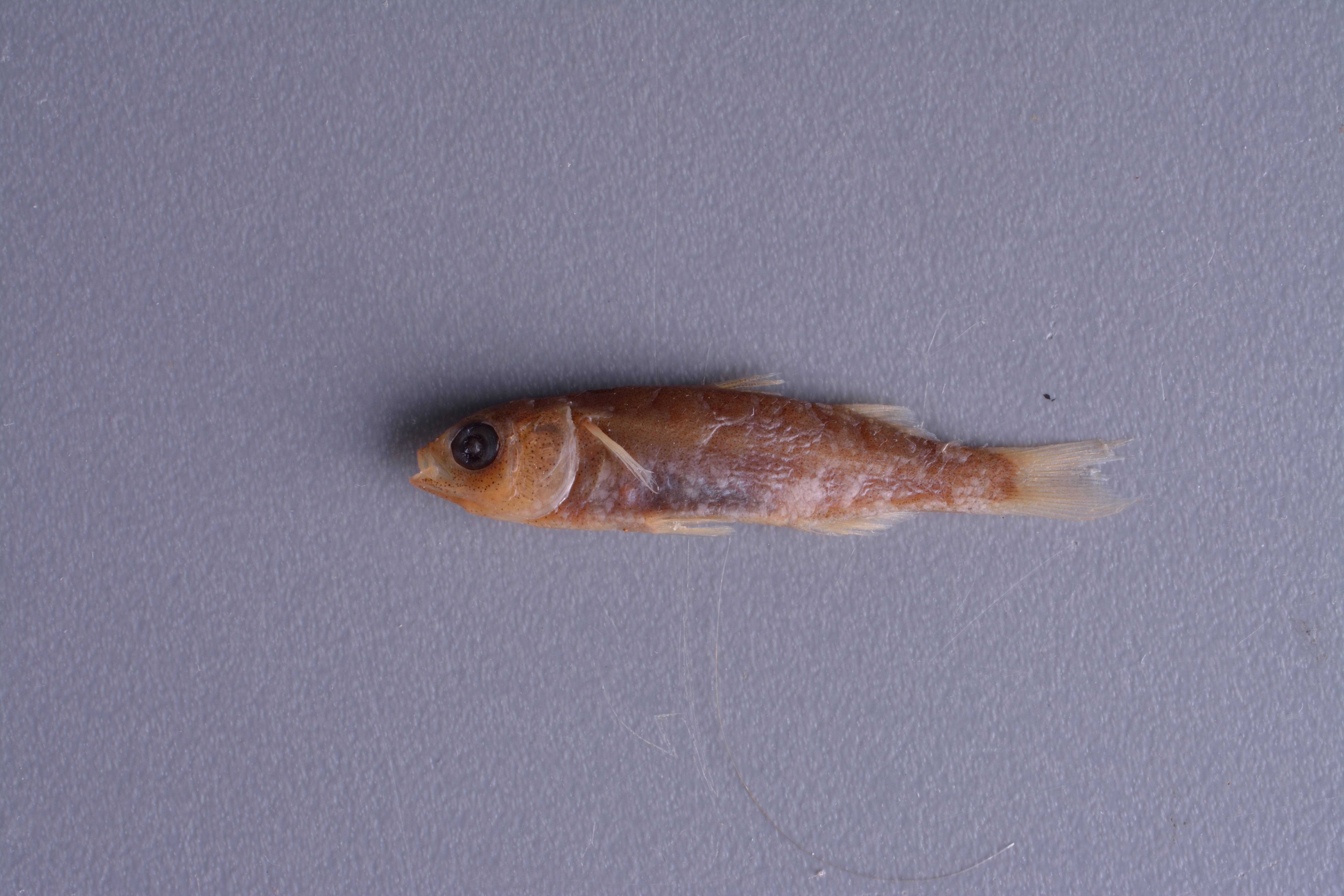
TNHCi_58158
Not suspect, not examinedPhotos
Map
Location
19.06309° N, 95.99067° W
(± 3596
m)
Taxonomy
FamilyMugilidae
GenusMugil
Specimen
Num Specimens3
PreparationFluid - 3
Identification
Identification RemarksFDM notes: 9 anal rays, but too immature to ID; these could be M. hospes, M. curema, or M. rubrioculus
Identified ByMartin, Floyd
Date Identified2015.2.18
Collection Event
CollectorHildebrand, H.
Collected Date1956.3.21
Field NumberZ20388
Event RemarksOld coll. method: : Beach seine
Geography
CountryMexico
StateVeracruz-Llave
LocalityAnton Lizardo
Latitude19.063087
Longitude-95.990666
DatumWGS84
Error3596.0
Record
Occurrence RemarksUpon IMS cleanup project, it was found that TNHC# 19476 contained 10 vials with different locality info (same species). IMS ledger shows 10 entries for IMS# 875. Each vial corresponds correctly to each ledger entry. Separated vials into 10 jars and re-catalogued TNHC# 58158 to reflect eighth locality data entry in ledger
Record Source
Source
Texas Natural History Collections
(type: specimens)
Institution
Texas Natural History Collections
(type: museum)
Curator
Dean Hendrickson
Record Added
June 24, 2020
Record Last Modified
March 23, 2026
Data Processing Track
Track 3
From Data Set Received
5/2017 to 11/2017
Identification
Suspect Notes
None
Count
3
Current Determination
Determiner
Floyd Douglas Martin
Determination Date
Feb. 18, 2015
Determination Type
specimen examination
Identification Comments
ID complete | 9 anal rays but too immature to ID: these could be M. hospes, M. curema, or M. rubrioculus
Identification Confidence
High
Collecting Event
Collected
March 21, 1956
Collector(s)
Collecting Event ID
280501
Field Notes
There are no field notes available.
Locality
Jurisdiction
Alvarado, Veracruz
Name
Anton Lizardo
Hydrography
Not available
Captive
no
Locality Photos
No locality photos available.
HUC
—
Georeferencing Remarks
Georeference needs verification/refinement; coordinates provided by donor
Georeferencing Annotation
—
Has not been Georeferenced because
This record, being part of the track 3 import, is not formally georeferenced by FoTX staff at this time. However, to allow mapping and visualization of this record, locality information has been provisionally accepted if provided by the donor or if location text could be matched to previously georeferenced records by FoTX team or donor data. For many records spatial error is either accepted from the donor (when provided) or derived based on coordinate precision.
Comments On TNHCi_58158