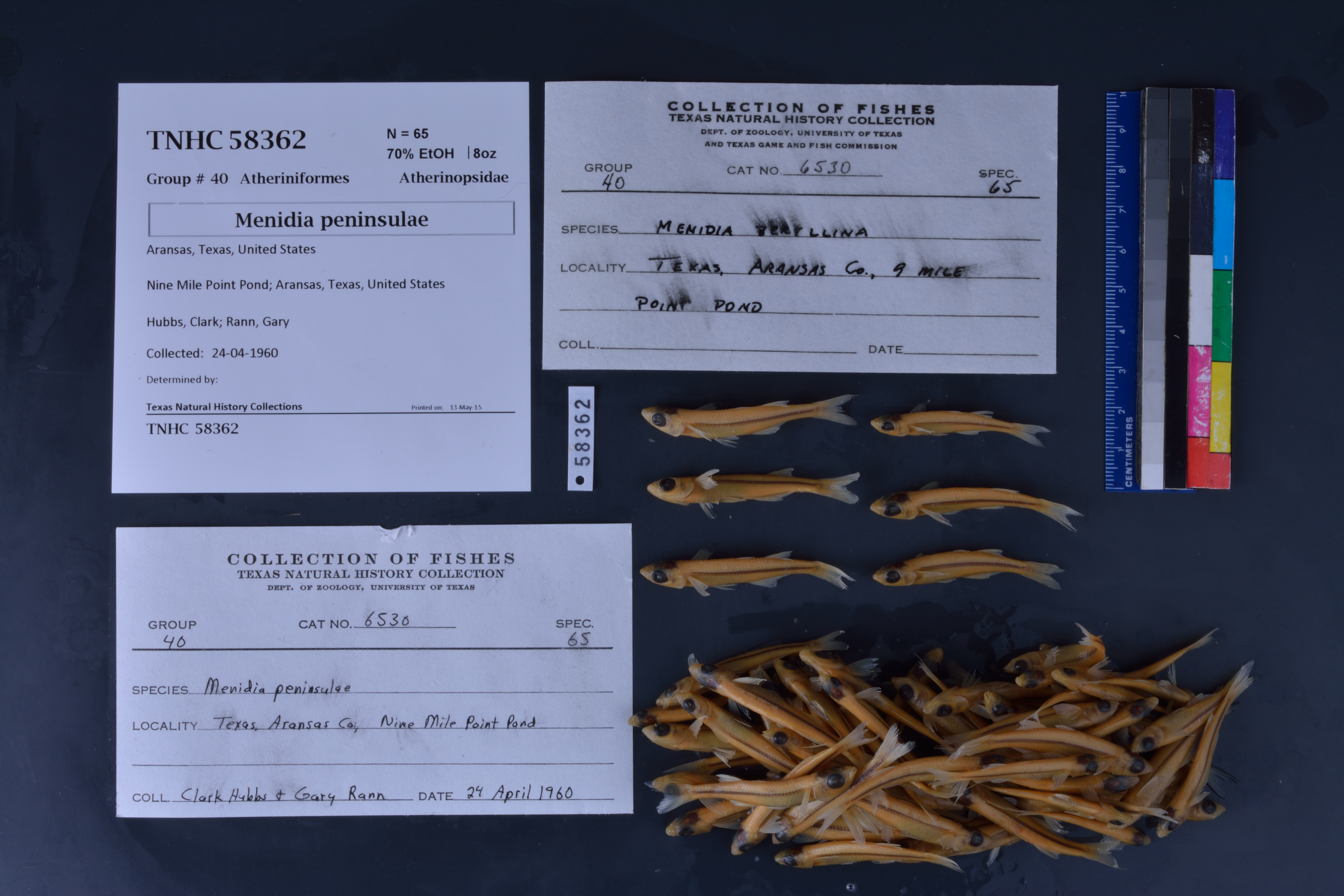
TNHCi_58362
Not suspect, not examinedPhotos
Map
Location
28.03201° N, 97.02620° W
(± 151.5
m)
Taxonomy
FamilyAtherinopsidae
GenusMenidia
Speciespeninsulae
Specimen
Num Specimens65
PreparationFluid - 65
Identification
Date Identified..
Collection Event
CollectorHubbs, Clark; Rann, Gary
Collected Date1960.4.24
Field Numberz58362
Geography
CountryUnited States
StateTexas
CountyAransas
LocalityNinemile Point
Latitude28.032009
Longitude-97.026203
DatumWGS84
Error151.482
Georeferencing
Georeference RemarksTreated as named place.
Record Source
Source
Texas Natural History Collections
(type: specimens)
Institution
Texas Natural History Collections
(type: museum)
Curator
Dean Hendrickson
Record Added
June 24, 2020
Record Last Modified
March 23, 2026
Data Processing Track
Track 3
From Data Set Received
5/2017 to 11/2017
Identification
Suspect Notes
None
Count
65
Current Determination
Determiner
Unknown
Determination Date
Unknown
Determination Type
Unspecified
Identification Comments
None
Identification Confidence
Unknown
Collecting Event
Collected
April 24, 1960
Collector(s)
Collecting Event ID
283083
Field Notes
There are no field notes available.
Locality
Jurisdiction
Aransas, Texas
Name
Ninemile Point
Hydrography
Texas-Gulf Region
Central Texas Coastal
Central Texas Coastal
Aransas Bay
Aransas Bay
Aransas Bay
Captive
no
Locality Photos
No locality photos available.
HUC 12
121004050400
Georeferencing Remarks
Georeference needs verification/refinement; coordinates provided by donor
Georeferencing Annotation
—
Has not been Georeferenced because
This record, being part of the track 3 import, is not formally georeferenced by FoTX staff at this time. However, to allow mapping and visualization of this record, locality information has been provisionally accepted if provided by the donor or if location text could be matched to previously georeferenced records by FoTX team or donor data. For many records spatial error is either accepted from the donor (when provided) or derived based on coordinate precision.
Comments On TNHCi_58362