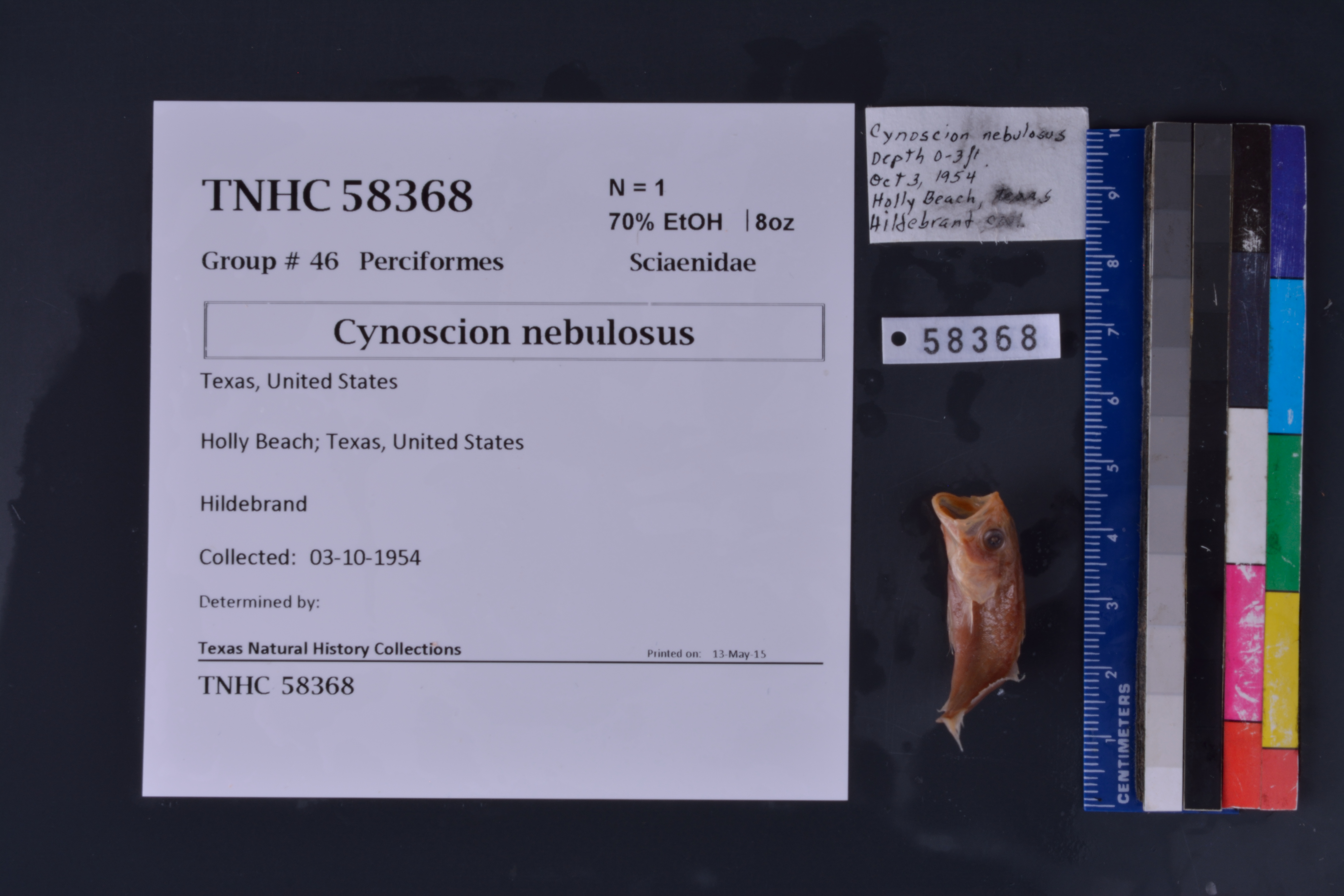
TNHCi_58368
Not suspect, not examinedPhotos
Map
Location
26.13910° N, 97.29762° W
(± 501.5
m)
Taxonomy
FamilySciaenidae
GenusCynoscion
Speciesnebulosus
Specimen
Num Specimens1
PreparationFluid - 1
Identification
Date Identified..
Collection Event
CollectorHildebrand
Collected Date1954.10.3
Field Numberz58368
Geography
CountryUnited States
StateTexas
LocalityHolly Beach
Latitude26.139098
Longitude-97.297624
DatumWGS84
Error501.492
Georeferencing
Georeference RemarksTreated as named place.
Record
Occurrence RemarksFound in TNHC #18505 - does not match any ledger entries for IMS #186, so cataloguing based solely from jar label
Record Source
Source
Texas Natural History Collections
(type: specimens)
Institution
Texas Natural History Collections
(type: museum)
Curator
Dean Hendrickson
Record Added
June 24, 2020
Record Last Modified
March 23, 2026
Data Processing Track
Track 3
From Data Set Received
5/2017 to 11/2017
Identification
Suspect Notes
None
Count
1
Current Determination
Determiner
Unknown
Determination Date
Unknown
Determination Type
Unspecified
Identification Comments
None
Identification Confidence
Unknown
Collecting Event
Collected
Oct. 3, 1954
Collector(s)
Collecting Event ID
278995
Field Notes
There are no field notes available.
Locality
Jurisdiction
Cameron, Texas
Name
Holly Beach
Hydrography
Texas-Gulf Region
Nueces-Southwestern Texas Coastal
Southwestern Texas Coastal
South Laguna Madre
Laguna Atascosa
Laguna Atascosa
Captive
no
Locality Photos
No locality photos available.
HUC 12
121102080800
Georeferencing Remarks
Georeference needs verification/refinement; coordinates provided by donor
Georeferencing Annotation
—
Has not been Georeferenced because
This record, being part of the track 3 import, is not formally georeferenced by FoTX staff at this time. However, to allow mapping and visualization of this record, locality information has been provisionally accepted if provided by the donor or if location text could be matched to previously georeferenced records by FoTX team or donor data. For many records spatial error is either accepted from the donor (when provided) or derived based on coordinate precision.
Comments On TNHCi_58368