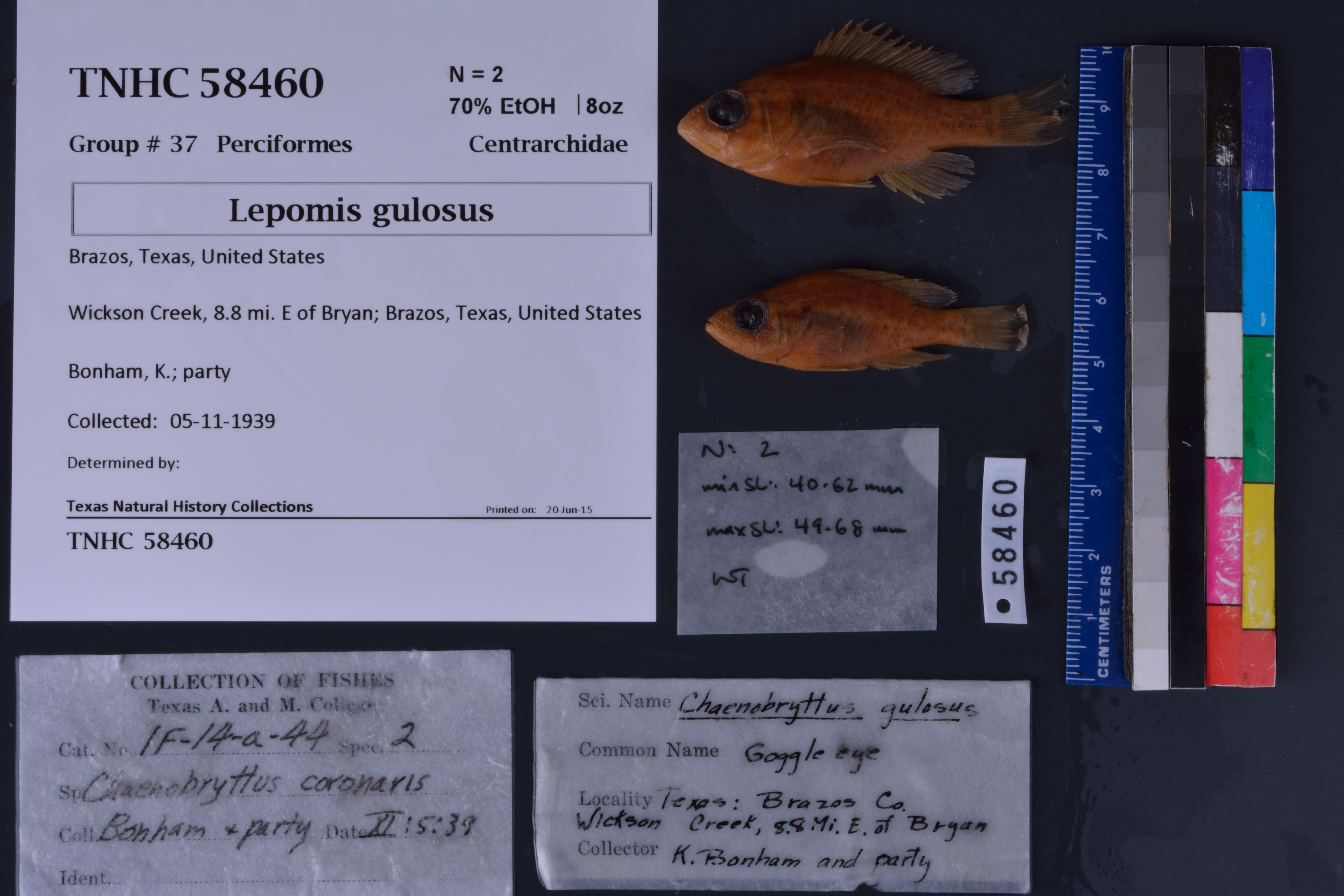
TNHCi_58460
Not suspect, not examinedPhotos
Map
Location
30.72326° N, 96.27308° W
(± 15721.5
m)
Taxonomy
FamilyCentrarchidae
GenusLepomis
Speciesgulosus
Specimen
Num Specimens2
PreparationFluid - 2
Identification
Date Identified..
Collection Event
CollectorBonham, K.; party
Collected Date1939.11.5
Field Numberz56344
Geography
CountryUnited States
StateTexas
CountyBrazos
LocalityWickson Creek
Latitude30.723255
Longitude-96.273075
DatumWGS84
Error15721.465
Georeferencing
Georeference RemarksTreated as named place - stream.
Record
Occurrence RemarksOriginal A&M catalog number: IF-14-a-44.
Record Source
Source
Texas Natural History Collections
(type: specimens)
Institution
Texas Natural History Collections
(type: museum)
Curator
Dean Hendrickson
Record Added
June 24, 2020
Record Last Modified
March 23, 2026
Data Processing Track
Track 3
From Data Set Received
5/2017 to 11/2017
Identification
Suspect Notes
None
Count
2
Current Determination
Determiner
Unknown
Determination Date
Unknown
Determination Type
Unspecified
Identification Comments
None
Identification Confidence
Unknown
Collecting Event
Collected
Nov. 5, 1939
Collecting Event ID
274161
Field Notes
There are no field notes available.
Locality
Jurisdiction
Brazos, Texas
Name
Wickson Creek
Hydrography
Texas-Gulf Region
Lower Brazos
Lower Brazos
Navasota
Wickson Creek-Navasota River
Upper Wickson Creek
Captive
no
Locality Photos
No locality photos available.
HUC 12
120701030602
Georeferencing Remarks
Georeference needs verification/refinement; coordinates provided by donor
Georeferencing Annotation
—
Has not been Georeferenced because
This record, being part of the track 3 import, is not formally georeferenced by FoTX staff at this time. However, to allow mapping and visualization of this record, locality information has been provisionally accepted if provided by the donor or if location text could be matched to previously georeferenced records by FoTX team or donor data. For many records spatial error is either accepted from the donor (when provided) or derived based on coordinate precision.
Comments On TNHCi_58460