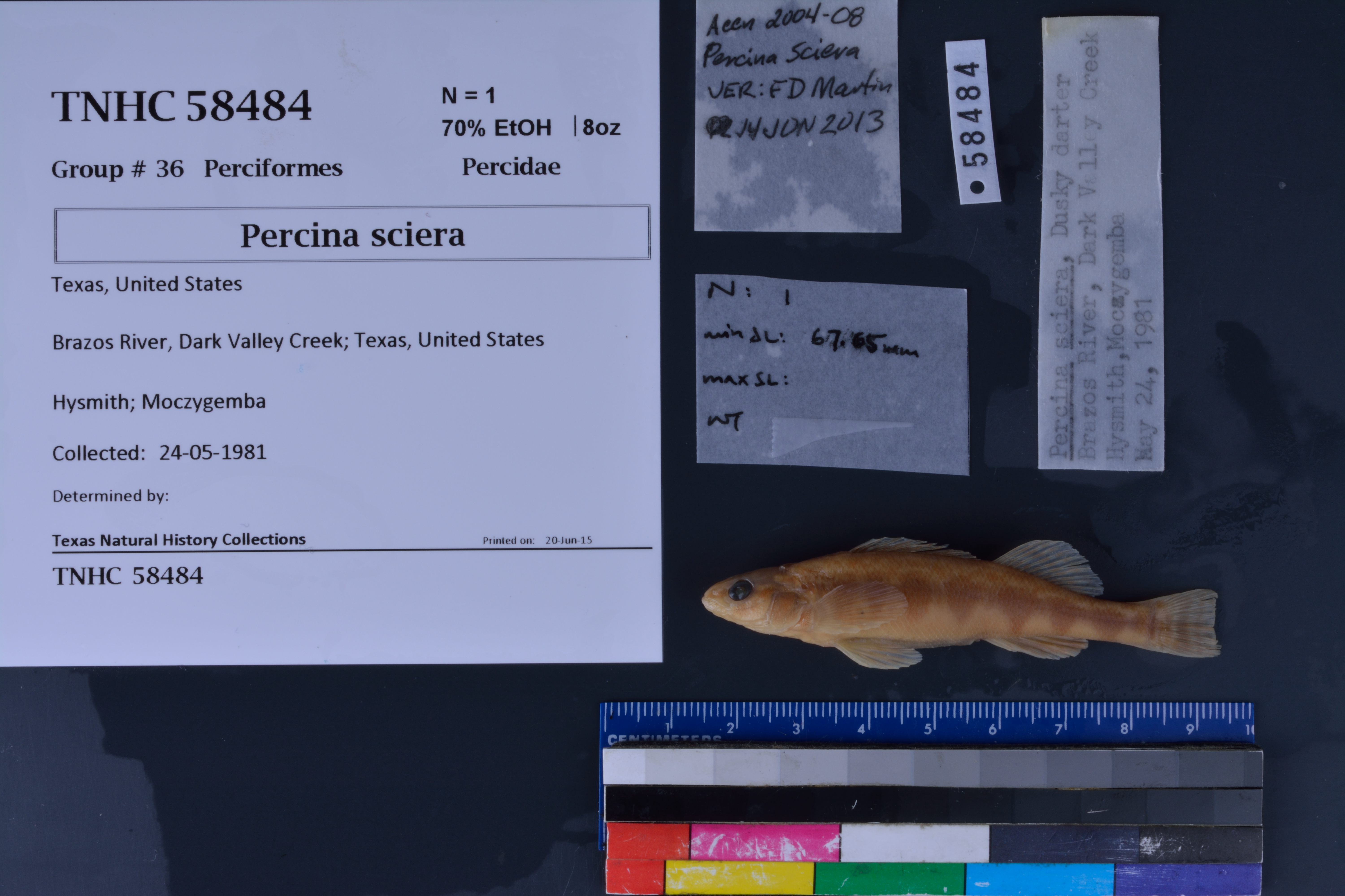
TNHCi_58484
Not suspect, not examinedPhotos
Map
Location
32.86334° N, 98.30354° W
(± 46.5
m)
Taxonomy
FamilyPercidae
GenusPercina
Speciessciera
Specimen
Num Specimens1
PreparationFluid - 1
Identification
Identification Remarksverified by: F.D. Martin, 14Jun2013
Date Identified..
Collection Event
CollectorHysmith; Moczygemba, John
Collected Date1981.5.24
Field Numberz58484
Event Remarksno county or state info provided - Texas is assumed
Geography
CountryUnited States
StateTexas
LocalityConfluence of Dark Valley Creek at Brazos River
Latitude32.863341
Longitude-98.303541
DatumWGS84
Error46.451
Georeferencing
Georeference RemarksTreated as named place.
Record Source
Source
Texas Natural History Collections
(type: specimens)
Institution
Texas Natural History Collections
(type: museum)
Curator
Dean Hendrickson
Record Added
June 24, 2020
Record Last Modified
March 23, 2026
Data Processing Track
Track 3
From Data Set Received
5/2017 to 11/2017
Identification
Suspect Notes
None
Count
1
Current Determination
Determiner
Unknown
Determination Date
Unknown
Determination Type
Unspecified
Identification Comments
None
Identification Confidence
Unknown
Collecting Event
Collected
May 24, 1981
Collector(s)
Collecting Event ID
309890
Field Notes
There are no field notes available.
Locality
Jurisdiction
Palo Pinto, Texas
Name
Confluence of Dark Valley Creek at Brazos River
Hydrography
Texas-Gulf Region
Middle Brazos
Middle Brazos-Bosque
Middle Brazos-Palo Pinto
Ioni Creek-Brazos River
Dark Valley Creek-Brazos River
Captive
no
Locality Photos
No locality photos available.
HUC 12
120602010705
Georeferencing Remarks
Georeference needs verification/refinement; coordinates provided by donor
Georeferencing Annotation
—
Has not been Georeferenced because
This record, being part of the track 3 import, is not formally georeferenced by FoTX staff at this time. However, to allow mapping and visualization of this record, locality information has been provisionally accepted if provided by the donor or if location text could be matched to previously georeferenced records by FoTX team or donor data. For many records spatial error is either accepted from the donor (when provided) or derived based on coordinate precision.
Comments On TNHCi_58484