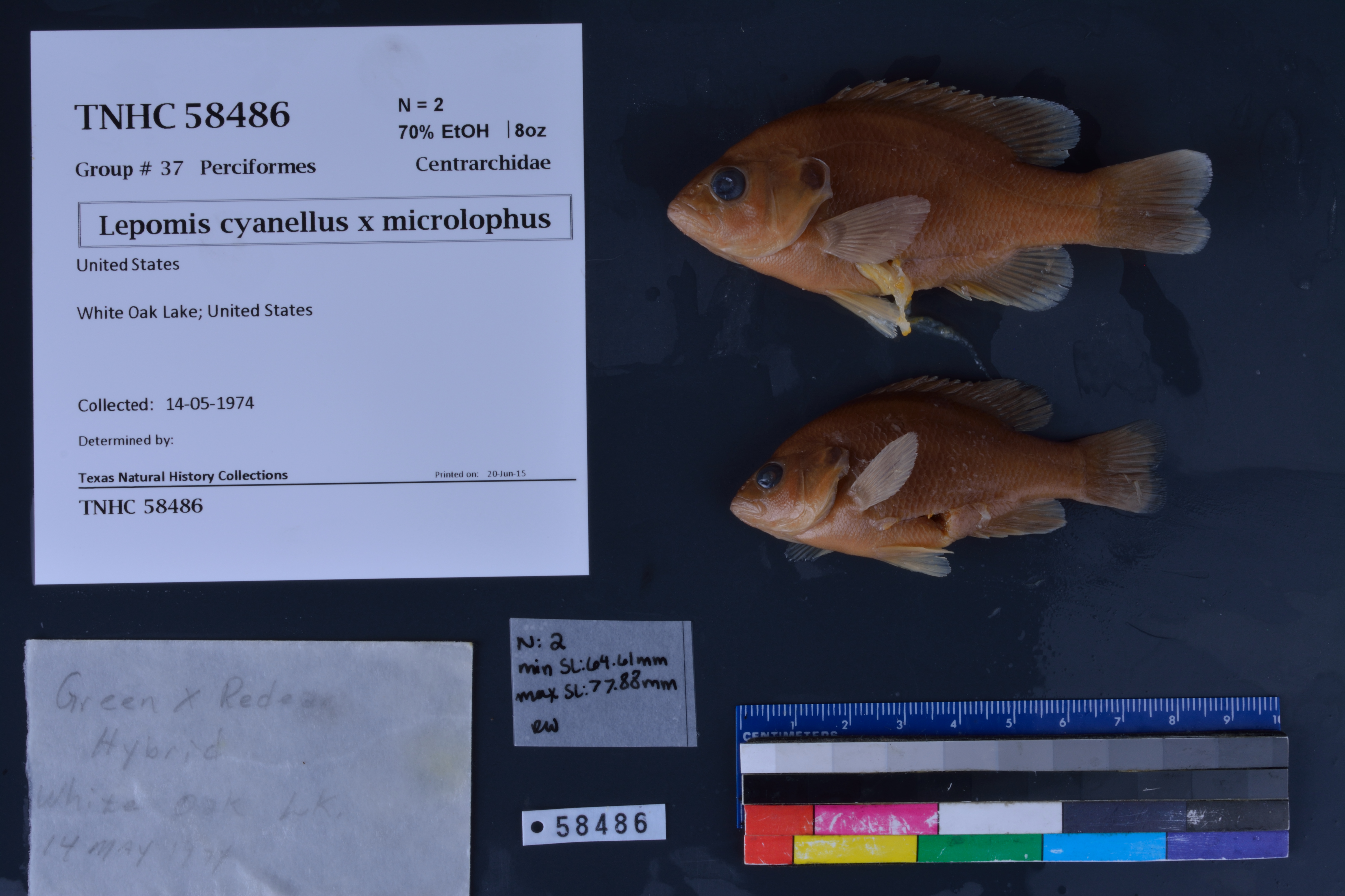
TNHCi_58486
Not suspect, not examinedPhotos
Map
Location
33.69097° N, 93.08682° W
(± 2700
m)
Taxonomy
FamilyCentrarchidae
GenusLepomis
Speciescyanellus x microlophus
Specimen
Num Specimens2
PreparationFluid - 2
Identification
Date Identified..
Collection Event
Collected Date1974.5.14
Field Numberz58486
Event Remarksno county, state, or collector info provided
Geography
CountryUnited States
StateArkansas
CountyOuachita
LocalityWhite Oak Lake
Latitude33.690974
Longitude-93.086816
DatumWGS84
Error2700.0
Georeferencing
Georeference RemarksAssuming it's White Oak Lake in Arkansas. Coordinates placed in the middle of White Oak Lake, and the uncertainty includes the entire lake.
Record Source
Source
Texas Natural History Collections
(type: specimens)
Institution
Texas Natural History Collections
(type: museum)
Curator
Dean Hendrickson
Record Added
June 24, 2020
Record Last Modified
March 23, 2026
Data Processing Track
Track 3
From Data Set Received
5/2017 to 11/2017
Identification
Suspect Notes
None
Count
2
Current Determination
Determiner
Unknown
Determination Date
Unknown
Determination Type
Unspecified
Identification Comments
None
Identification Confidence
Unknown
Collecting Event
Collected
May 14, 1974
Collector(s)
No collector information is available for this record.
Collecting Event ID
298557
Field Notes
There are no field notes available.
Locality
Jurisdiction
Ouachita, Arkansas
Name
White Oak Lake
Hydrography
USGS HUC
Lower Mississippi Region
Lower Red-Ouachita
Upper Ouachita
Little Missouri
Little Missouri River-Ouachita River
Upper White Oak Creek
HydroBASINS
7422
742229
74222963
7422296302
742229630200
Captive
no
Locality Photos
No locality photos available.
HUC 12
080401030904
Georeferencing Remarks
Georeference needs verification/refinement; coordinates provided by donor
Georeferencing Annotation
—
Has not been Georeferenced because
This record, being part of the track 3 import, is not formally georeferenced by FoTX staff at this time. However, to allow mapping and visualization of this record, locality information has been provisionally accepted if provided by the donor or if location text could be matched to previously georeferenced records by FoTX team or donor data. For many records spatial error is either accepted from the donor (when provided) or derived based on coordinate precision.
Comments On TNHCi_58486