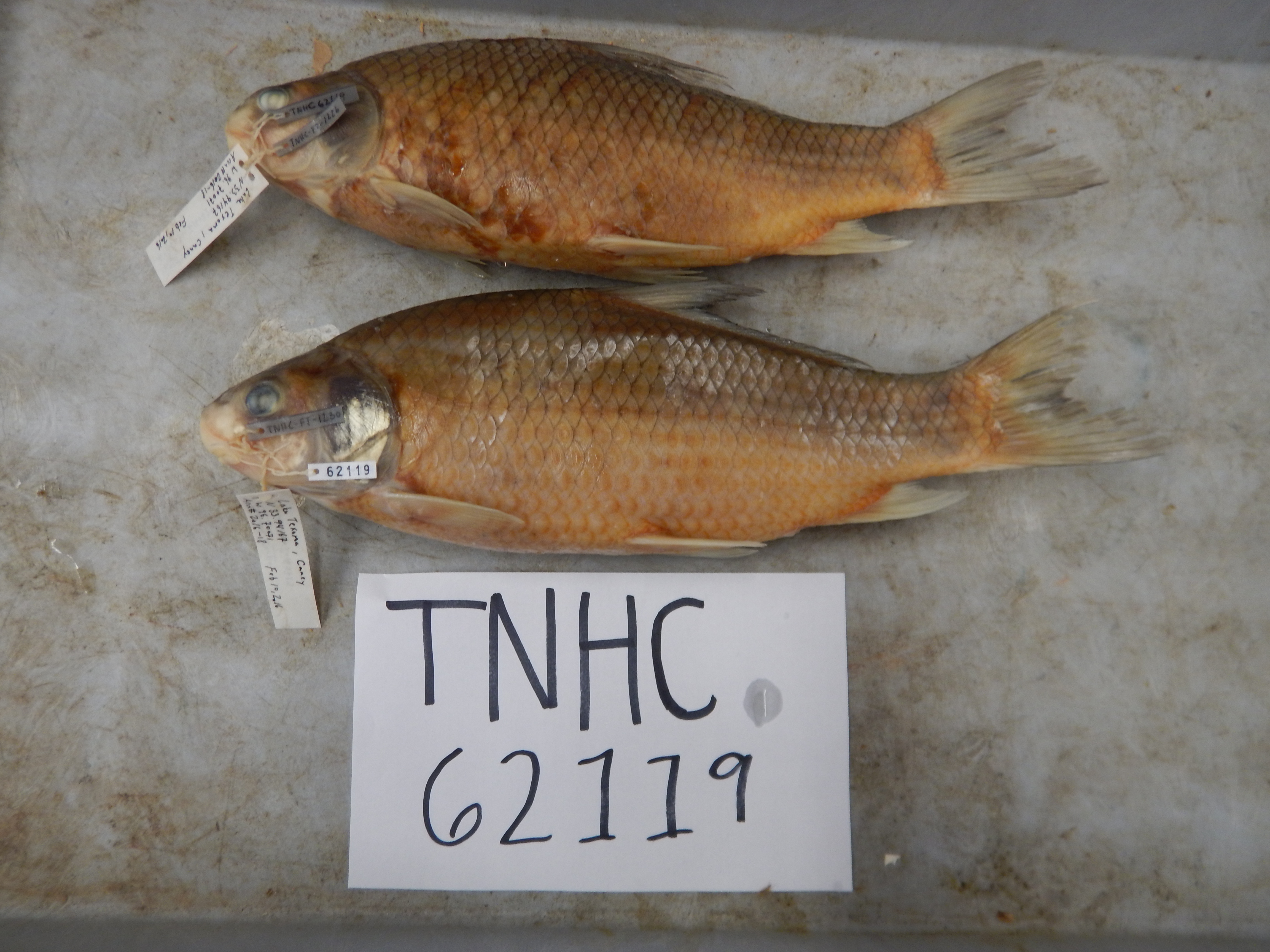
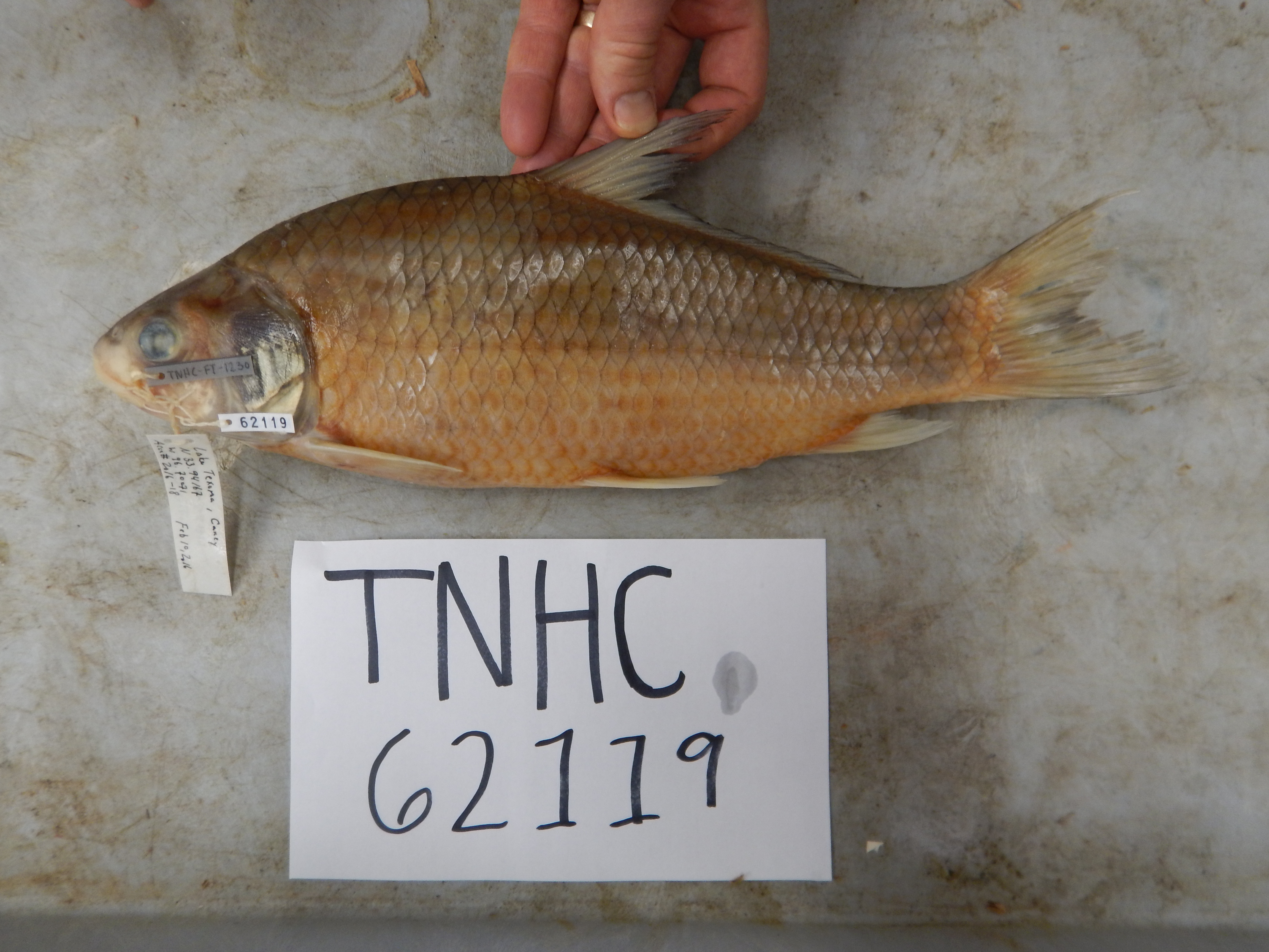
TNHCi_62119
Not suspect, not examinedPhotos
Map
Location
33.94167° N, 96.70071° W
(± 2000
m)
Taxonomy
FamilyCatostomidae
GenusCarpiodes
Speciescarpio
Specimen
Num Specimens2
PreparationTissue - 1; Fluid - 2; Tissue - 1
Identification
Identified ByCohen, A.
Date Identified2016.7.29
Collection Event
CollectorMoczygemba, John; Bennett, Dan; Robinson, Todd
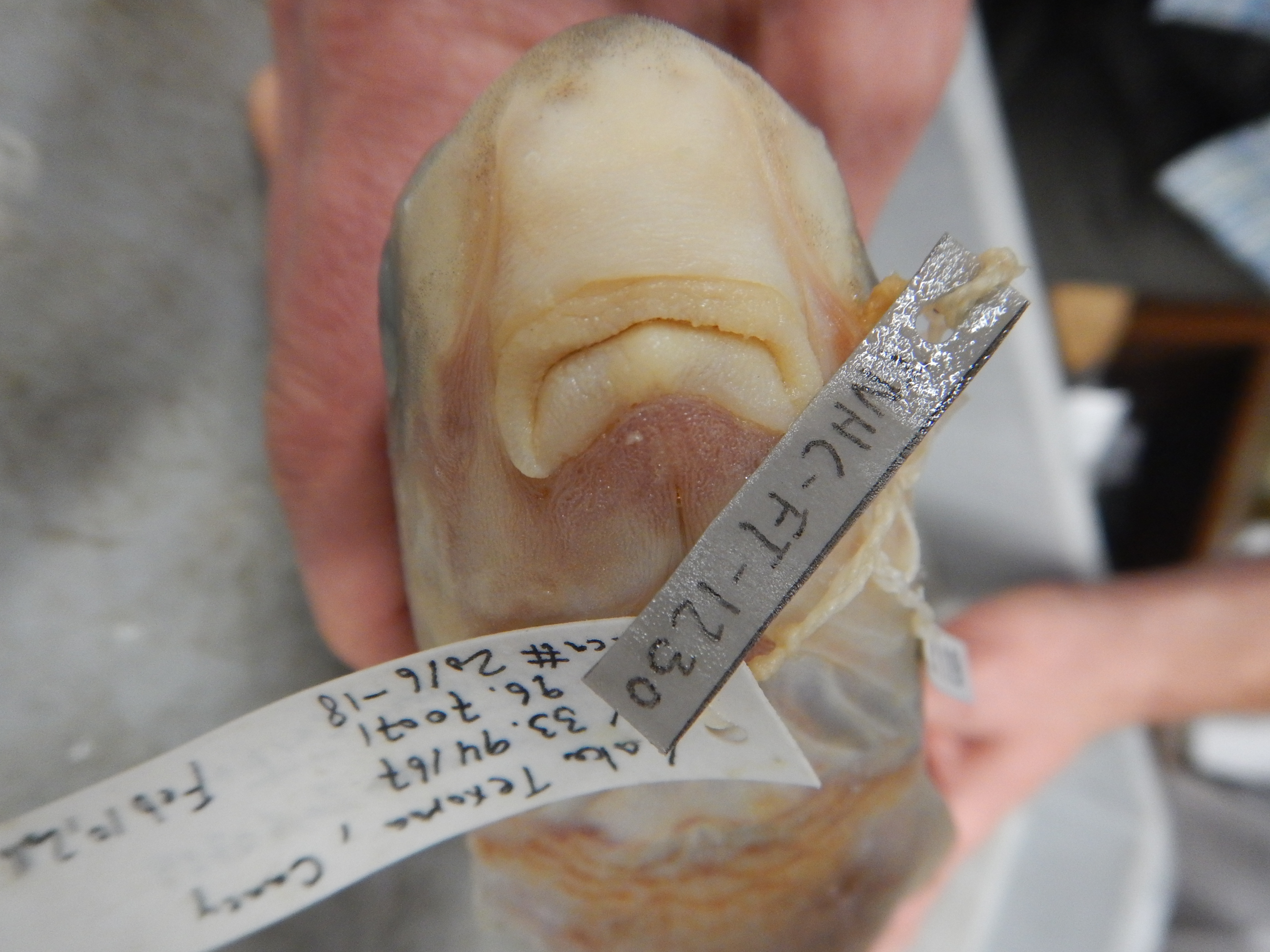
Collected Date2016.2.10
Field Numberz62119
Event RemarksECS notes: County and state info not provided in donor data; info taken from GPS coordinates in Google Maps
Geography
CountryUnited States
StateOklahoma
CountyMarshall
LocalityLake Texoma near mouth of Caney Creek
Latitude33.94167
Longitude-96.70071
DatumWGS84
Error2000.0
Georeferencing
Georeference RemarksUncertainty estimated to extend slightly beyond the southernmost edge of the Caney Creek Public Use Area
Record
Occurrence RemarksSpecimens donated by TPWD
Record Source
Source
Texas Natural History Collections
(type: specimens)
Institution
Texas Natural History Collections
(type: museum)
Curator
Dean Hendrickson
Record Added
June 24, 2020
Record Last Modified
March 23, 2026
Data Processing Track
Track 3
From Data Set Received
5/2017 to 11/2017
Identification
Suspect Notes
None
Count
2
Current Determination
Determiner
Unknown
Determination Date
Unknown
Determination Type
Unspecified
Identification Comments
None
Identification Confidence
Unknown
Collecting Event
Collected
Feb. 10, 2016
Collector(s)
Collecting Event ID
430554
Field Notes
There are no field notes available.
Locality
Jurisdiction
Marshall, Oklahoma
Name
Lake Texoma near mouth of Caney Creek
Hydrography
Arkansas-White-Red Region
Red-Washita
Red-Lake Texoma
Lake Texoma
Denison Dam-Red River
Rock Creek
Captive
no
Locality Photos
No locality photos available.
HUC 12
111302100502
Georeferencing Remarks
Georeference needs verification/refinement; coordinates provided by donor
Georeferencing Annotation
—
Has not been Georeferenced because
This record, being part of the track 3 import, is not formally georeferenced by FoTX staff at this time. However, to allow mapping and visualization of this record, locality information has been provisionally accepted if provided by the donor or if location text could be matched to previously georeferenced records by FoTX team or donor data. For many records spatial error is either accepted from the donor (when provided) or derived based on coordinate precision.
Comments On TNHCi_62119