TNHCi_62800
Not suspect, not examinedPhotos
Map
Location
34.08831° N, 98.20361° W
(± 150
m)
Taxonomy
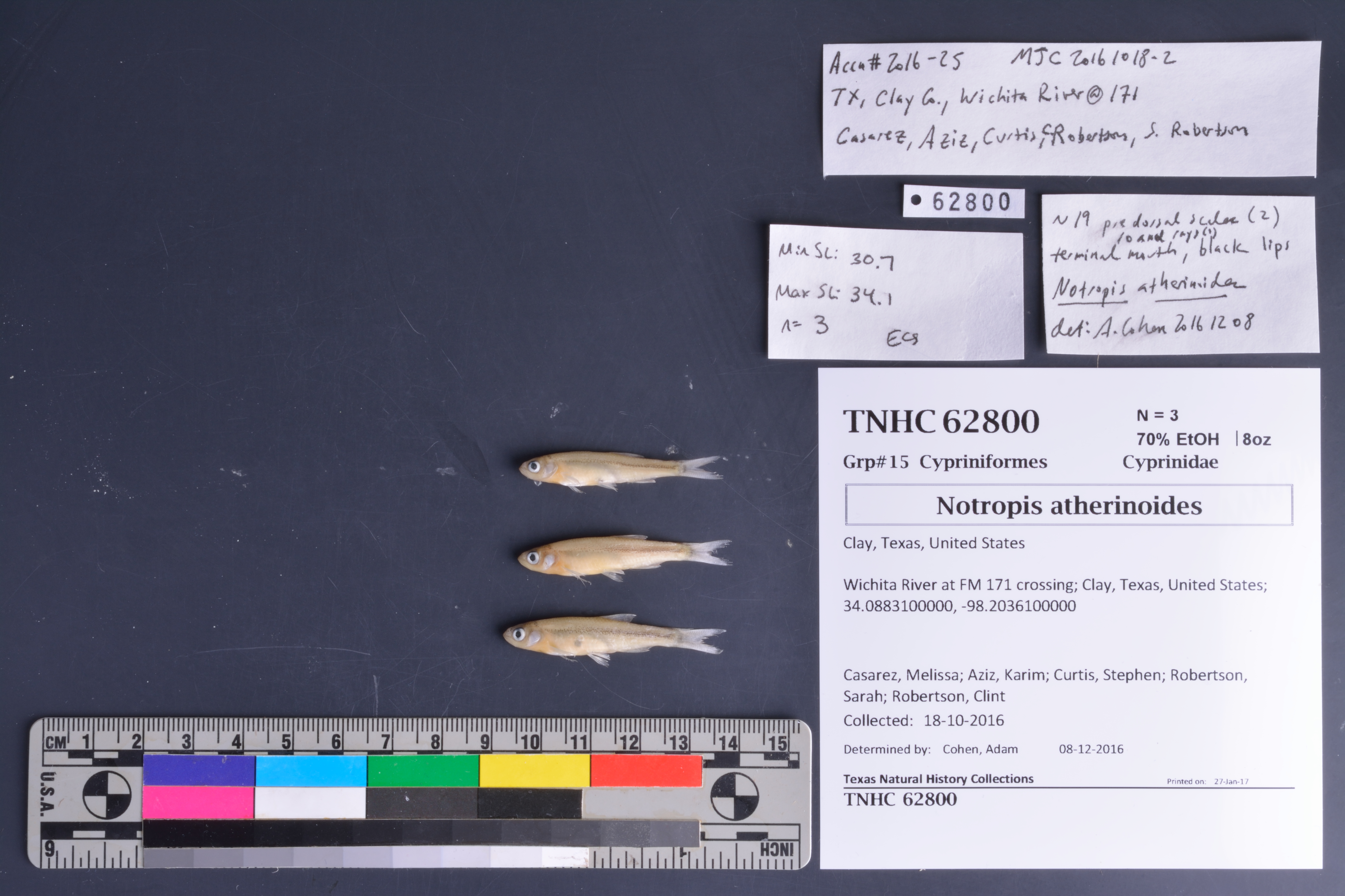
FamilyCyprinidae
GenusNotropis
Speciesatherinoides
Specimen
Num Specimens3
PreparationFluid - 3
Identification
Identification RemarksAEC notes: ~19 predorsal scales (2); 10 anal rays (1); terminal mouth; black lips
Identified ByCohen, Adam
Date Identified2016.12.8
Collection Event
CollectorCasarez, Melissa; Aziz, Karim; Curtis, Stephen; Robertson, Sarah; Robertson, Clint
Collected Date2016.10.18
Field NumberMJC20161018-2
Geography
CountryUnited States
StateTexas
CountyClay
LocalityWichita River at FM 171 crossing
Latitude34.08831
Longitude-98.20361
DatumWGS84
Error150.0
Georeferencing
Georeference RemarksUncertainty estimated to include well upstream and downstream, and across the river itself
Record Source
Source
Texas Natural History Collections
(type: specimens)
Institution
Texas Natural History Collections
(type: museum)
Curator
Dean Hendrickson
Record Added
June 24, 2020
Record Last Modified
March 23, 2026
Data Processing Track
Track 3
From Data Set Received
5/2017 to 11/2017
Identification
Suspect Notes
None
Count
3
Current Determination
Determiner
Unknown
Determination Date
Unknown
Determination Type
Unspecified
Identification Comments
None
Identification Confidence
Unknown
Collecting Event
Collected
Oct. 18, 2016
Collecting Event ID
432185
Field Notes
There are no field notes available.
Locality
Jurisdiction
Clay, Texas
Name
Wichita River at FM 171 crossing
Hydrography
Arkansas-White-Red Region
Red-Washita
Red-Lake Texoma
Wichita
Wichita River Outlet
City Lake-Wichita River
Captive
no
Locality Photos
No locality photos available.
HUC 12
111302060503
Georeferencing Remarks
Georeference needs verification/refinement; coordinates provided by donor
Georeferencing Annotation
—
Has not been Georeferenced because
This record, being part of the track 3 import, is not formally georeferenced by FoTX staff at this time. However, to allow mapping and visualization of this record, locality information has been provisionally accepted if provided by the donor or if location text could be matched to previously georeferenced records by FoTX team or donor data. For many records spatial error is either accepted from the donor (when provided) or derived based on coordinate precision.
Comments On TNHCi_62800