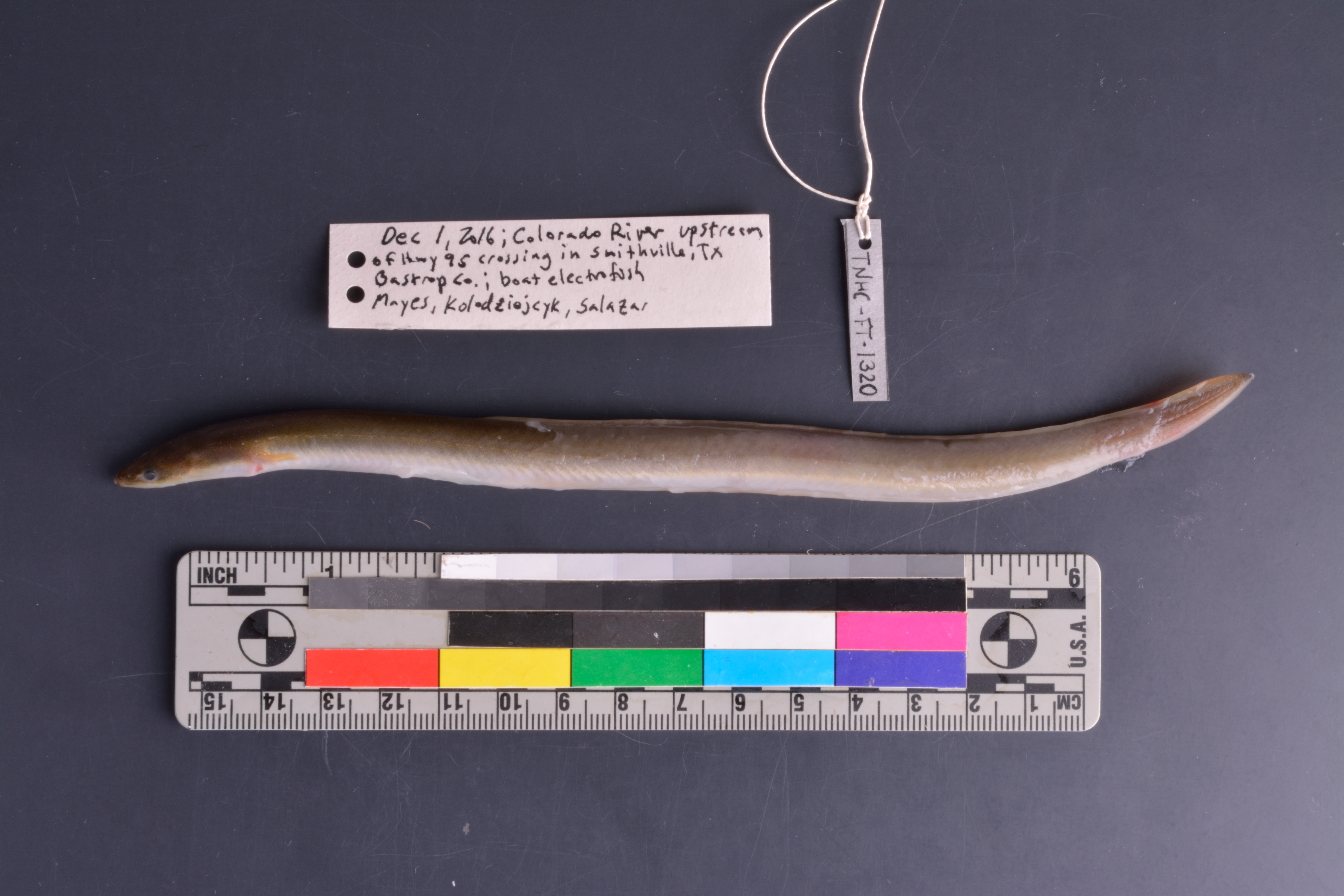
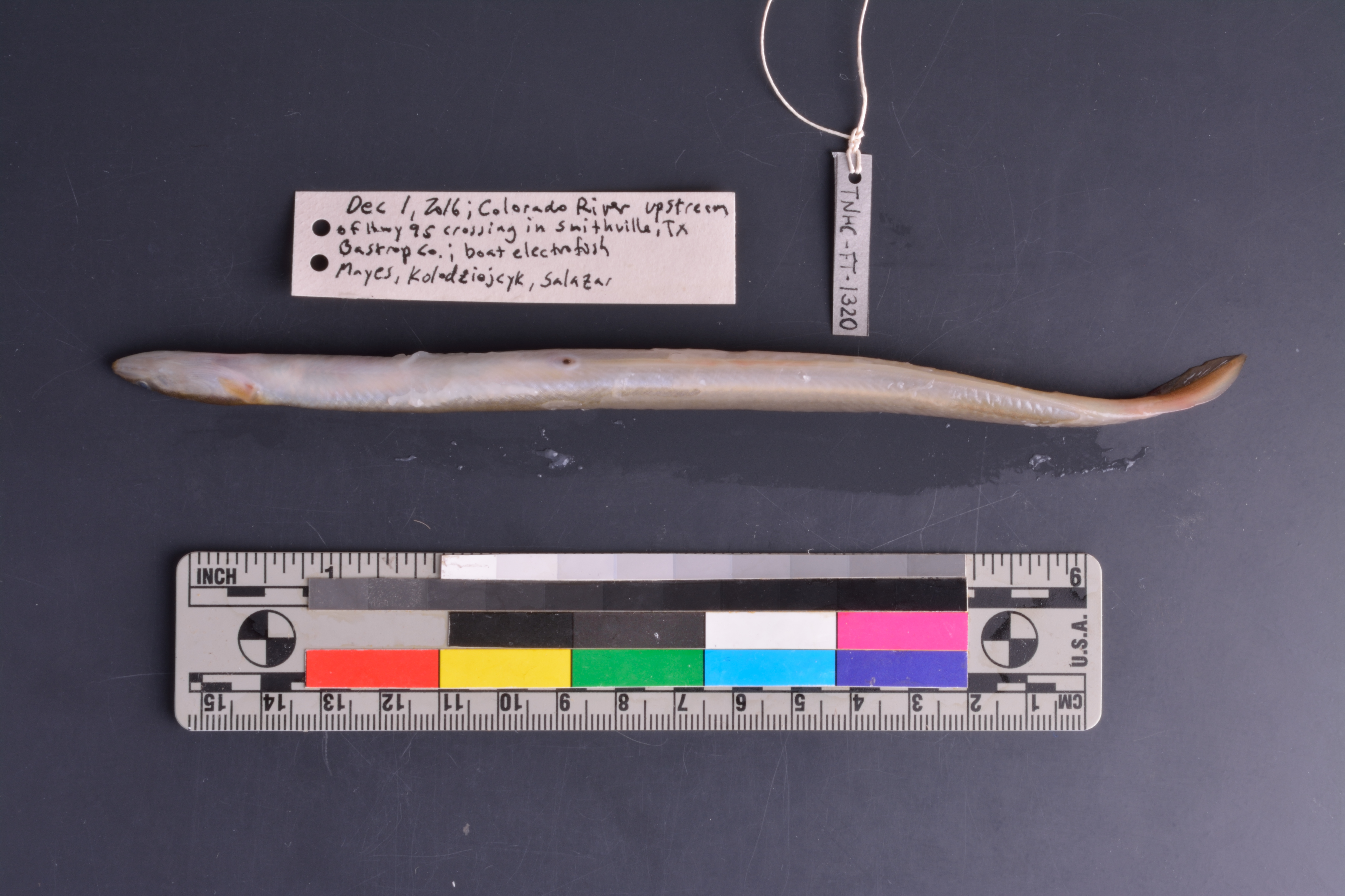
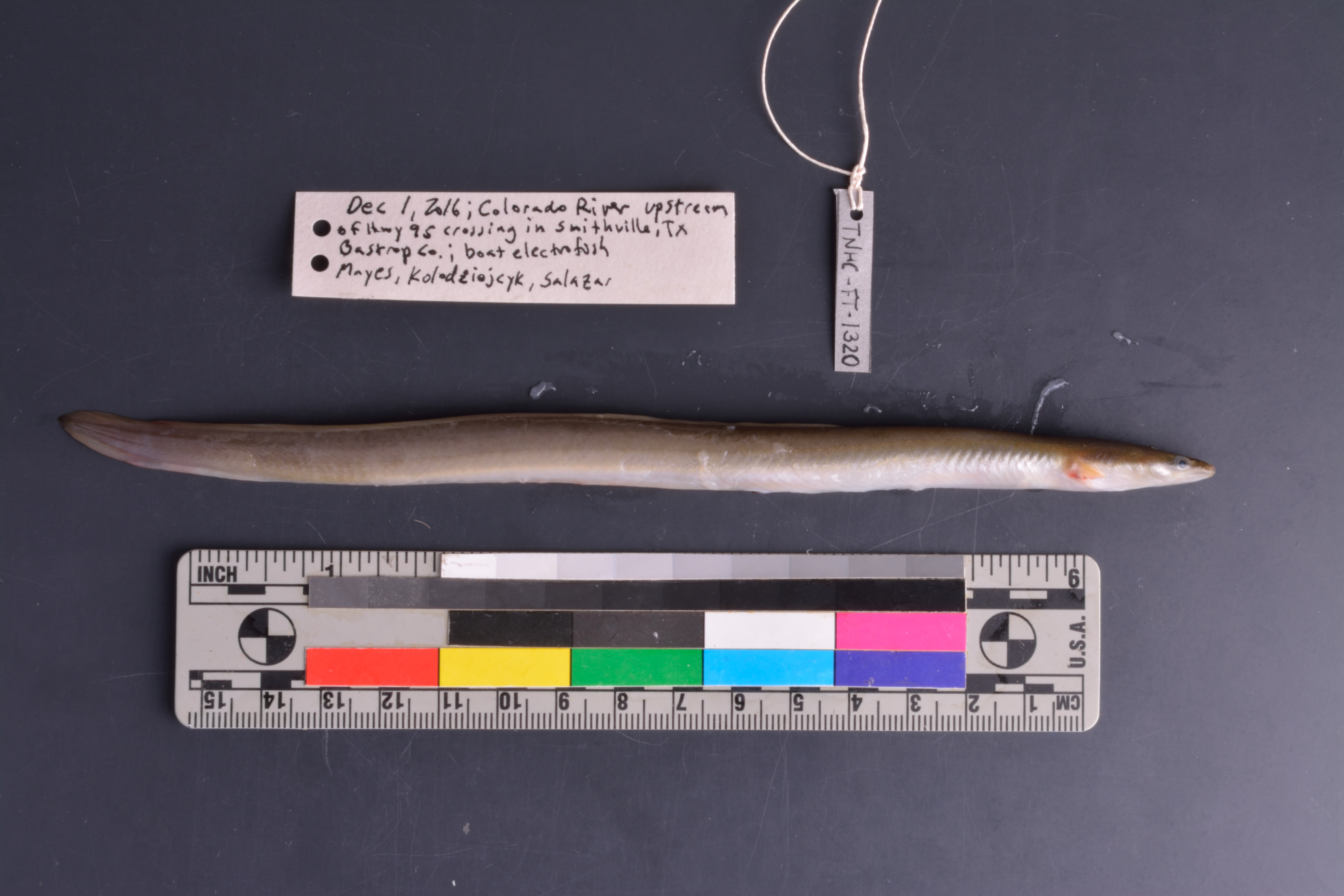
TNHCi_62994
Not suspect, not examinedPhotos

Map
Location
30.01306° N, 97.16236° W
(± 1450
m)
Taxonomy
FamilyAnguillidae
GenusAnguilla
Speciesrostrata
Specimen
Num Specimens1
PreparationTissue - 1; Fluid - 1; Otolith - 2
Identification
Identified ByCohen, Adam
Date Identified2016.12.20
Collection Event
CollectorMayes, Kevin; Kolodziejyck, K.; Salazar
Collected Date2016.12.1
Field Numberz62994
Geography
CountryUnited States
StateTexas
CountyBastrop
LocalityColorado River upstream from SH 95 crossing, Smithville
Latitude30.01306
Longitude-97.162365
DatumWGS84
Error1450.0
Georeferencing
Georeference RemarksCentroid placed just upstream from SH 95 crossing; uncertainty estimated to include entire upstream stretch of Colorado River that runs adjacent to Smithville
Record Source
Source
Texas Natural History Collections
(type: specimens)
Institution
Texas Natural History Collections
(type: museum)
Curator
Dean Hendrickson
Record Added
June 24, 2020
Record Last Modified
March 23, 2026
Data Processing Track
Track 3
From Data Set Received
5/2017 to 11/2017
Identification
Suspect Notes
None
Count
1
Current Determination
Determiner
Unknown
Determination Date
Unknown
Determination Type
Unspecified
Identification Comments
None
Identification Confidence
Unknown
Collecting Event
Collected
Dec. 1, 2016
Collector(s)
Collecting Event ID
432404
Field Notes
There are no field notes available.
Locality
Jurisdiction
Bastrop, Texas
Name
Colorado River upstream from SH 95 crossing, Smithville
Hydrography
Texas-Gulf Region
Lower Colorado-San Bernard Coastal
Lower Colorado
Lower Colorado-Cummins
Alum Creek-Colorado River
Willow Creek-Colorado River
Captive
no
Locality Photos
No locality photos available.
HUC 12
120903010404
Georeferencing Remarks
Georeference needs verification/refinement; coordinates provided by donor
Georeferencing Annotation
—
Has not been Georeferenced because
This record, being part of the track 3 import, is not formally georeferenced by FoTX staff at this time. However, to allow mapping and visualization of this record, locality information has been provisionally accepted if provided by the donor or if location text could be matched to previously georeferenced records by FoTX team or donor data. For many records spatial error is either accepted from the donor (when provided) or derived based on coordinate precision.
Comments On TNHCi_62994