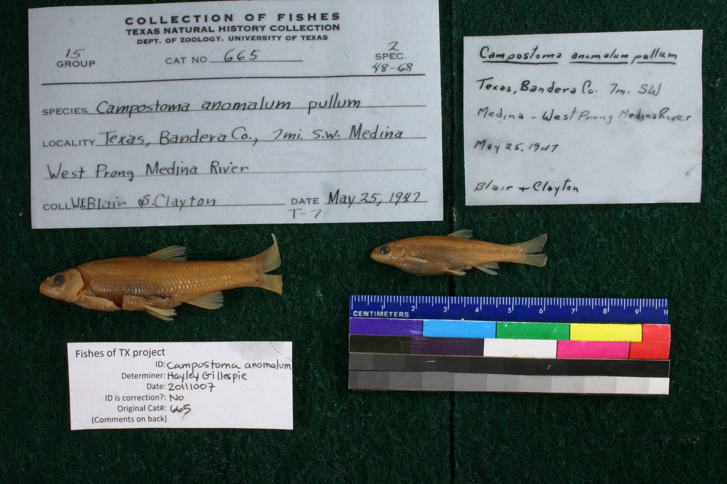
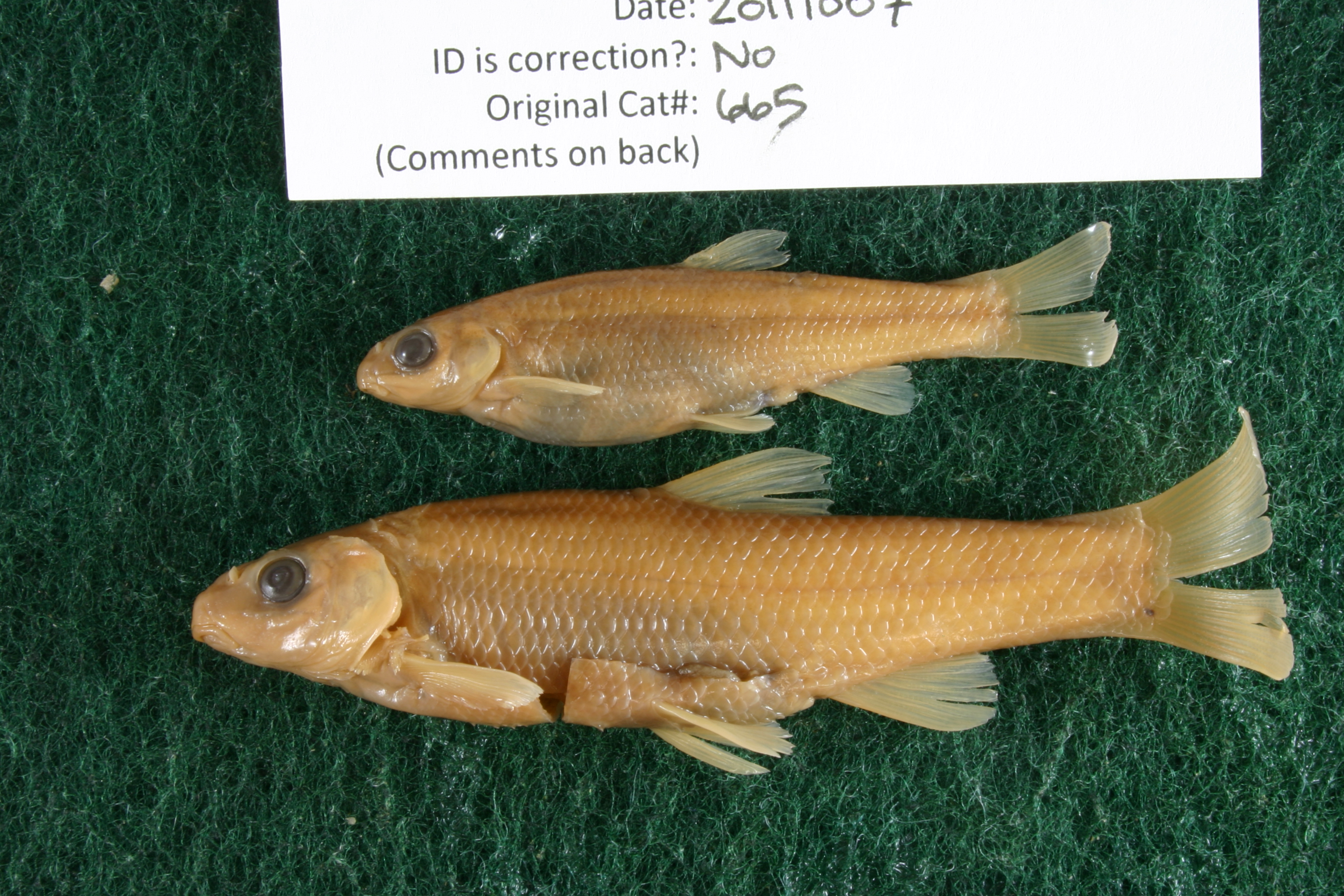
TNHCi_665
Not suspect, examinedPhotos
Map
Location
29.77956° N, 99.35897° W
(± 5162.8
m)
Taxonomy
GenusCampostoma
Speciesanomalum
Hybrid Speciespullum
Specimen
Num Specimens2
Collection Event
CollectorBlair, W.F. and S. Clayton
Collected Date1947.5.24
Geography
DrainageSan Antonio
CountryUnited States
StateTexas
CountyBandera
Locality7 mi. SW Medina W Prong of Medina River
Record Source
Source
Texas Natural History Collections
(type: specimens)
Institution
Texas Natural History Collections
(type: museum)
Curator
Dean Hendrickson
Record Added
May 13, 2010
Record Last Modified
March 23, 2026
Data Processing Track
Track 2
From Data Set Received
04/2009 to 10/2010
Identification
Suspect Notes
None
Count
2
Current Determination
Determiner
Jennifer Hayley Gillespie
Determination Date
Oct. 7, 2011
Determination Type
specimen examination
Identification Comments
Specimen examined and Id'ed for FoTX project. | ID notes: ; MinSL(mm): 47.11; MaxSL(mm): 67.82; Jar: 8 oz; Specimen condition: fair; Mutations: none; Count Male: ; Count female: ; Extern parasites: y
Identification Confidence
High
Collecting Event
Collected
May 25, 1947
Collector(s)
Collecting Event ID
7033
Field Notes
There are no field notes available.
Locality
Region
Edwards Plateau
Jurisdiction
Bandera, Texas
Name
West Prong Medina River 7 miles southwest of Medina
Hydrography
Texas-Gulf Region
Central Texas Coastal
San Antonio
Medina
North Prong Medina River
Lower West Prong Medina River
Captive
no
Locality Photos
No locality photos available.
flag (suspect/examine)
suspect: noexamination: yes
date
date_range: 5/25/1947-5/25/1947
collectors
collectors: Blair, W. Frank Clayton, S.
collectors
collectors: W. Frank Blair, S. Clayton
date
date_range: 5/24/1947-5/24/1947
staff comment
ID Status: Not flagged for specimen examination. By default we accept donor specimen determinations (after synonymization to our taxonomy). If georeferenced to TX this record has been considered in spatial context with other occurences of this species and accepted as correct.
ID Comments: NAGeoref Remark: Point is placed as measured by SH 337 and distance to measurement by stream is added to starting extent.
georeference
Error: 5162.77555197785
Remarks: Point is placed as measured by SH 337 and distance to measurement by stream is added to starting extent.
Locality: West Prong Medina River 7 miles southwest of MedinaCoordinates: 29.779561212;-99.358969408Georeferencer: AECGeographic note: Inland USA TexasPoint is placed as measured by SH 337 and distance to measurement by stream is added to starting extent.
Comments On TNHCi_665