TNHCi_71127
Not suspect, not examinedPhotos
Map
Location
29.88355° N, 97.93520° W
(± 3231.6
m)
Taxonomy
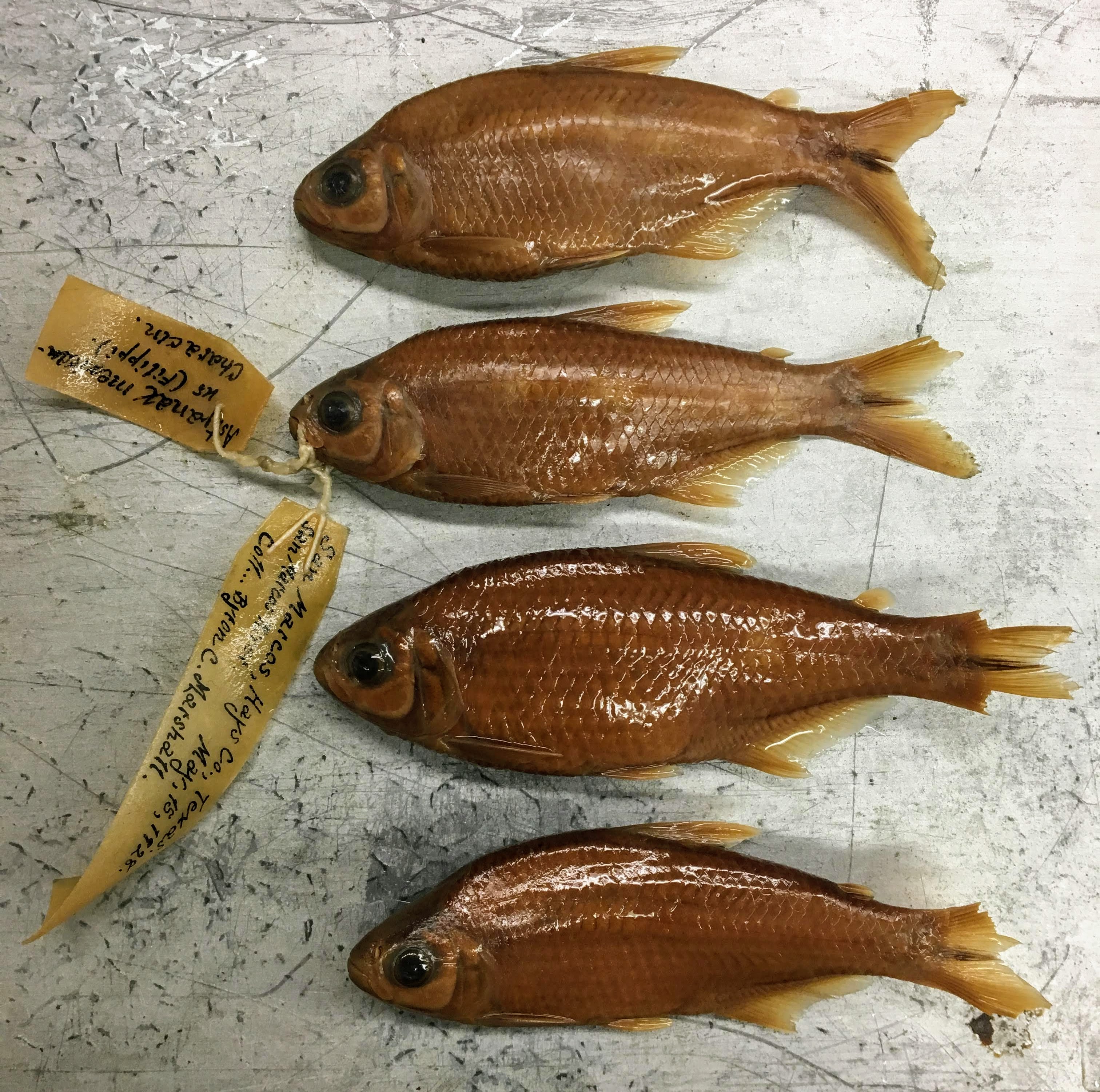
FamilyCharacidae
GenusAstyanax
Speciesmexicanus
Specimen
Num Specimens12
PreparationFluid - 12
Collection Event
CollectorMarshall, Bryan C.
Collected Date15-5-1928 to 15-5-1928
Field Numberz71127
Geography
CountryUnited States
StateTexas
CountyHays
LocalitySan Marcos River at San Marcos; Hays, Texas, United States; 29.8835500000, -97.9352000000
Latitude29.8835500000
Longitude-97.9352000000
DatumWGS84
Error3231.5627520000
Record Source
Source
Texas Natural History Collections
(type: specimens)
Institution
Texas Natural History Collections
(type: museum)
Curator
Dean Hendrickson
Record Added
June 24, 2020
Record Last Modified
March 23, 2026
Data Processing Track
Track 3
From Data Set Received
June 6, 2020
Identification
Suspect Notes
None
Count
12
Current Determination
Determiner
Unknown
Determination Date
Unknown
Determination Type
Unspecified
Identification Comments
None
Identification Confidence
Unknown
Collecting Event
Collected
May 15, 1928
Collector(s)
Collecting Event ID
271857
Field Notes
There are no field notes available.
Locality
Jurisdiction
Hays, Texas
Name
San Marcos River at San Marcos; Hays, Texas, United States; 29.8835500000, -97.9352000000
Hydrography
Texas-Gulf Region
Central Texas Coastal
Guadalupe
San Marcos
Upper San Marcos River
Purgatory Creek-San Marcos River
Captive
no
Locality Photos
No locality photos available.
HUC 12
121002030302
Georeferencing Remarks
Georeferencing details copied from donor into FoTX fields | Georef remarks: Reach inside 2.5 mile radius of city center;
Georeferencing Annotation
—
Has not been Georeferenced because
This record, being part of the track 3 import, is not formally georeferenced by FoTX staff at this time. However, to allow mapping and visualization of this record, locality information has been provisionally accepted if provided by the donor or if location text could be matched to previously georeferenced records by FoTX team or donor data. For many records spatial error is either accepted from the donor (when provided) or derived based on coordinate precision.
Comments On TNHCi_71127