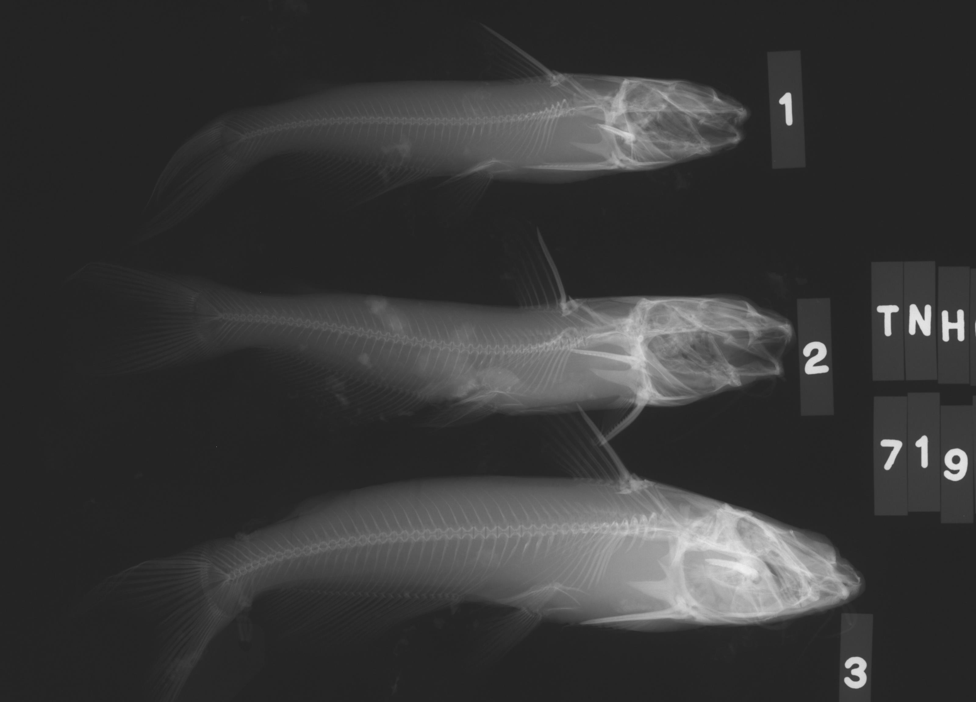
TNHCi_7194
Not suspect, not examinedPhotos
Map
Location
30.17123° N, 97.65721° W
(± 7415.9
m)
Taxonomy
GenusIctalurus
Speciespunctatus
Specimen
Num Specimens4
Collection Event
CollectorBirkhead, W.
Collected Date1967.8.16
Geography
DrainageColorado
CountryUnited States
StateTexas
CountyTravis
LocalityOnion Creek SW of Austin
Record Source
Source
Texas Natural History Collections
(type: specimens)
Institution
Texas Natural History Collections
(type: museum)
Curator
Dean Hendrickson
Record Added
May 13, 2010
Record Last Modified
March 23, 2026
Data Processing Track
Track 2
From Data Set Received
04/2009 to 10/2010
Identification
Suspect Notes
None
Count
4
Current Determination
Determiner
Fishes of Texas staff
Determination Date
Unknown
Determination Type
Unspecified
Identification Comments
None
Identification Confidence
Unknown
Collecting Event
Collected
Aug. 17, 1967
Collector(s)
Collecting Event ID
10553
Field Notes
There are no field notes available.
Locality
Region
Blackland Prairies
Jurisdiction
Travis, Texas
Name
Onion Creek southwest of Austin
Hydrography
Texas-Gulf Region
Lower Colorado-San Bernard Coastal
Middle Colorado-Llano
Austin-Travis Lakes
Onion Creek-Colorado River
Carson Creek-Colorado River
Captive
no
Locality Photos
No locality photos available.
flag (suspect/examine)
suspect: noexamination: no
date
date_range: 8/17/1967-8/17/1967
collectors
collectors: Birkhead, William
collectors
collectors: William Birkhead
date
date_range: 8/16/1967-8/16/1967
staff comment
ID Status: Not flagged for specimen examination. By default we accept donor specimen determinations (after synonymization to our taxonomy). If georeferenced to TX this record has been considered in spatial context with other occurences of this species and accepted as correct.
ID Comments: NAGeoref Remark: Reach defined by line drawn south from Austin geographic center downstream to confluence with Colorado River.
georeference
Error: 7415.85715196818
Remarks: Reach defined by line drawn south from Austin geographic center downstream to confluence with Colorado River.
Locality: Onion Creek southwest of AustinCoordinates: 30.171231505;-97.657207301Georeferencer: AECGeographic note: Inland USA TexasReach defined by line drawn south from Austin geographic center downstream to confluence with Colorado River.
Comments On TNHCi_7194