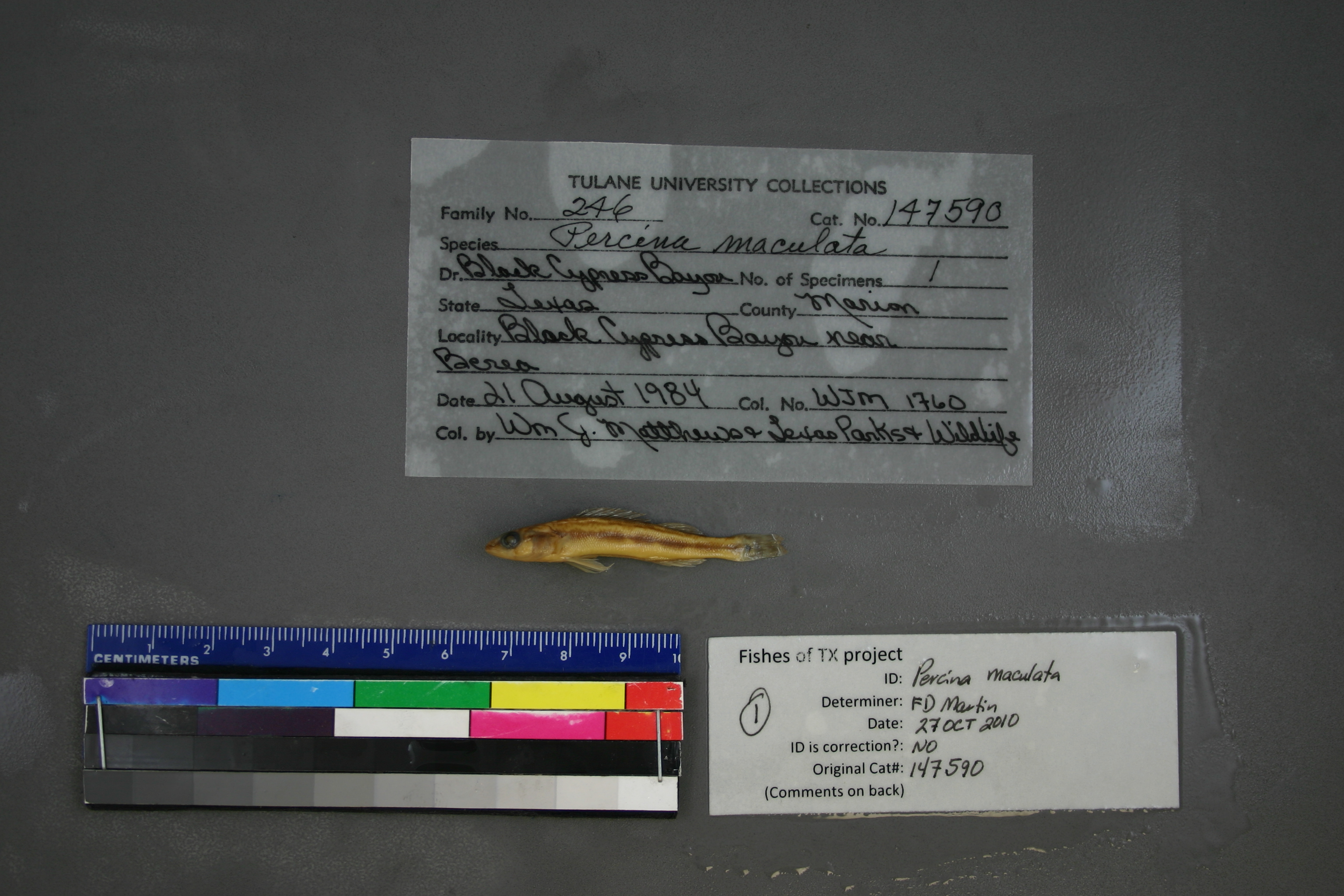
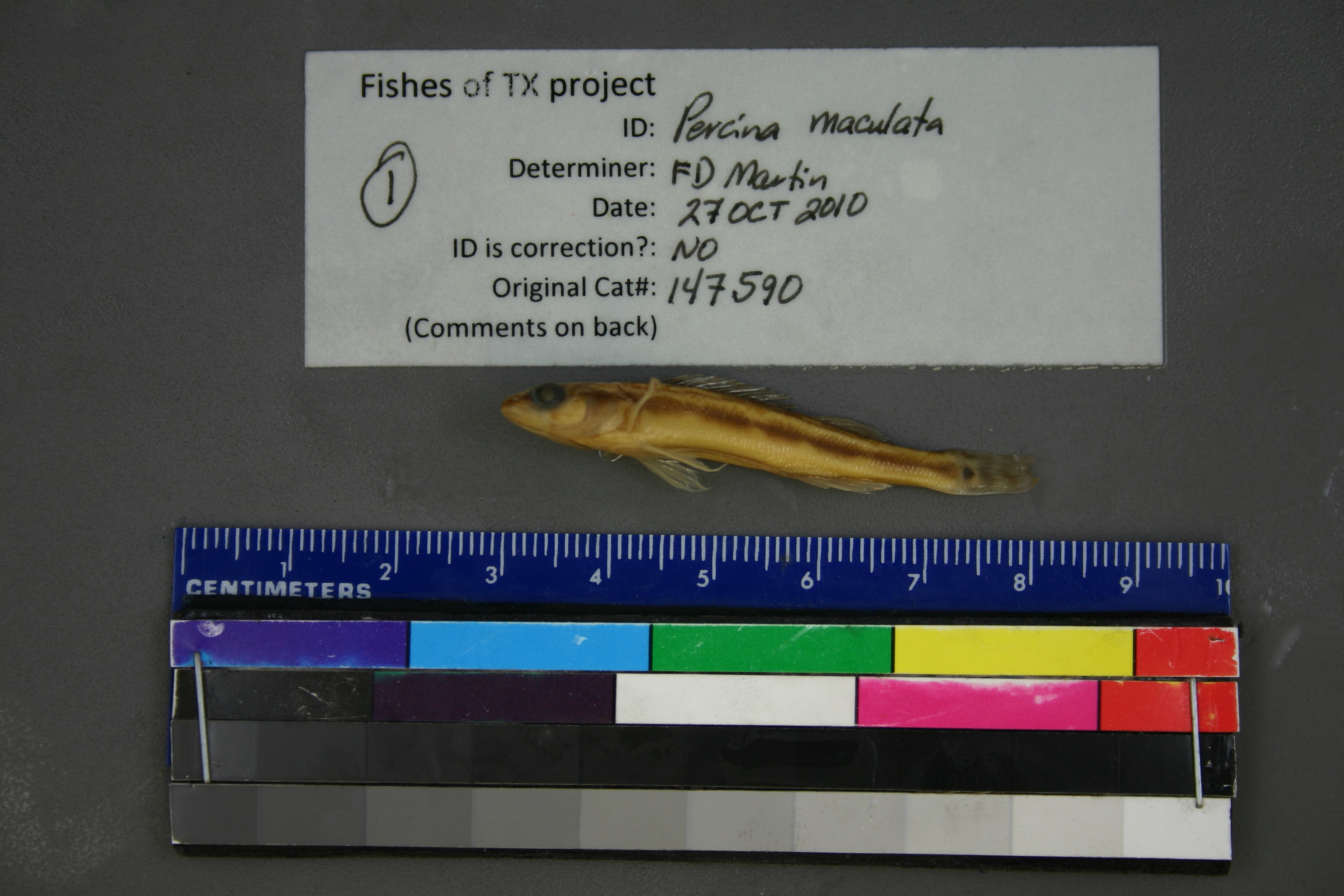
TU_147590
Not suspect, examinedPhotos
Map
Location
32.81029° N, 94.37805° W
(± 2909.7
m)
Taxonomy
GenusPercina
Speciesmaculata
Specimen
Num Specimens0
Identification
DeterminerR.D. Suttkus/1987
Collection Event
CollectorW.J. Matthews, TX Parks & Wildlife
Collected Date1984.8.21
Geography
DrainageCypress
CountryUnited States
StateTexas
CountyMarion
LocalityBlack Cypress Bayou near Berea.
Record Source
Source
Tulane Museum of Natural History
(type: specimens)
Institution
Tulane Museum of Natural History
(type: museum)
Curator
Henry L. Bart
Record Added
May 13, 2010
Record Last Modified
July 27, 2022
Data Processing Track
Track 1
From Data Set Received
11/1997 to 05/2006
Identification
Suspect Notes
None
Count
No data
Current Determination
Determiner
Floyd Douglas Martin
Determination Date
Oct. 27, 2010
Determination Type
specimen examination
Identification Comments
ID complete
Identification Confidence
High
Collecting Event
Collected
Aug. 21, 1984
Collector(s)
Collecting Event ID
1254
Field Notes
There are no field notes available.
Locality
Region
Piney Woods
Jurisdiction
Marion, Texas
Name
Black Cypress Bayou near Barea
Hydrography
Arkansas-White-Red Region
Red-Sulphur
Big Cypress-Sulphur
Caddo Lake
Black Cypress Creek-Black Cypress Bayou
Scotts Creek-Black Cypress Bayou
Captive
no
Locality Photos
No locality photos available.
flag (suspect/examine)
suspect: noexamination: yes
date
date_range: 8/21/1984-8/21/1984
collectors
collectors: Matthews, William J. Texas Parks & Wildlife Department
collectors
collectors: William J. Matthews, Texas Parks & Wildlife Department
date
date_range: 8/21/1984-8/21/1984
staff comment
ID Status: Specimen examined and ID'ed for FoTX project
Georef Remark: Point is placed at nearest road crossing to Barea and extent runs halfway to Jefferson.
ID Confidence: high
georeference
Error: 2909.69395198752
Remarks: Point is placed at nearest road crossing to Barea and extent runs halfway to Jefferson.
Locality: Black Cypress Bayou near BareaCoordinates: 32.810286279;-94.378047682Georeferencer: AECGeographic note: Inland USA TexasPoint is placed at nearest road crossing to Barea and extent runs halfway to Jefferson.
Comments On TU_147590