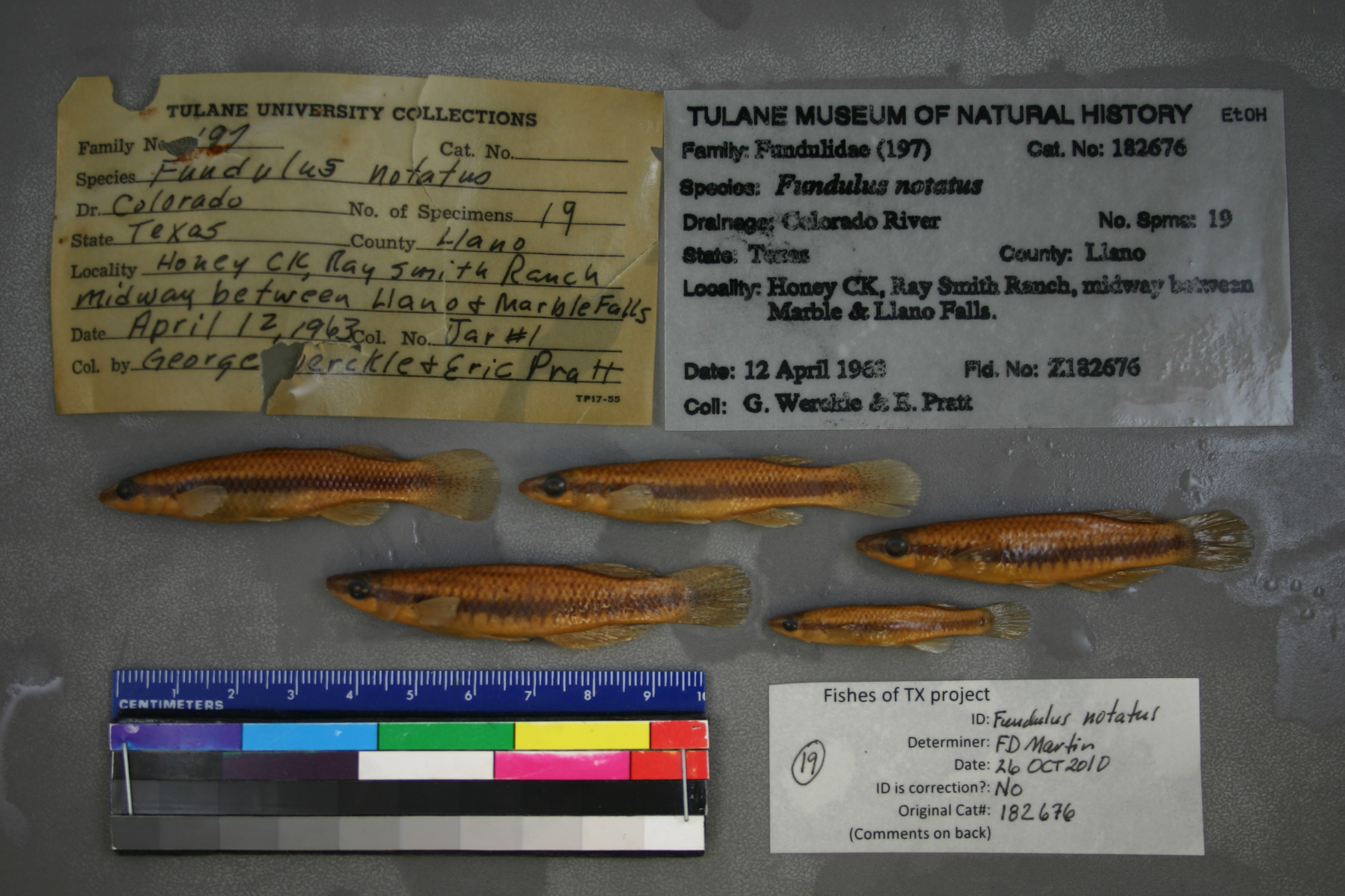
TU_182676
Not suspect, examinedPhotos
Map
Location
30.63968° N, 98.57429° W
(± 8542.4
m)
Taxonomy
GenusFundulus
Speciesnotatus
Specimen
Num Specimens0
Identification
DeterminerR.D. Suttkus/?
Collection Event
CollectorG. Werckle & E. Pratt
Collected Date1963.4.12
Geography
DrainageColorado
CountryUnited States
StateTexas
CountyLlano
LocalityHoney CK, Ray Smith Ranch, midway between Marble & Llano Falls.
Record Source
Source
Tulane Museum of Natural History
(type: specimens)
Institution
Tulane Museum of Natural History
(type: museum)
Curator
Henry L. Bart
Record Added
May 13, 2010
Record Last Modified
July 27, 2022
Data Processing Track
Track 1
From Data Set Received
11/1997 to 05/2006
Identification
Suspect Notes
None
Count
No data
Current Determination
Determiner
Floyd Douglas Martin
Determination Date
Oct. 26, 2010
Determination Type
specimen examination
Identification Comments
ID complete
Identification Confidence
High
Collecting Event
Collected
April 12, 1963
Collector(s)
Collecting Event ID
1238
Field Notes
There are no field notes available.
Locality
Region
Llano Uplift
Jurisdiction
Llano, Texas
Name
Honey Creek
Hydrography
Texas-Gulf Region
Lower Colorado-San Bernard Coastal
Middle Colorado-Llano
Llano
Little Llano River-Llano River
Honey Creek-Lake Lyndon B Johnson
Captive
no
Locality Photos
No locality photos available.
flag (suspect/examine)
suspect: noexamination: yes
date
date_range: 4/12/1963-4/12/1963
collectors
collectors: Werckle, G. Pratt, E.
collectors
collectors: G. Werckle, E. Pratt
date
date_range: 4/12/1963-4/12/1963
staff comment
ID Status: Specimen examined and ID'ed for FoTX project
Georef Remark: Treated as shown. Can't find 'Ray Smith Ranch'. Extent covers the entire reach.
ID Confidence: highGeoref Annotation: 'Llano Falls' is assumed to be in or near Llano.
georeference
Error: 8542.39795196335
Remarks: Treated as shown. Can't find 'Ray Smith Ranch'. Extent covers the entire reach. 'Llano Falls' is assumed to be in or near Llano.
Locality: Honey CreekCoordinates: 30.639684717;-98.57429179Georeferencer: AECGeographic note: Inland USA TexasTreated as shown. Can't find 'Ray Smith Ranch'. Extent covers the entire reach. 'Llano Falls' is assumed to be in or near Llano.
Comments On TU_182676