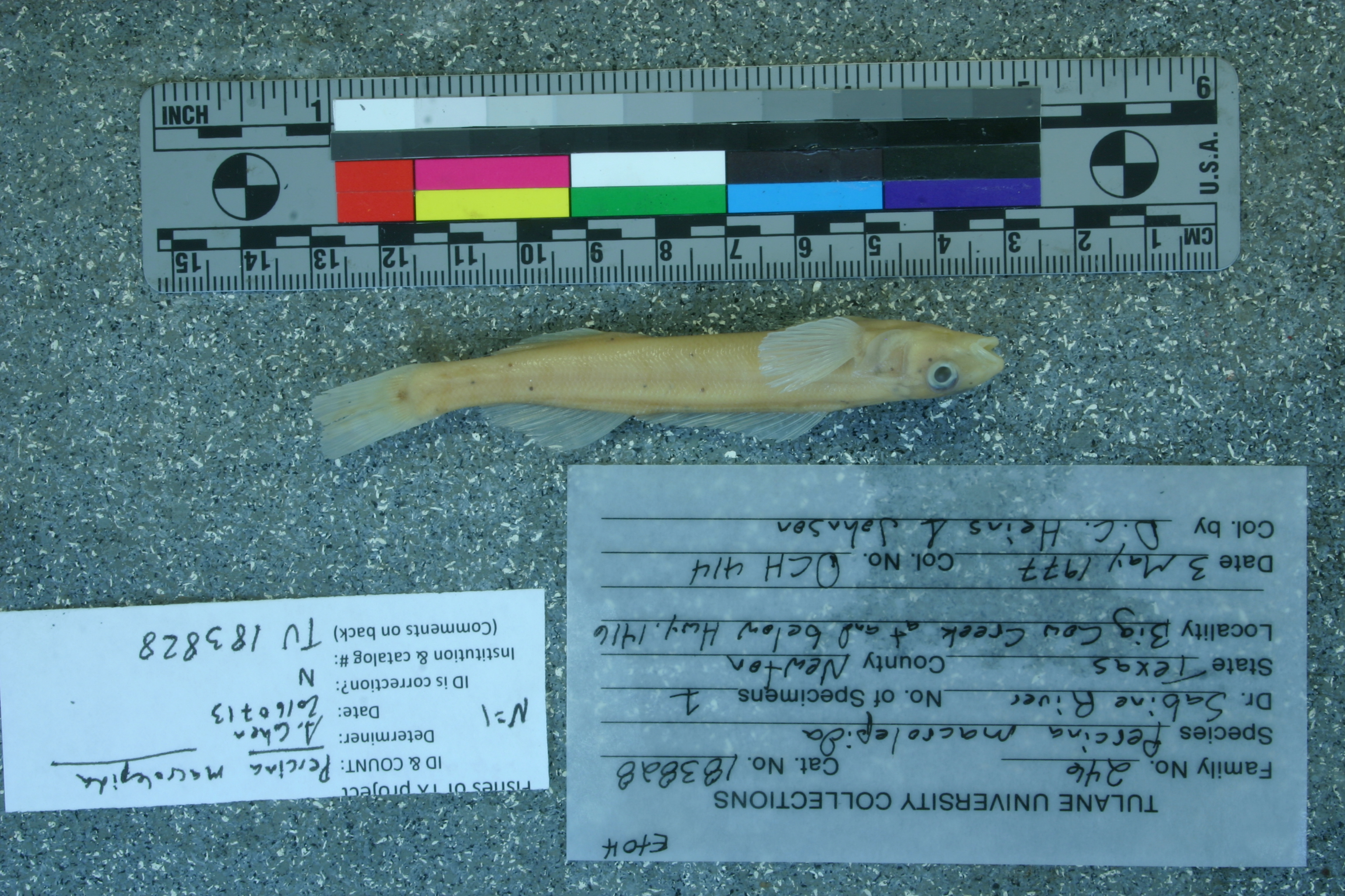
TU_183828
Not suspect, examinedPhotos
Map
Location
30.57907° N, 93.76726° W
(± 3553.4
m)
Taxonomy
GenusPercina
Speciescaprodes
Specimen
Num Specimens0
Identification
DeterminerD.C. Heins/1977
Collection Event
CollectorD.C. Heins & Johnson
Collected Date1977.5.3
Geography
CountryUnited States
StateTexas
CountyNewton
LocalityBig Cow Creek at and below Hwy. 1416.
Record Source
Source
Tulane Museum of Natural History
(type: specimens)
Institution
Tulane Museum of Natural History
(type: museum)
Curator
Henry L. Bart
Record Added
May 13, 2010
Record Last Modified
July 27, 2022
Data Processing Track
Track 1
From Data Set Received
11/1997 to 05/2006
Identification
Suspect Notes
None
Count
No data
Current Determination
Determiner
Adam Cohen
Determination Date
July 13, 2016
Determination Type
specimen examination
Identification Comments
ID complete | scales on breast and prepectoral area
Identification Confidence
High
Collecting Event
Collected
May 3, 1977
Collector(s)
Collecting Event ID
1708
Field Notes
There are no field notes available.
Locality
Region
Piney Woods
Jurisdiction
Newton, Texas
Name
Big Cow Creek downstream of SH 1416
Hydrography
Texas-Gulf Region
Sabine
Sabine
Lower Sabine
Big Cow Creek
Big Cow Creek
Captive
no
Locality Photos
No locality photos available.
flag (suspect/examine)
suspect: noexamination: yes
flag (suspect/examine) note
This lot in need of examination, but not yet examined. Work in progress.
staff comment
not currently verified
date
date_range: 5/3/1977-5/3/1977
collectors
collectors: Heins, David C. Johnson
collectors
collectors: David C. Heins, Johnson
date
date_range: 5/3/1977-5/3/1977
flag (suspect/examine)
suspect flag — We wish to examine this specimen
staff comment
ID Status: This lot in need of examination, but not yet examined. Work in progress.Georef Remark: Reach runs from SH 1416 downstream to confluence with Sabine River.
staff comment
not currently verified
georeference
Error: 3553.43155198475Remarks: Reach runs from SH 1416 downstream to confluence with Sabine River.Locality: Big Cow Creek downstream of SH 1416Coordinates: 30.579073675;-93.767258472Georeferencer: AECGeographic note: Inland USA Texas
Reach runs from SH 1416 downstream to confluence with Sabine River.
Comments On TU_183828