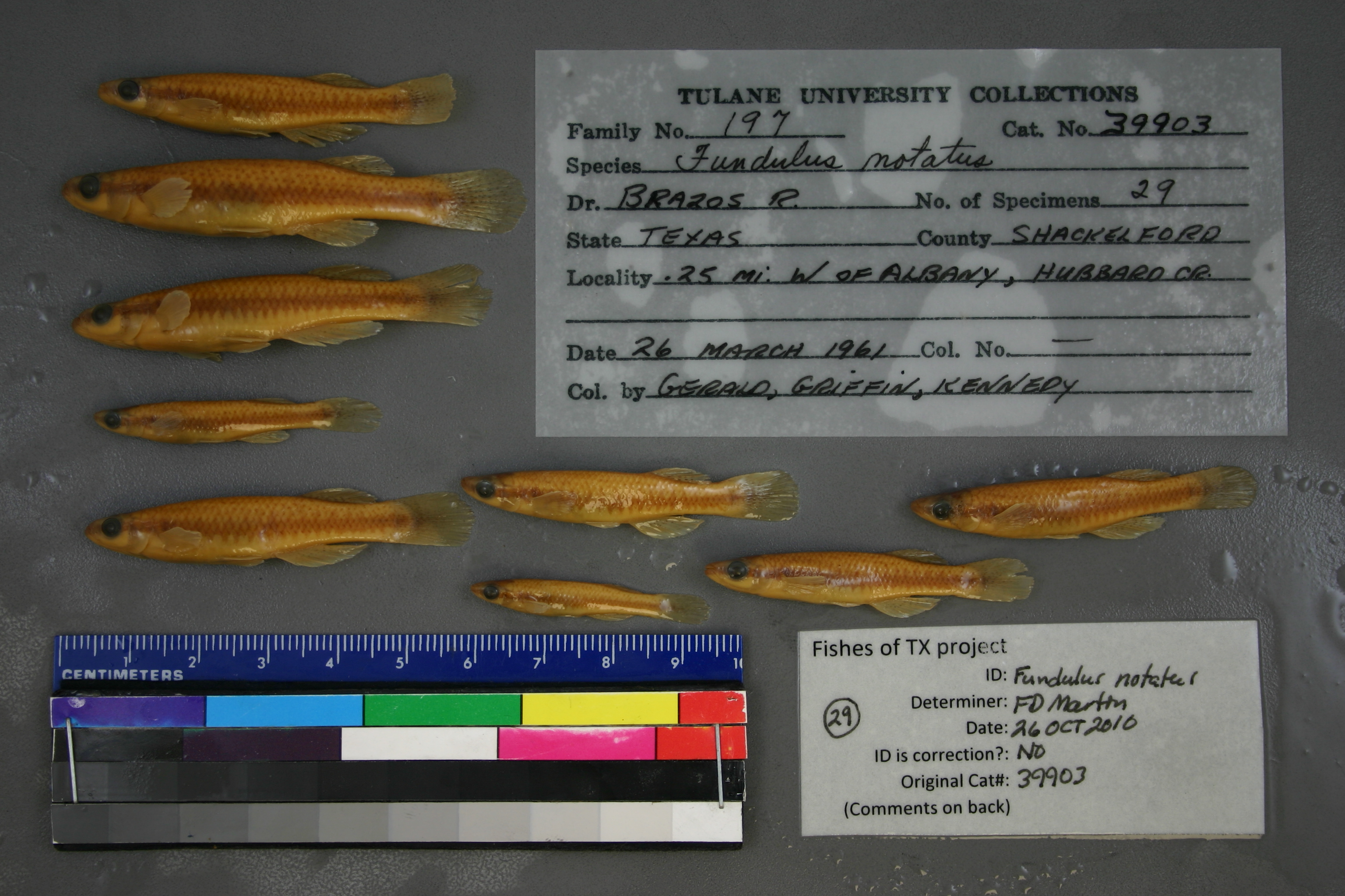
TU_39903
Not suspect, examined
Blackstripe Topminnow –
Fundulus notatus
Photos
Map
Location
32.72728° N, 99.31202° W
(± 1050.0
m)
Taxonomy
GenusFundulus
Speciesnotatus
Specimen
Num Specimens0
Identification
DeterminerR.D. Suttkus/1961
Collection Event
CollectorGerald, Griffin & Kennedy
Collected Date1961.3.26
Geography
DrainageBrazos
CountryUnited States
StateTexas
CountyShackelford
Locality0.25 mi. W of Albany, Hubbard Creek.
Record Source
Source
Tulane Museum of Natural History
(type: specimens)
Institution
Tulane Museum of Natural History
(type: museum)
Curator
Henry L. Bart
Record Added
May 13, 2010
Record Last Modified
July 27, 2022
Data Processing Track
Track 1
From Data Set Received
11/1997 to 05/2006
Identification
Suspect Notes
None
Count
No data
Current Determination
Determiner
Floyd Douglas Martin
Determination Date
Oct. 26, 2010
Determination Type
specimen examination
Identification Comments
ID complete
Identification Confidence
High
Collecting Event
Collected
March 26, 1961
Collecting Event ID
2144
Field Notes
There are no field notes available.
Locality
Region
Rolling Plains
Jurisdiction
Shackelford, Texas
Name
North Fork Salt Prong Hubbard Creek West of Albany
Hydrography
USGS HUC
Texas-Gulf Region
Middle Brazos
Middle Brazos-Clear Fork
Hubbard
Salt Prong Hubbard Creek
North Fork Salt Prong Hubbard Creek
HydroBASINS
7516
751660
75166024
7516602402
751660240200
Captive
no
Locality Photos
No locality photos available.
flag (suspect/examine)
suspect: noexamination: yes
date
date_range: 3/26/1961-3/26/1961
collectors
collectors: Gerald, Griffin, Kennedy
collectors
collectors: Gerald, Griffin, Kennedy
date
date_range: 3/26/1961-3/26/1961
staff comment
ID Status: Specimen examined and ID'ed for FoTX projectID Confidence: highGeoref Annotation: North Fork Salt Prong Hubbard Creek, not Hubbard Creek
georeference
Error: 1049.9640672042Remarks: North Fork Salt Prong Hubbard Creek, not Hubbard CreekLocality: North Fork Salt Prong Hubbard Creek West of AlbanyCoordinates: 32.727280257;-99.312016692Georeferencer: BJLGeographic note: Inland USA Texas
North Fork Salt Prong Hubbard Creek, not Hubbard Creek
Comments On TU_39903